Weather
Temps to vary; a more active pattern across the Heartland
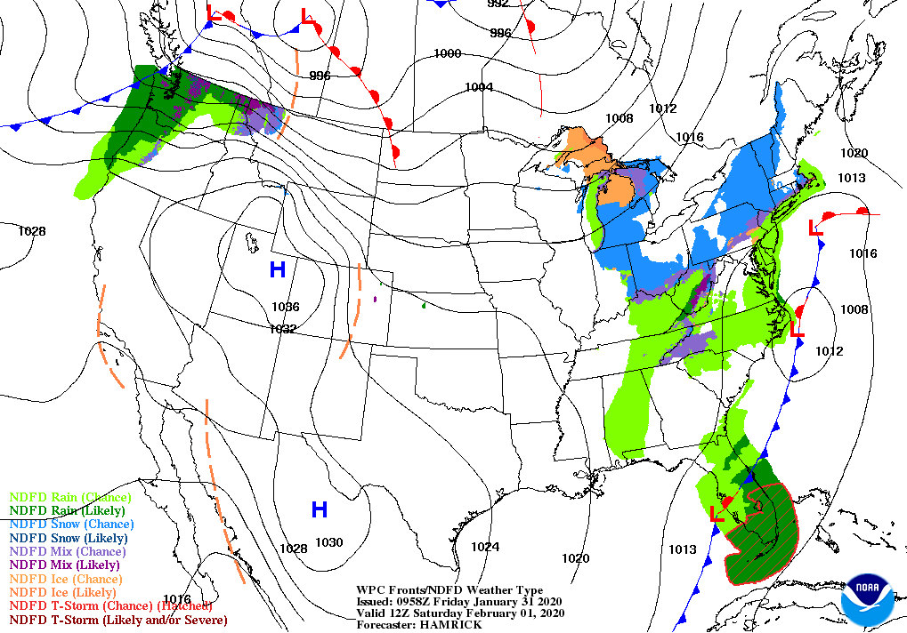
A weather system crossing the eastern one-third of the country will reach the mid-Atlantic by Saturday and pass well east of New England on Sunday, with storm-total rainfall possibly topping an inch in parts of the Carolinas.
Meanwhile, a new storm system will drive southeastward across the West during the weekend, accompanied by wind, rain, and snow. High-elevation snow, initially across the Northwest, will shift across the Intermountain West and central Rockies by early next week.
Subsequently, snow may develop across the central Plains and spread northeastward. Farther south, rain should fall across the mid-South and lower Midwest.
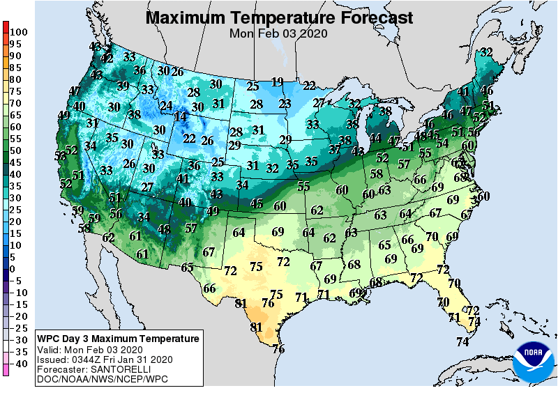
Record-setting warmth will develop early next week in the Southeast and mid-Atlantic, while colder air will arrive across the Plains and upper Midwest.
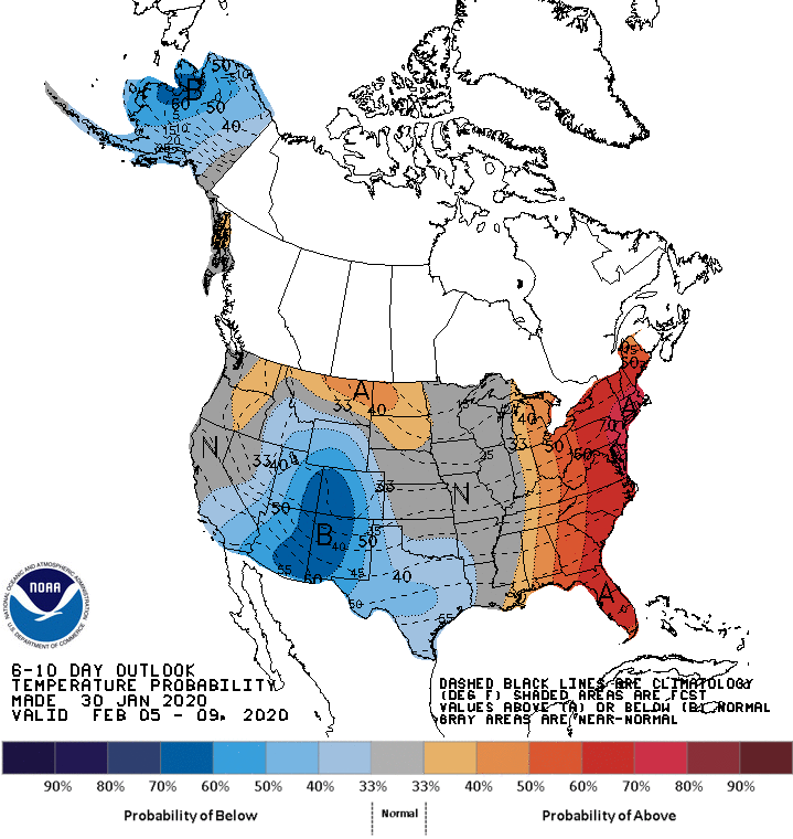
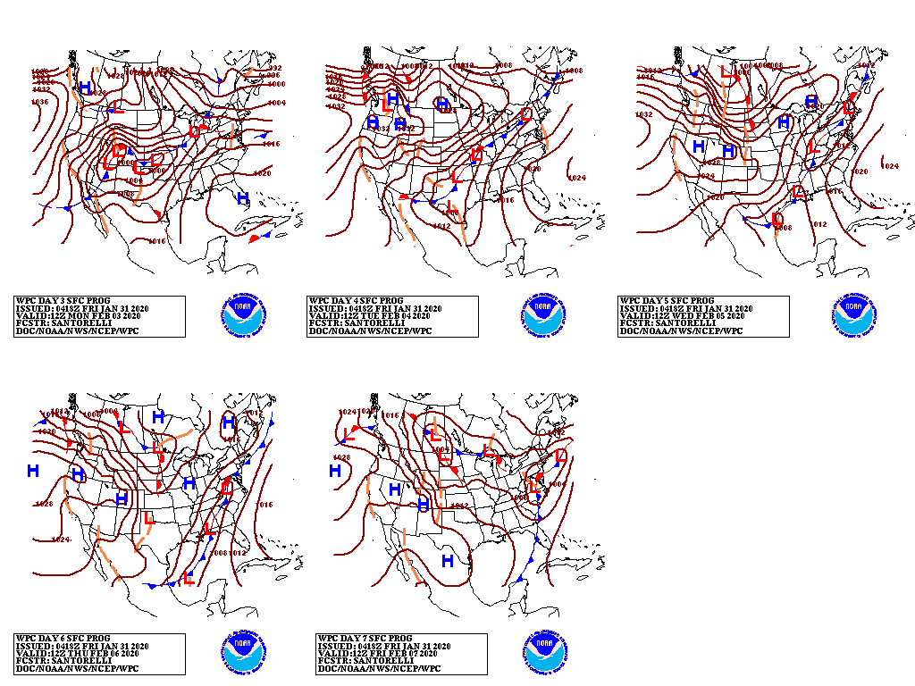
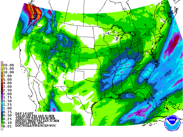
Looking ahead, the 6- to 10-day outlook calls for the likelihood of warmer- and wetter-than-normal weather across the East and parts of the northern Plains, while near- or below-normal temperatures will dominate the western and central U.S.
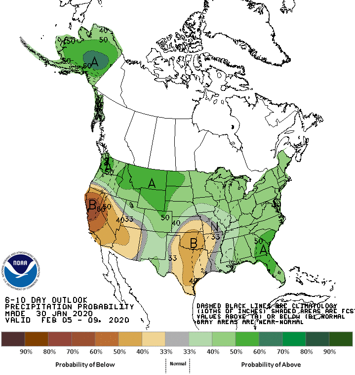
Meanwhile, wetter-than-normal conditions in the Rockies, as well as the northern and eastern U.S., should contrast with below-normal precipitation across California, the Desert Southwest, and the southern Plains.
Add Comment