Weather
Temps to again vary; a more active pattern to return
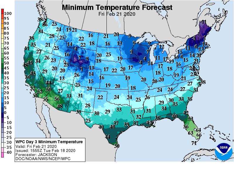
Cold air will briefly engulf much of the country. However, chilly conditions should not reach southern California and the Desert Southwest. In contrast, below-normal temperatures will soon arrive and persist through week’s end across the South.
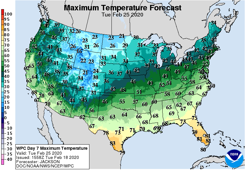
Late in the weekend, however, temperatures will rebound to significantly above-normal levels in much of the eastern U.S.
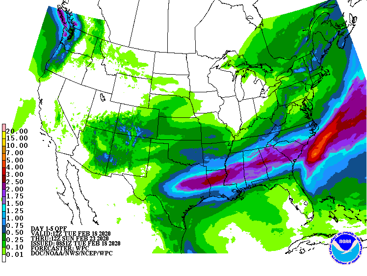
Meanwhile, 5-day precipitation totals could reach 1 to 3 inches or more from central Texas to Georgia and the Carolinas. Some of the rain will fall in areas—such as the Mississippi Delta—where rivers are already running high. Farther north, precipitation will end by mid-week in the Northeast, followed by a period of dry weather.
Mostly dry weather will also cover the remainder of the northern U.S. Most of the West will also experience several days of dry weather, although precipitation will develop late in the week across the Southwest.
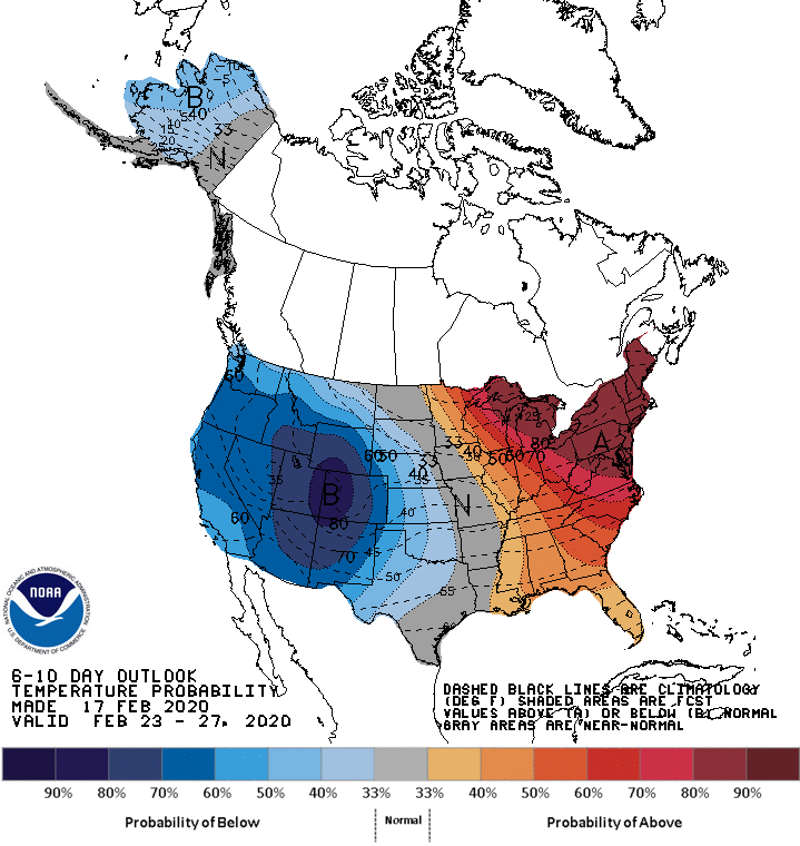
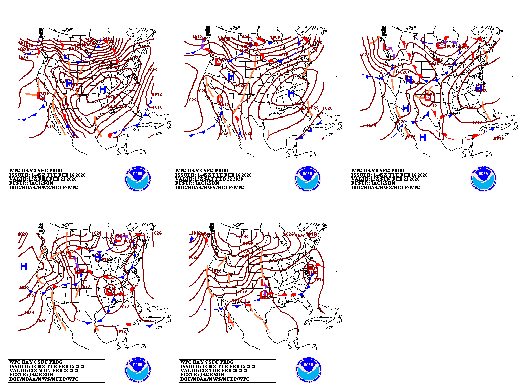
Looking ahead, the 6- to 10-day outlook calls for the likelihood of above-normal temperatures east of the Mississippi River, while colder-than-normal conditions will dominate the western half of the U.S.
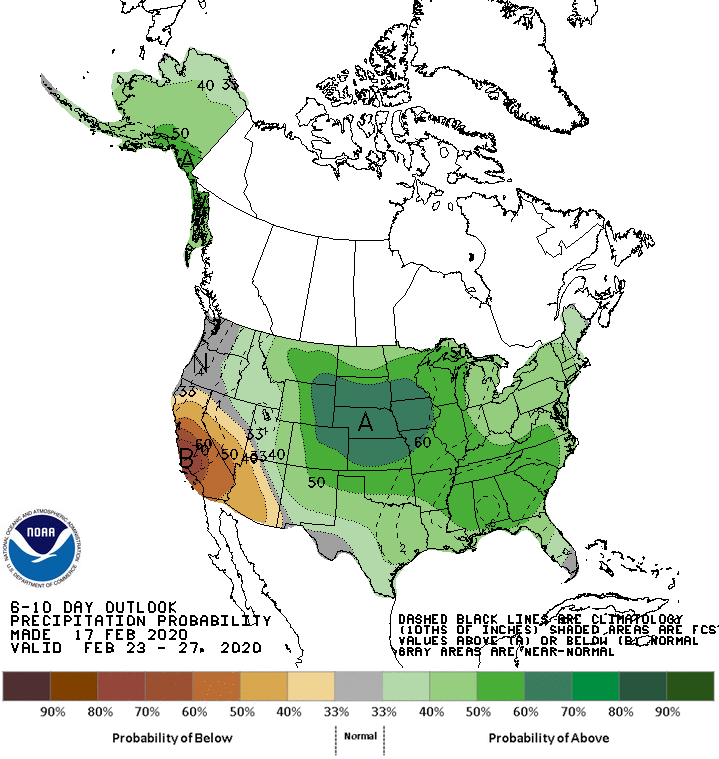
Meanwhile, near- or below-normal precipitation in the Pacific Coast States and the Desert Southwest should contrast with wetter-than-normal weather across the remainder of the country.
Add Comment