Weather
More moisture ahead for the Plains, Corn Belt
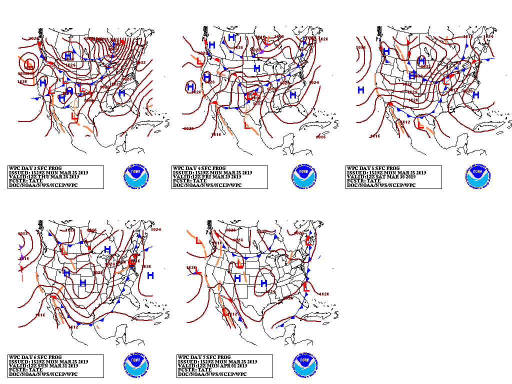
A slow-moving storm system will affect the West, particularly northern California, before reaching the nation’s mid-section late in the week.

A surge of warmth will precede the storm’s arrival.
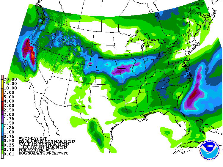
Storm-total precipitation in northern California and southwestern Oregon could reach 2 to 6 inches or more. Later, significant precipitation will also affect the Pacific Northwest and northern and central Rockies, but mostly dry weather will prevail in the Southwest.
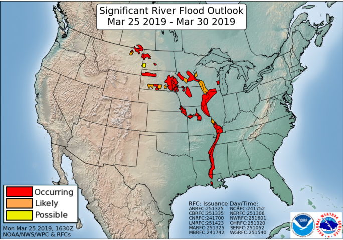
On March 28-29, substantial precipitation (generally 1 to 2 inches) may fall across recently flood-ravaged areas of Nebraska, Iowa, and northern Missouri.
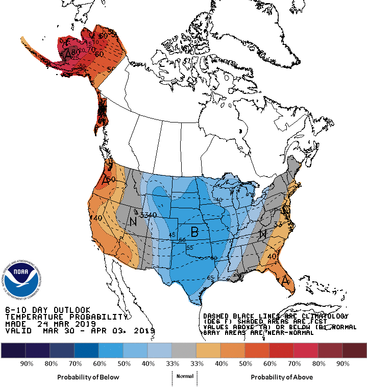
Looking ahead, the 6- to 10-day outlook calls for the likelihood of below-normal temperatures between the Rockies and Appalachians, while warmer-than-normal conditions will prevail in the Pacific Coast States and along the Atlantic Seaboard.
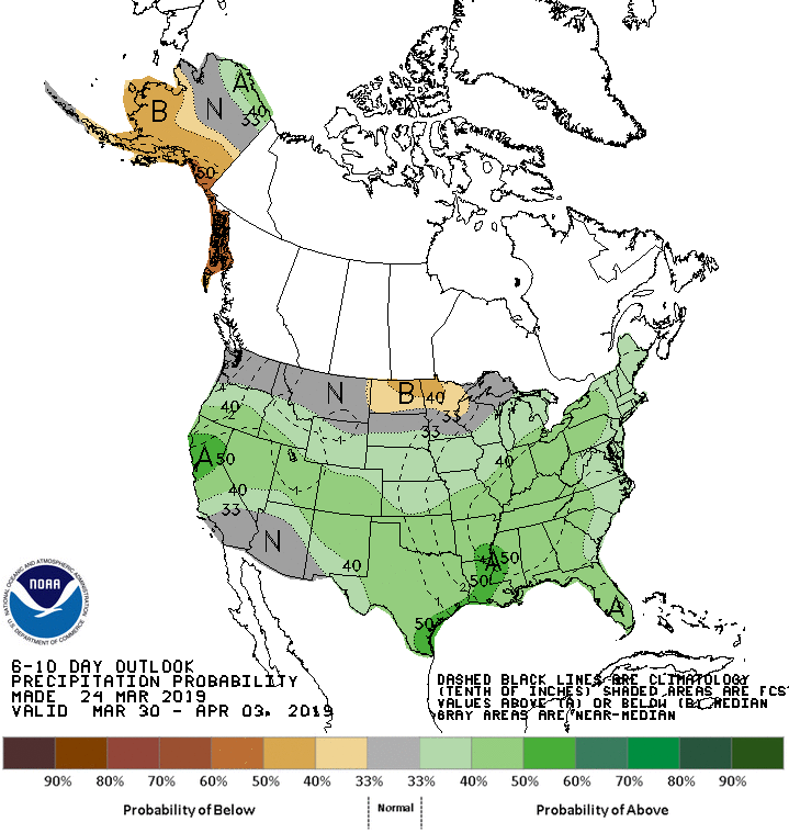
Meanwhile, near- or below-normal precipitation in the Desert Southwest and across the nation’s northern tier from Washington to Lake Superior will contrast with wetter-than-normal weather across the remainder of the country.
Add Comment