Weather
Heat on the Plains; cooler days ahead of the Midwest
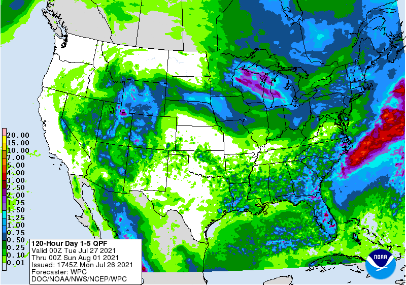
Although many parts of the country will receive some rain during the next 5 days, amounts are expected to be mostly light. A few higher totals, locally 1 to 2 inches or more, may occur from the Great Lakes region into the Northeast and in the Southeast. Interior sections of the West, particularly the Great Basin and the Four Corner States, should also experience locally heavy showers. In contrast, little or no rain will fall in the Pacific Coast States and northernmost sections of the Rockies and Plains. Only spotty showers will dot the heart of the Midwest.
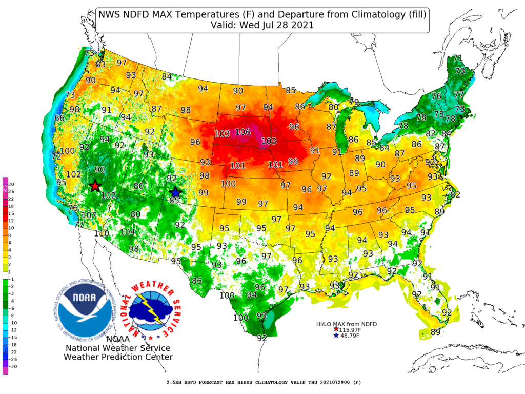
Meanwhile, temperatures will soar across the Plains and Midwest, with readings above 100°F common through Wednesday as far north as South Dakota, western Iowa, and southwestern Minnesota.
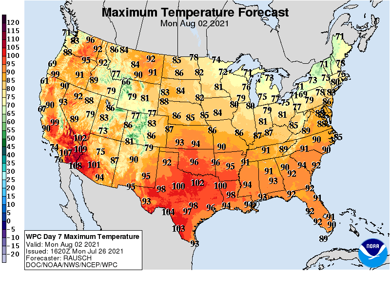
Cooler air should overspread the Midwest during the second half of the week, while heat will linger from the southern half of the Plains into the Southeast. Heat will also persist in much of the West, particularly across the northern Rockies and Pacific Coast States.
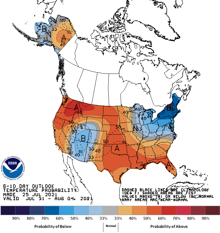
Looking ahead, the 6- to 10-day outlook calls for the likelihood of above-normal temperatures nationwide, except for cooler-than-normal conditions in the Four Corners region and from the lower Great Lakes region into the Northeast.
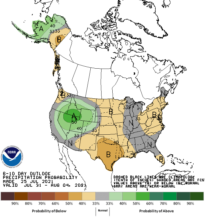
Meanwhile, near- or below-normal rainfall across most of the country should contrast with wetter-than-normal weather in the Great Basin and Intermountain West.
Add Comment