Weather
Cool weather for early-August across the Heartland
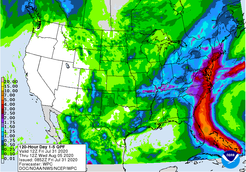
Showers and thunderstorms across the mid-South and environs will continue to spread eastward, maintaining the threat of flash flooding during the next couple of days.
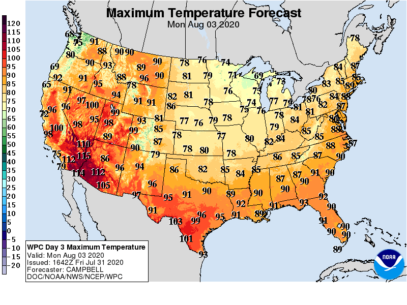
Meanwhile, unusually cool air for this time of year will blanket areas between the Rockies and Appalachians, except across the Deep South. In contrast, the West will endure several days of hot, dry weather, although showers associated with the Southwestern monsoon circulation may return across the central and southern Rockies during the weekend.
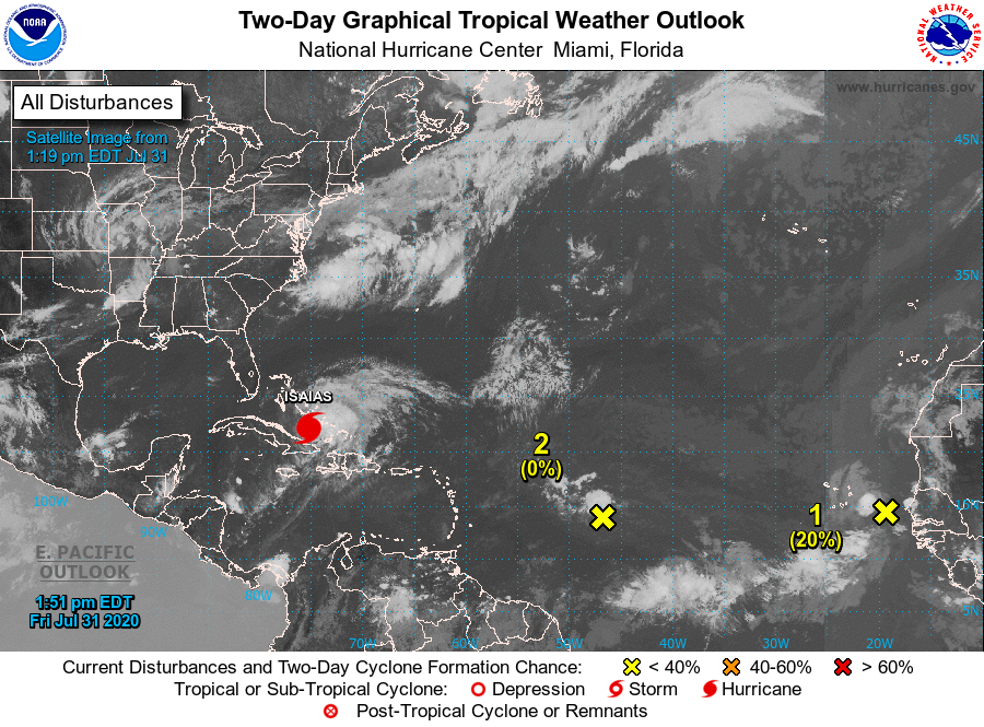
Elsewhere, Hurricane Isaias should approach or reach the southern Atlantic Coast during the weekend before turning northward, although there is still a large degree of uncertainty regarding potential wind-, rain-, and storm surge-related impacts along the Atlantic Seaboard.
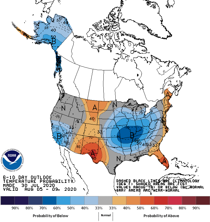
Looking ahead, the 6- to 10-day outlook calls for the likelihood of near- or below-normal temperatures across much of the country, particularly in southern California and from the mid-South into the Midwest. Warmer-than-normal weather should be limited to the Atlantic Seaboard, the central and southern Rockies, and portions of the High Plains.
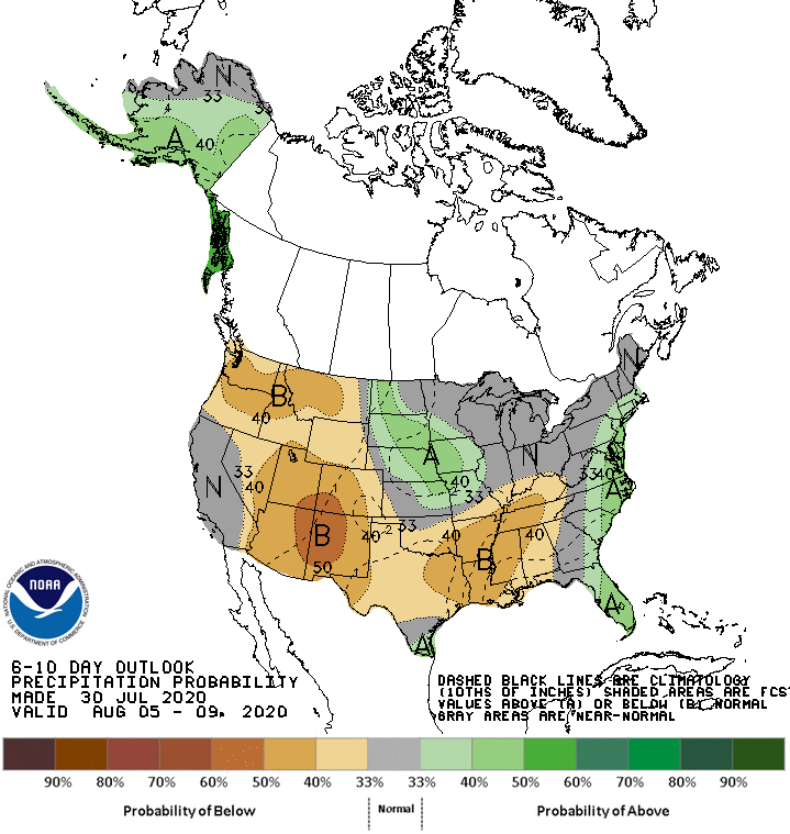
Meanwhile, near- or below-normal rainfall in most areas of the U.S. should contrast with wetter-than-normal conditions in Deep South Texas, the upper Midwest, and from Florida’s peninsula northward into southern New England.
Add Comment