Weather
Cold, active pattern for much of the Heartland
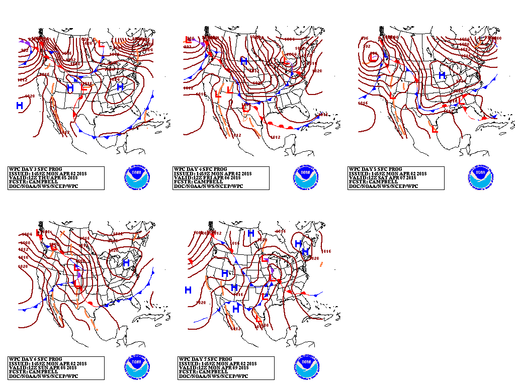 A steady procession of storms will maintain cool, unsettled conditions in the Northwest and from the mid- South into the Northeast. For the remainder of Monday, a disturbance near the Atlantic Coast will produce some additional rain and snow in the Northeast before departing. Meanwhile, a new storm will emerge from the West, crossing the central Plains on Tuesday and reaching the Northeast by mid-week. That storm will produce widespread snow from the northern Rockies into the Great Lakes region, as well as showers and thunderstorms across the South. Toward week’s end, a subsequent storm will also result in precipitation (rain and snow) across a broad area. As a result, 5-day precipitation totals could reach 1 to 3 inches from the mid-South into the Northeast, with higher amounts expected in the Pacific Northwest. In contrast, dry weather will prevail from southern California to the southern High Plains.
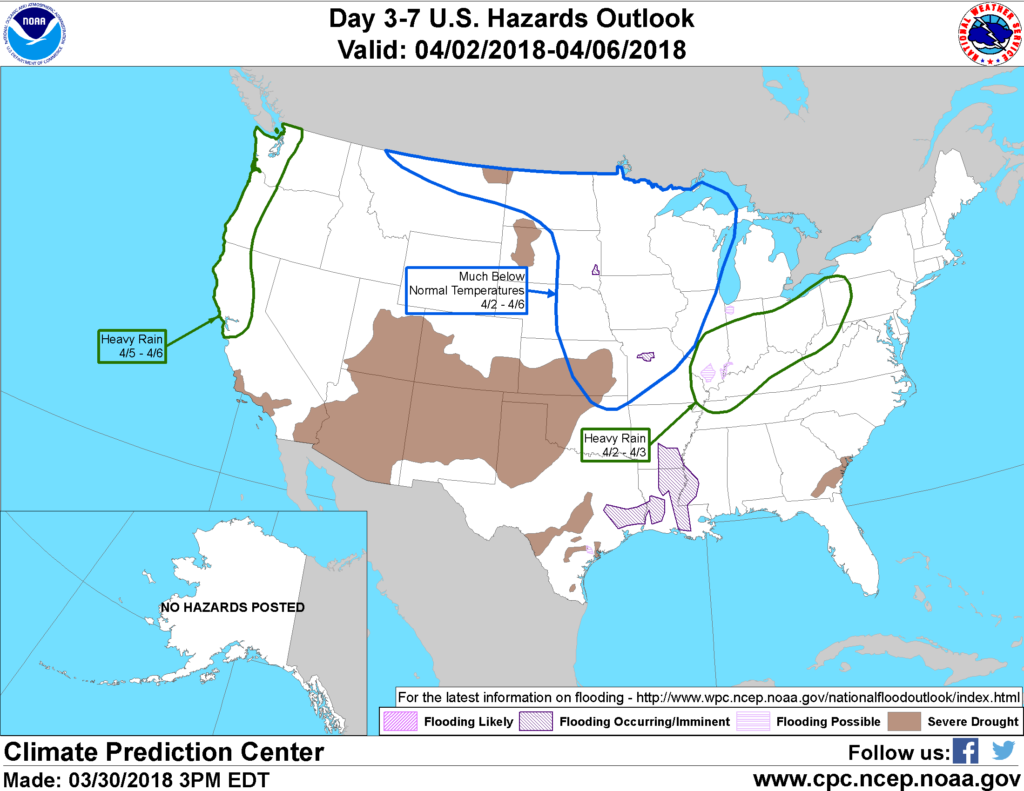 Looking ahead, the 6- to 10-day outlook calls for the likelihood of below-normal temperatures from the Plains to the northern and middle Atlantic Coast, while warmer-than-normal weather will prevail across the Deep South and much of the West. Meanwhile, near- to above-normal precipitation across most of the country should contrast with drier-than-normal conditions in the upper Great Lakes region and the southern High Plains.
Add Comment