Weather
Brownfield Ag Weather Today
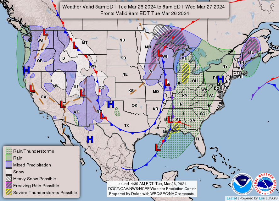
A storm system centered just south of Lake Superior early Tuesday will continue to drift northward and gradually weaken. Wind-blown snow will linger Tuesday across the upper Great Lakes region, with improving conditions elsewhere. However, the front’s trailing cold front will remain active, with showers and thunderstorms shifting into the eastern U.S. The front will be slow to clear the Atlantic Coast, with rain lingering through Thursday—and into Friday in New England, where a rain-to-snow transition may occur. Meanwhile, cold weather will trail the departing storm system, with mid-week freezes expected as far south as the southern Plains and the Ozark Plateau. In the western U.S., a new round of stormy weather will arrive during the second half of the week, starting in the Northwest. Late in the week, active weather will shift southward into California and the Great Basin, with heavy snow expected in the Sierra Nevada and other high-elevation sites.
Add Comment