Weather
Brownfield Ag Weather Today
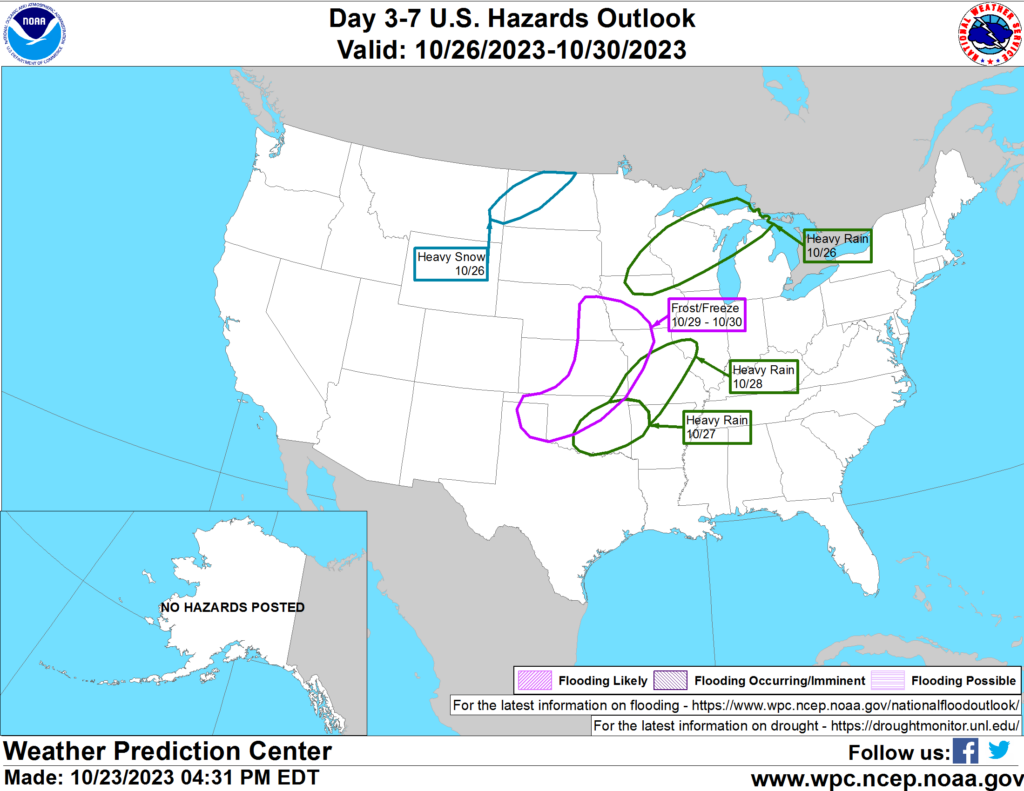
A major pattern change underway across western North America will include a strong surge of cold air—starting on Tuesday—across northern sections of the Rockies and High Plains. During the second half of the week, chilly conditions will encompass much of the western U.S., along with the Plains and upper Midwest. Late-season warmth will linger, however, across the South, East, and lower Midwest. Mid- to late-week temperatures will remain below 32°F in much of Montana and portions of neighboring states, with minimum temperatures expected to fall below 10°F. In many areas, snow accumulations should precede the coldest weather, helping to insulate emerging winter wheat. However, some livestock producers will have to contend with wind-driven snow. Snow should develop on Tuesday from the Cascades to Montana, with accumulations shifting eastward by Thursday into parts of the Dakotas. Elsewhere, dry weather will prevail during the next 5 days in the Southeast and along the Atlantic Coast, while a band of heavy rain (locally 2 to 4 inches or more) should stretch from central Texas into portions of the Great Lakes States.
Add Comment