Weather
Blizzard conditions to severe weather headline another spring storm for the Heartland
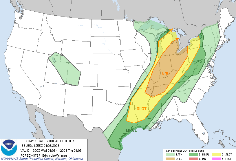
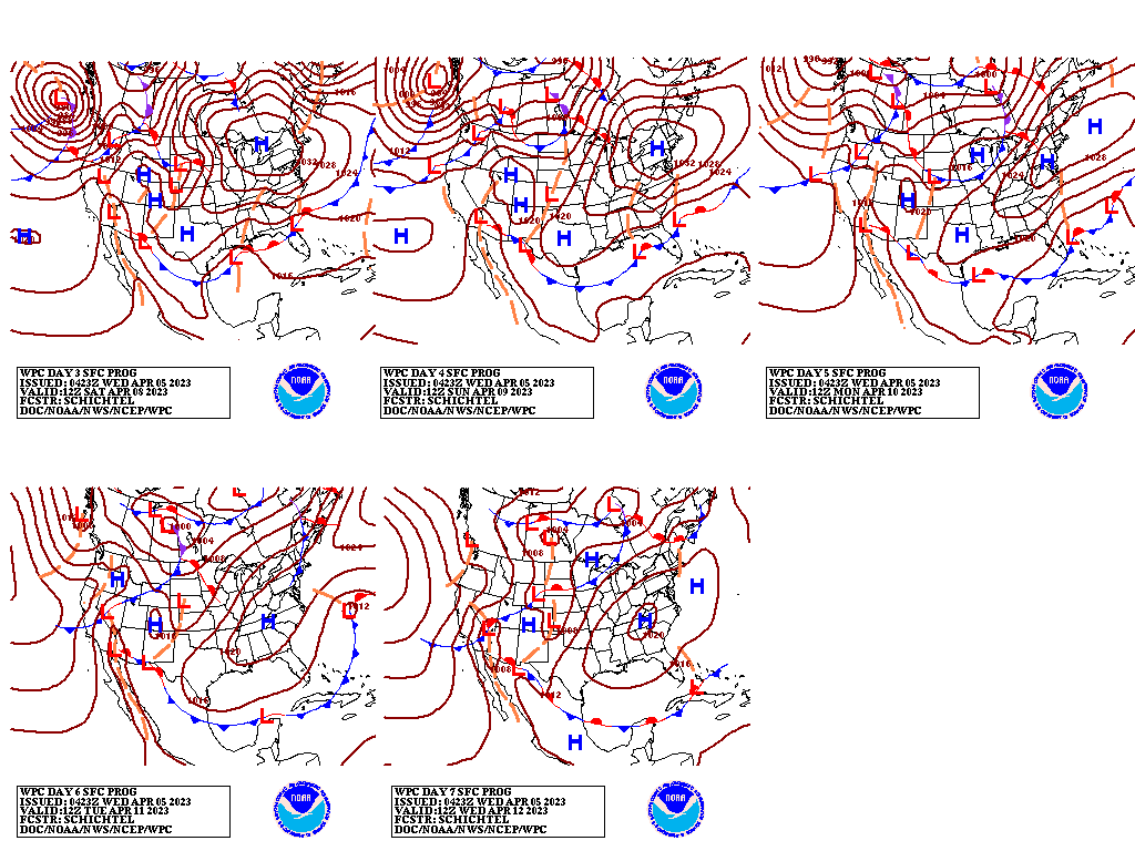
A threat of severe weather—including high winds, large hail, and isolated tornadoes—will linger Wednesday in the vicinity of a cold front stretching from the Great Lakes region into the mid-South.
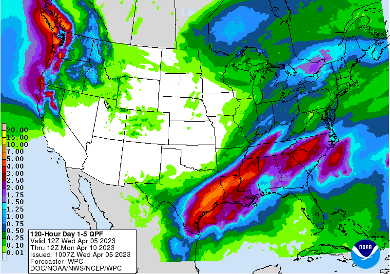
Eventually, the front will stall across the Deep South, leading to 5-day rainfall totals of 2 to 6 inches from the western Gulf Coast region to the Mississippi Delta. In contrast, dry weather will prevail during the next 5 days across large sections of the Plains, Great Basin, and Southwest, including southern California.
Farther north, precipitation will return during the second half of the week across northern California and the Northwest.
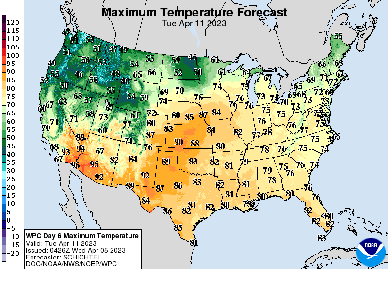
By week’s end, notably warmer air will arrive across the nation’s southwestern quadrant, with temperatures topping 90°F in the Desert Southwest.
Add Comment