Weather
An active weather pattern for much of the Heartland over the next, couple of days
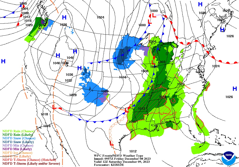
A storm system currently crossing the Northwest will traverse the nation’s mid-section over the next couple of days.
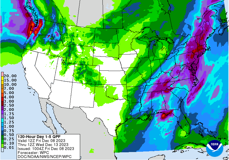
Rain along the storm’s trailing cold front will become heavy—totaling 1 to 3 inches—during the weekend, mainly along and east of a line from the Mississippi Delta to the lower Great Lakes region.

Thunderstorms in the vicinity of the front may become severe, especially on Saturday in the lower Mississippi Valley and neighboring areas. Meanwhile, snow should develop on Friday across the central Rockies and adjacent High Plains, with subsequent accumulations possible across the northern Plains and upper Midwest.

Cooler weather will trail the storm system and its attendant cold front, although temperatures will not be unusually low for this time of year.
Elsewhere, mostly dry weather will prevail during the next 5 days from southern California to the southern Plains, while periodic rain and snow showers will continue in the Northwest.
Add Comment