Weather
A mild mid-winter pattern across the Heartland

Bitterly cold conditions will not affect the continental U.S. for the remainder of January, although chilly, breezy weather will briefly affect the Northeast around the middle of the week. Late in the weekend, however, markedly colder air will begin to overspread the Far West.
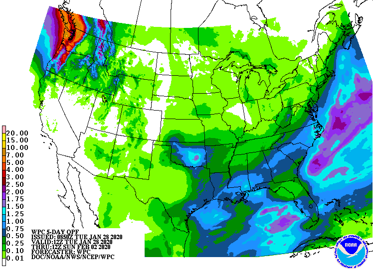
Prior to the arrival of colder air, stormy weather will continue in the Pacific Northwest, where 5-day precipitation totals west of the Cascades could reach 3 to 6 inches or more. Farther east, the storm system currently affecting the central and southern Plains will drift eastward, crossing Florida’s peninsula by Thursday.
Subsequently, a stronger storm system should develop over the Southeast by week’s end. That storm could eventually produce rain, snow, and wind in the middle and northern Atlantic States.
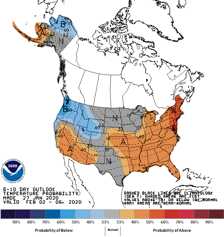
Looking ahead, the 6- to 10-day outlook calls for near- or above-normal temperatures nationwide, except for cooler-than-normal conditions in the Northwest.

Meanwhile, near- or below-normal precipitation west of the Rockies and from the western Gulf Coast region into the Midwest should contrast with wetter-than-normal weather across the Rockies, High Plains, and from the Appalachians to the Atlantic Seaboard.
Add Comment