Weather
Winter-like cold north; temps moderating across the rest of the Heartland
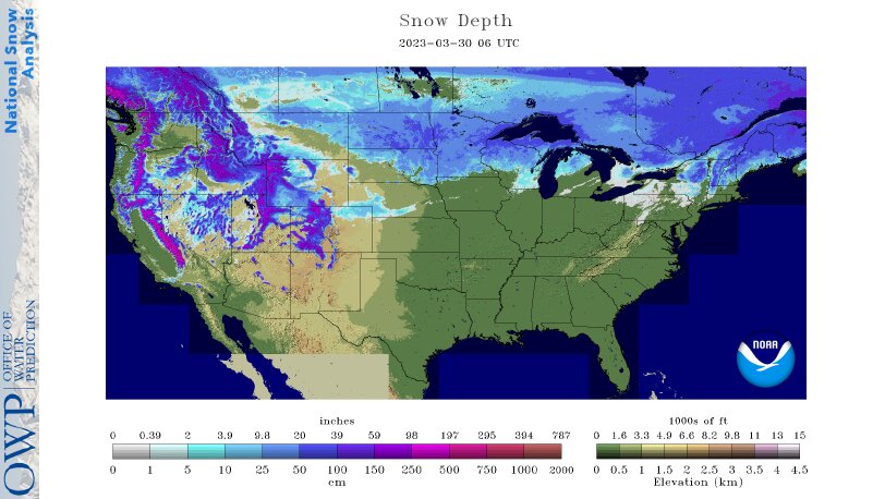
Across the Corn Belt, cool, dry weather prevails in advance of an approaching storm system. Remarkably cold weather persists across the far upper Midwest, including eastern North Dakota and northern Minnesota, where Thursday morning’s minimum temperatures fell below 0°F. In Fargo, North Dakota, where the current snow depth is 20 inches, a temperature of 40°F or higher was last observed more than 20 weeks ago, on November 9, 2022.
On the Plains, dry weather prevails. However, unusually cold conditions on the northern Plains contrast with warm, breezy weather on the southern Plains. A significantly elevated wildfire threat exists Thursday across the southern High Plains, although lack of fuel availability due to drought could curb ignition potential. Meanwhile on the northern Plains, livestock producers are preparing for an impending, late-season snowstorm.
In the South, light freezes were noted Thursday morning as far south as the Tennessee Valley. Cool weather covers the remainder of the Southeast, while warmth is returning west of the Mississippi Delta. Planting is advancing in drier areas of the Deep South and southern Atlantic region. In Texas, 22% of the intended rice acreage had been planted by March 26.
In the West, a Pacific storm system is finally moving inland. Lingering impacts in southern California include rain and snow showers, along with gusty winds. Cool, unsettled weather extends inland to other parts of the West. Meanwhile, portions of California’s San Joaquin Valley are contending with near-record river stages. For example, the level of the San Joaquin River at Patterson is nearly steady, approximately a foot below the February 2017 high-water mark.
Add Comment