Weather
Widespread rains developing across much of the Corn Belt
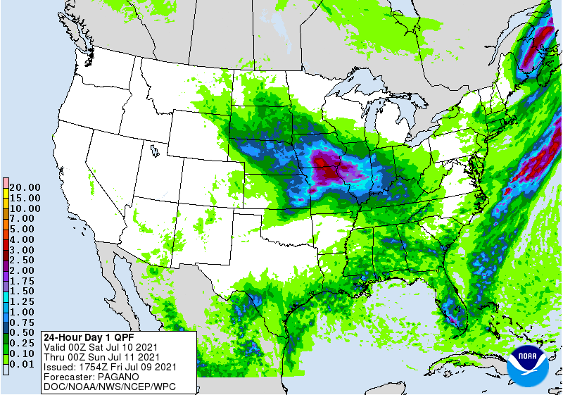
Across the Corn Belt, an important rainfall event is underway as summer crops approach or enter reproduction. Early Friday, the heaviest rain is falling in parts of Iowa and Nebraska. On July 4, Iowa led the Midwest with 5% of its soybeans setting pods. However, the latest band of rain is setting up south of the driest area of the upper Midwest, which includes much of Minnesota and the Dakotas. Meanwhile, Friday’s Midwestern high temperatures will remain below 85°, except for higher readings in the southwestern Corn Belt (e.g. eastern Nebraska, southwestern Iowa, and northern Missouri).
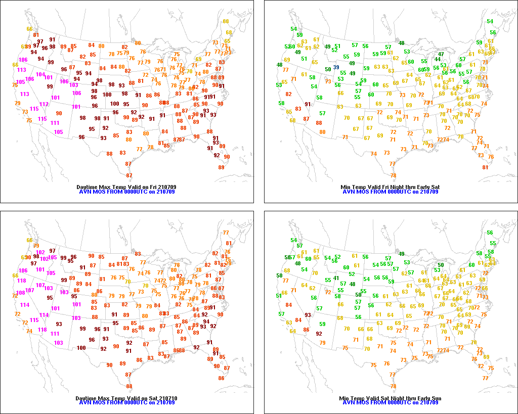
On the Plains, warm weather is promoting winter wheat maturation and harvesting, as well as summer crop growth. However, scattered thunderstorms across the central Plains are causing minor fieldwork disruptions. On the northern Plains, drought continues to adversely affect rangeland and pastures, as well as a variety of winter grains and spring-sown crops.
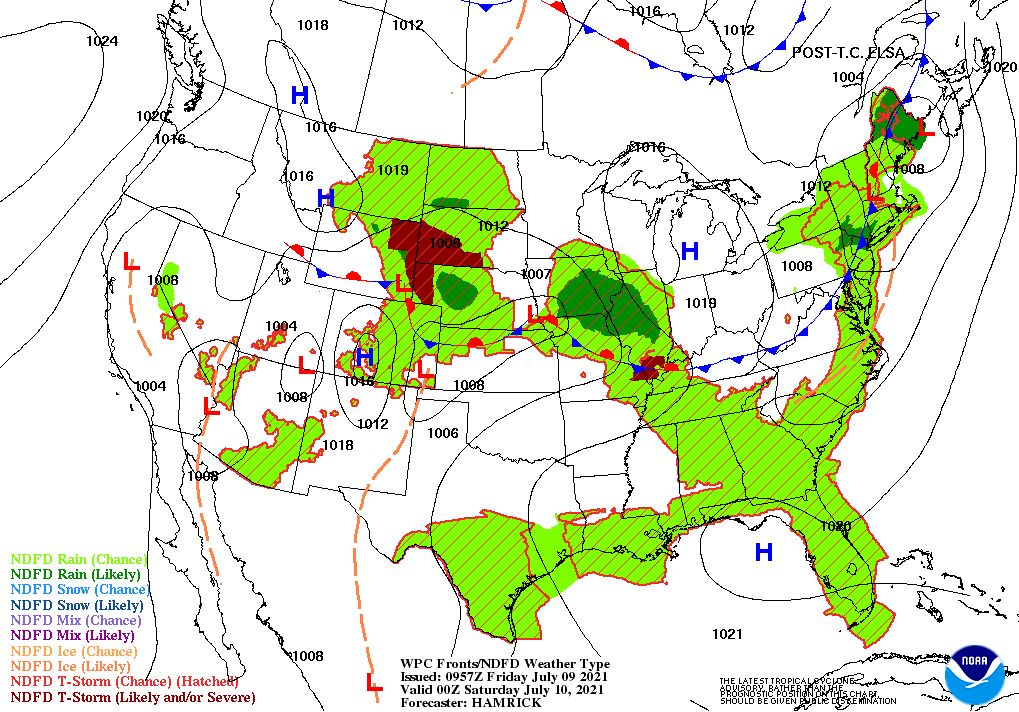
In the South, mostly dry weather prevails in the southern Atlantic States in the wake of Tropical Storm Elsa’s departure. Farther west, however, locally heavy showers linger in the western Gulf Coast region. Elsewhere, very warm, humid weather favors a rapid pace of summer crop development.
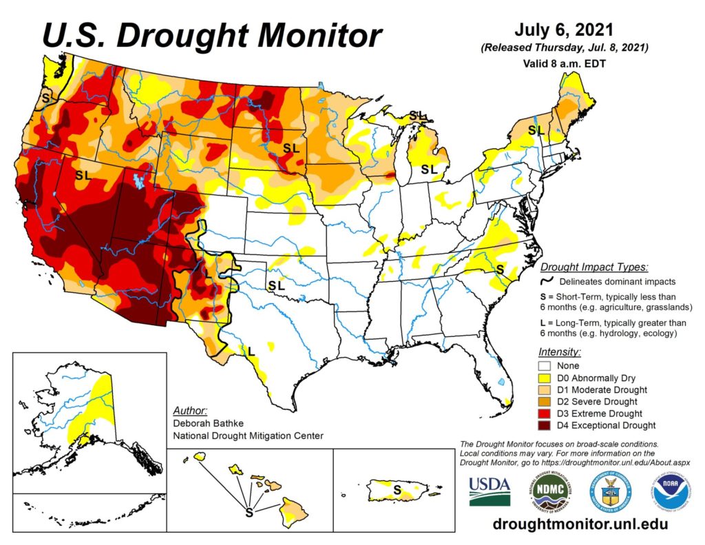
In the West, a hot, dry pattern is resulting in mounting drought complications, ranging from sharply reduced irrigation reserves to severely stressed rangeland, pastures, and small grains. In addition, an elevated wildfire threat continues in some areas, particularly across the Intermountain West. Later Friday, dry thunderstorms could ignite new fires in the central and northern Rockies and environs.
Add Comment