Weather
Wide-ranging weather dominates the Heartland
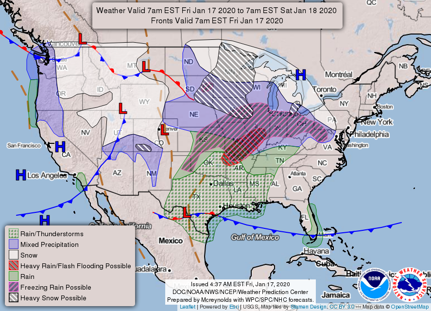
Across the Corn Belt, wintry precipitation is overspreading the middle Mississippi Valley and the middle and lower Missouri Valley. The remainder of the Midwest is experiencing cold weather and thickening cloudiness as precipitation approaches from the south and west. Lower Midwestern river levels remain substantially elevated; for example, moderate flooding is occurring on the White River from Newberry, Indiana, downstream to its confluence with the Wabash River.
On the Plains, a major winter storm is underway from Kansas northward. Early Friday, snow is blanketing much of Nebraska, while wintry precipitation—including sleet and freezing rain—is falling in Kansas. Elsewhere, showers and thunderstorms are affecting the southern Plains, with some wintry precipitation lingering across western sections of Oklahoma and Texas.

In the South, wintry precipitation (sleet and freezing rain) is spreading across the Ozark Plateau. Elsewhere, scattered rain showers are developing in advance of an approaching storm system. Due to earlier downpours, moderate flooding is occurring in Mississippi along portions of the Pearl and Big Black Rivers. The Mississippi River at Natchez, Mississippi, continues to rise and is nearly 2 feet above flood stage, but remains more than 8 feet below last year’s highest crest.
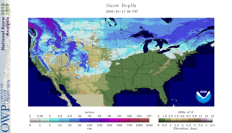
In the West, snow is falling in parts of the northern Rockies, while rain and snow showers dot the Intermountain region. Some light precipitation also lingers in northern California and the Pacific Northwest. In general, Northwestern snowpack has greatly improved in recent weeks and is close to the mid-January average.
Add Comment