Weather
Weather & temps continue to vary greatly northwest to southeast across the Heartland
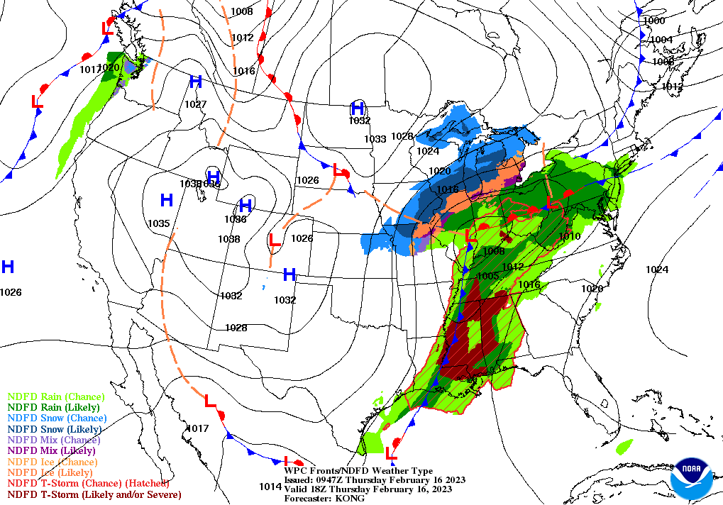
Across the Corn Belt, a storm system traversing the middle Mississippi Valley is resulting in a variety of weather hazards. A band of snow expanding northeastward from the western Corn Belt is leading to travel difficulties and increased livestock stress. Early Thursday, some of the most significant snow is falling from southeastern Nebraska into Iowa. Meanwhile, heavy showers and locally severe thunderstorms are affecting the lower Ohio Valley. Flash flooding is a concern in areas where the heaviest rain is falling. Elsewhere, cold, dry weather covers the far upper Midwest.
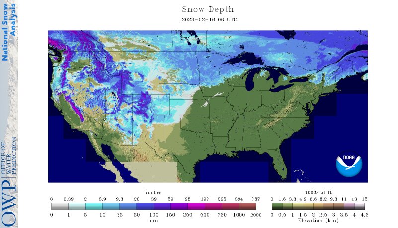
On the Plains, snow and gusty winds linger early Thursday across northern Kansas and southern Nebraska. As the central Plains’ snow shifts eastward, cold air is engulfing the nation’s mid-section. Thursday morning’s low temperatures dipped below 0°F in eastern North Dakota and environs and fell to 10°F or lower as far south as Texas’ northern panhandle.
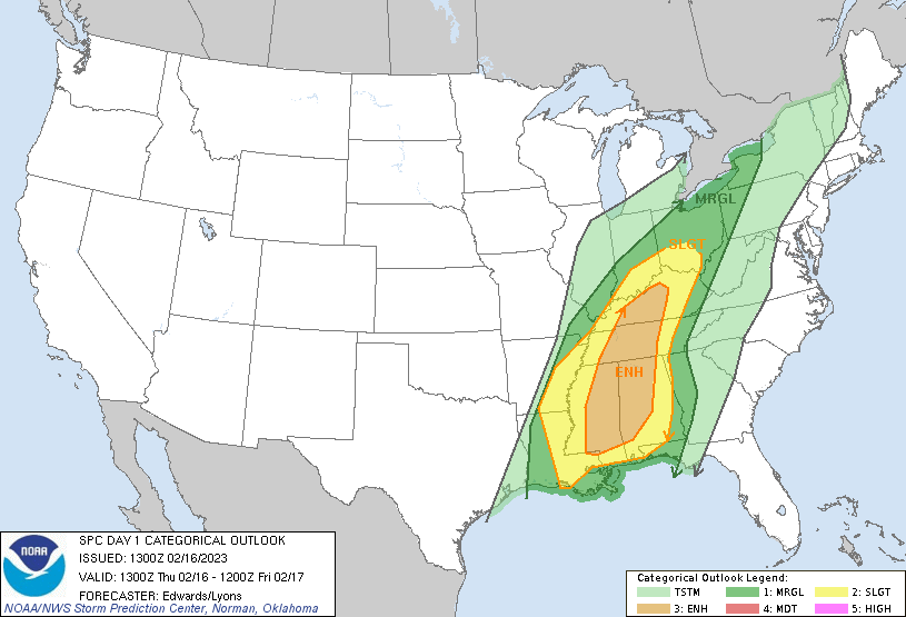
In the South, unseasonably warm weather prevails in advance of an approaching cold front. Later Thursday, Southeastern high temperatures will generally range from 70 to 85°F. Meanwhile, showers and thunderstorms in the Tennessee Valley and neighboring regions are causing flash flooding and localized wind damage. Cooler, drier air has begun to overspread the western Gulf Coast region.
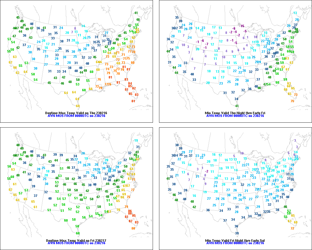
In the West, cold, dry weather prevails. A few readings below -20°F were reported Thursday morning in the northern Intermountain West. Meanwhile, a Freeze Warning was in effect for the second consecutive day in California’s San Joaquin Valley. Freezes were also noted in parts of southern California and the Desert Southwest. Elsewhere, a cold front approaching the Pacific Northwest remains offshore.
Add Comment