Weather
Warmer weather, rain to return to the Corn Belt
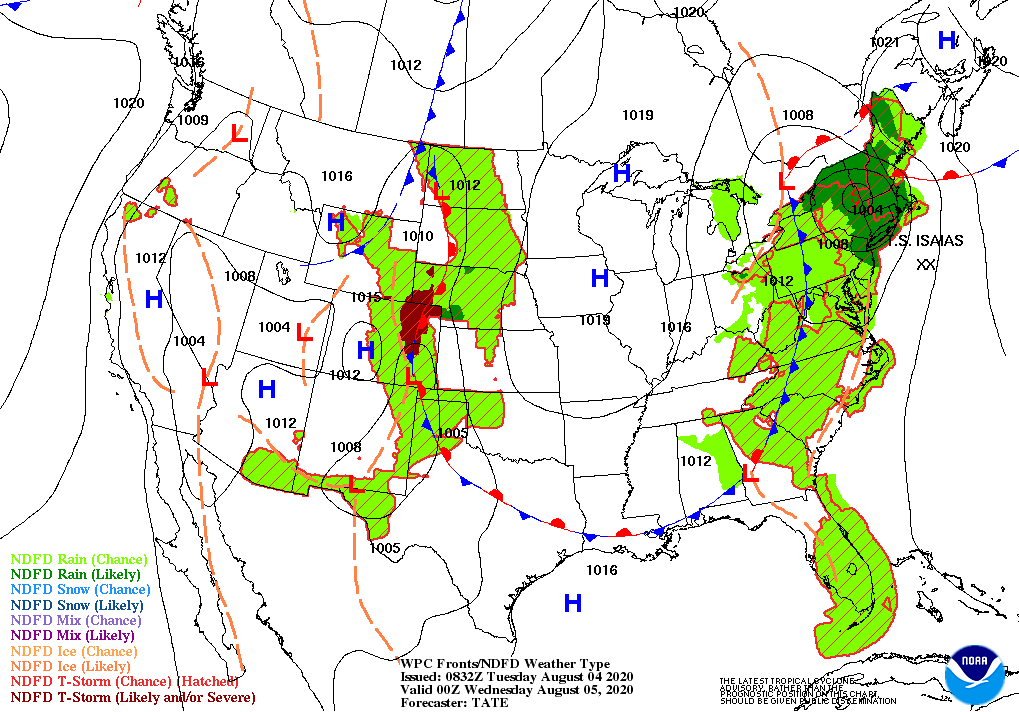
After having made landfall in the eastern Carolinas, Isaias will accelerate but remain just inland near the Atlantic Seaboard, reaching New England late Tuesday. Storm-total rainfall along the path of Isaias should reach 3 to 6 inches, with locally higher amounts, leading to flash flooding. Tropical storm-force winds (39 mph or greater) should affect a broad area along and east of the center of Isaias, possibly leading to downed trees and powerlines. Finally, a 2- to 5-foot storm surge could affect the coastal Carolinas, while a 1- to 3-foot surge can be expected north of Cape Hatteras, North Carolina.
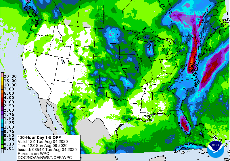
Outside of the tropical system’s influence, rain showers will be mostly light and scattered, with only a few spots between the Rockies and Appalachians receiving in excess of an inch.
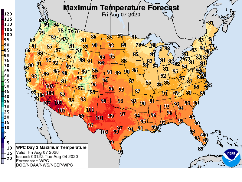
Meanwhile, a cool spell from the eastern Plains to the Appalachians will continue for much of the week, but heat in the Far West will be replaced by cooler conditions.
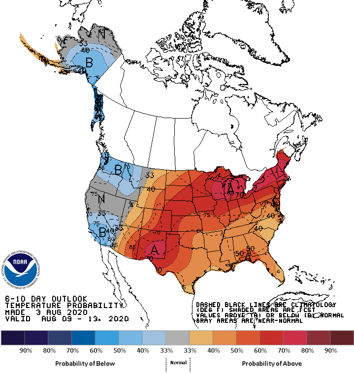
Looking ahead, the 6- to 10-day outlook calls for the likelihood of above-normal temperatures in northern California and environs, as well as all areas along and east of a line from Arizona to North Dakota. Cooler-than-normal conditions should be limited to southern California and the interior Northwest.
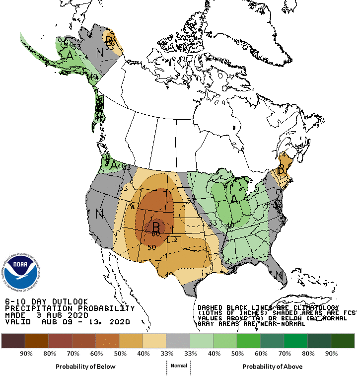
Meanwhile, near- or below-normal rainfall across most of the country should contrast with wetter-than-normal weather in southern Texas and from the Great Lakes States into the mid-Atlantic.
Add Comment