Weather
Warmer for the Heartland; Wetter days may follow
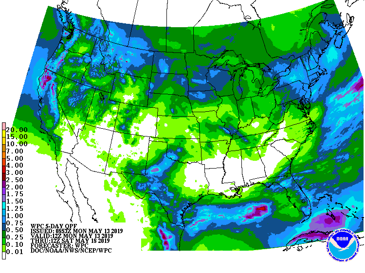
For the remainder of Monday, precipitation will linger across the East, with wet snow possible in northern New England. Some of the heaviest rain will fall across Florida and the Northeast. Showers will also persist the rest of Monday in the Rio Grande Valley and the western Gulf Coast region.
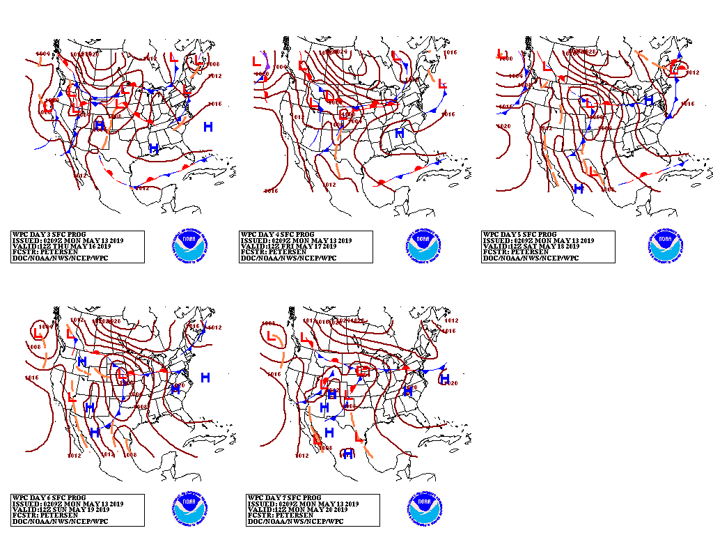
By mid-week, the first in a series of Pacific storms will arrive in California. The storm, more typical of a late-winter or early-spring system, will result in snow in the Sierra Nevada and widespread rain in valley locations. Toward week’s end, precipitation will develop across the North, especially from the northern Rockies to the Great Lakes region.
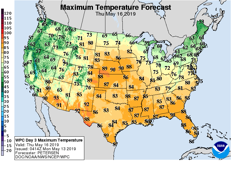
Cool weather will cover much of the country, but warmth will develop around mid-week across the nation’s mid-section in advance of the Pacific storm.
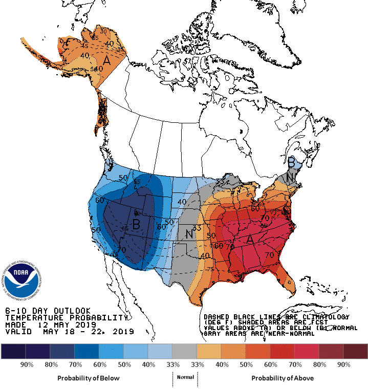
Looking ahead, the 6- to 10-day outlook calls for cooler-than-normal conditions will prevail from the Pacific Coast to the High Plains, while above-normal temperatures will prevail across the eastern half of the U.S., except along the Canadian border.
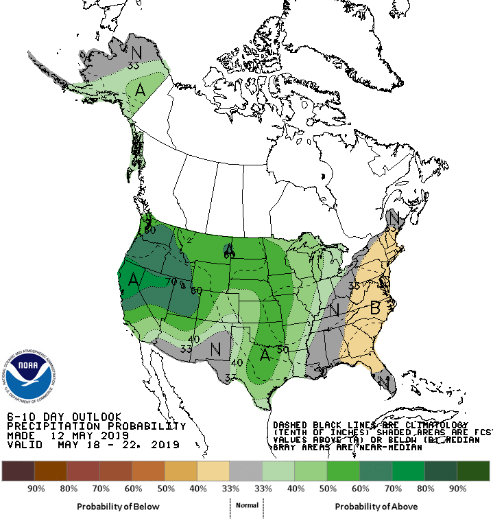
Meanwhile, drier-than-normal weather in the Atlantic Coast States will contrast with near- or above-normal precipitation across the remainder of the country.
Add Comment