Weather
Warmer days ahead; still wet sections of the Corn Belt
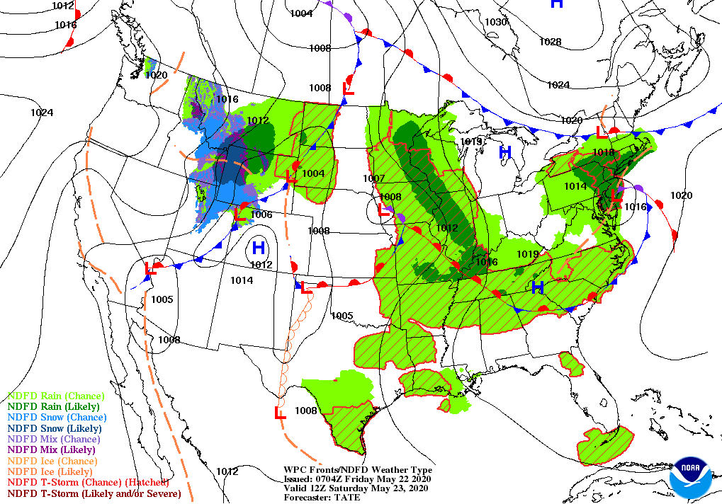
Slow-moving storm systems are currently centered over the Tennessee Valley and the southern Canadian Prairies, respectively. The Southeastern storm will gradually weaken and drift eastward but could produce an additional 1 to 3 inches of rain in the middle Atlantic States. Meanwhile, the Canadian storm will continue to spark scattered showers from the Pacific Northwest to the northern Rockies.
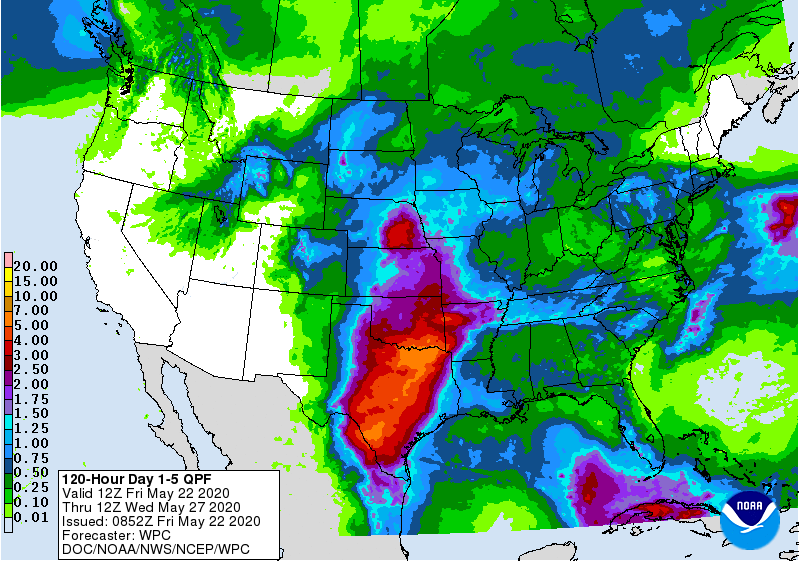
In addition, showers and locally severe thunderstorms will remain active in the vicinity of the storm’s trailing cold front; 5-day rainfall totals could reach 1 to 3 inches or more across portions of the Plains and Mississippi Valley. In contrast, little or no rain will fall during the next 5 days in northern New England and from California to the Four Corners region.

Building warmth will accompany California’s dry weather, while temperatures will also rebound to above-normal levels from the Gulf Coast northward into the Midwest.
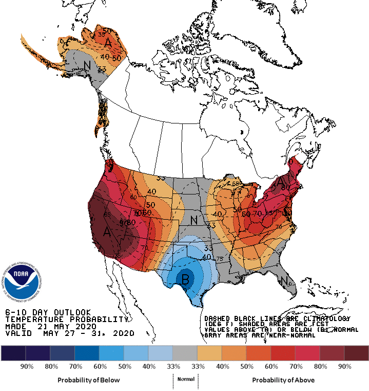
Looking ahead, the 6- to 10-day outlook calls for the likelihood of near- or above-normal temperatures nationwide, except for cooler-than-normal conditions in the southcentral U.S.
Looking ahead, the 6- to 10-day outlook calls for the likelihood of near- or above-normal temperatures nationwide, except for cooler-than-normal conditions in the south-central U.S.
Add Comment