Weather
Unsettled weather covers much of the Heartland
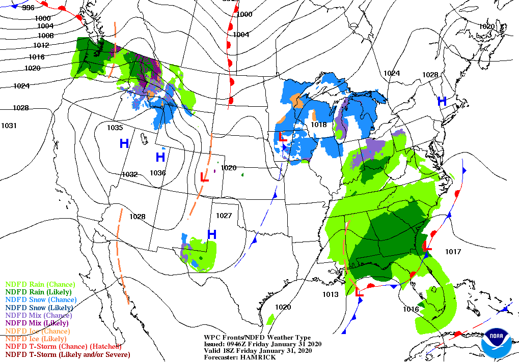
Across the Corn Belt, rain is maintaining soggy conditions in the lower Ohio Valley. Across the remainder of the Midwest, patches of light, wintry precipitation—mainly snow and freezing drizzle—are causing generally minor travel disruptions. Despite cloudiness, fog, and precipitation, Midwestern temperatures remain mostly above normal for this time of year.
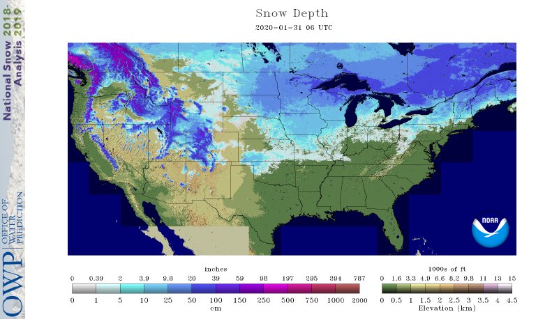
On the Plains, windy weather is developing across Montana, further eroding winter wheat’s protective snow cover. Farther east, however, a deep snow cover remains in place across the eastern Dakotas, where most corn and sunflower harvest efforts have been stalled for the last 2 months. In southwestern Kansas and neighboring areas, winter wheat, rangeland, and pastures are benefiting as recent snowfall begins to melt.
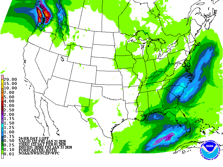
In the South, widespread rain showers are overspreading the Tennessee Valley and parts of the Southeast. Meanwhile, cool, dry, breezy weather prevails in the western Gulf Coast region. Elsewhere, the Mississippi River at Natchez, Mississippi, crested 5.61 feet above flood stage on Thursday and has begun to slowly fall.
In the West, Pacific moisture continues to push inland toward the northern Rockies. Early Friday, heavy precipitation is falling in parts of western Washington. Mild, dry weather covers the remainder of the West, favoring winter fieldwork in California and the Desert Southwest.
Add Comment