Weather
Unseasonably warm days ahead for the Heartland
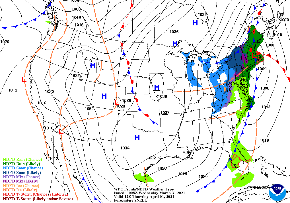
For the remainder of Wednesday and into Thursday, locally heavy showers will spread from the interior Southeast into the middle and northern Atlantic States. However, the flood threat across the Tennessee Valley and environs will gradually subside as rain shifts eastward. With colder air arriving in the Northeast, precipitation will change to accumulating snow at some interior locations, particularly across northern sections of New York and Vermont.
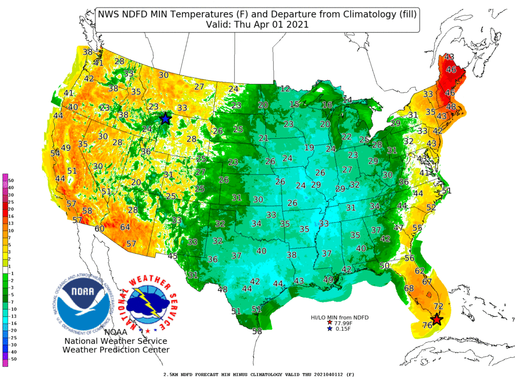
Cold air in the storm’s wake will result in freezes on April 1 across portions of the southern High Plains and as far south as the northern Mississippi Delta.
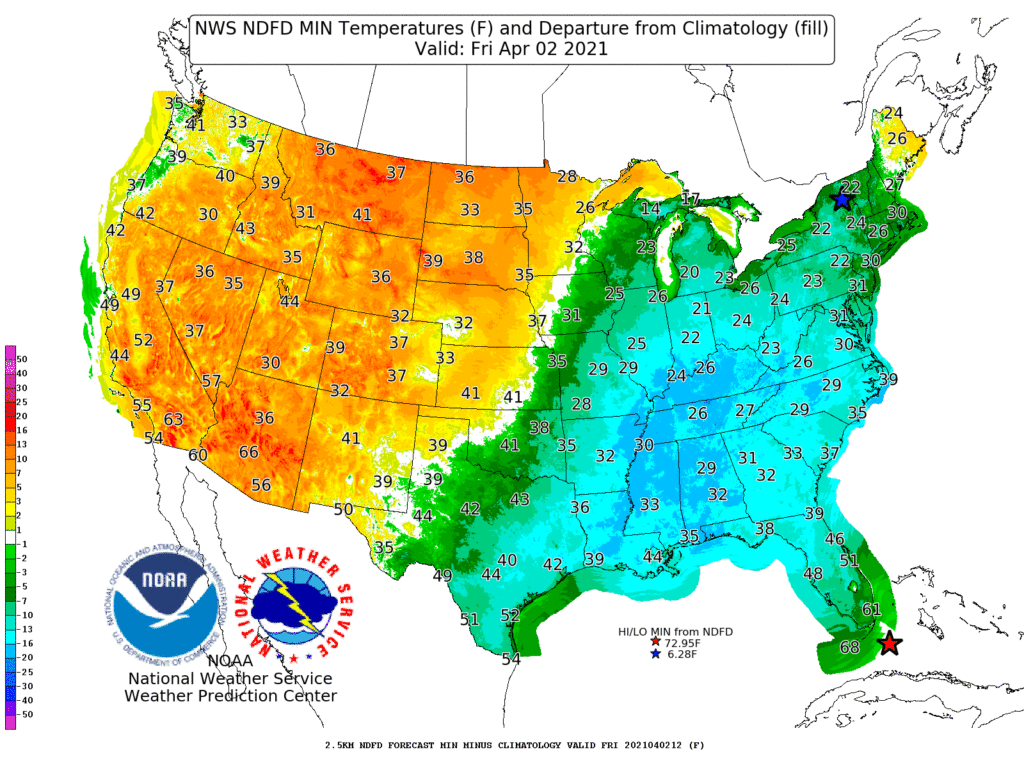
On April 2, freezes will occur deep into the Southeast as far south as Alabama and Georgia, possibly threatening blooming fruits and other temperature-sensitive crops.
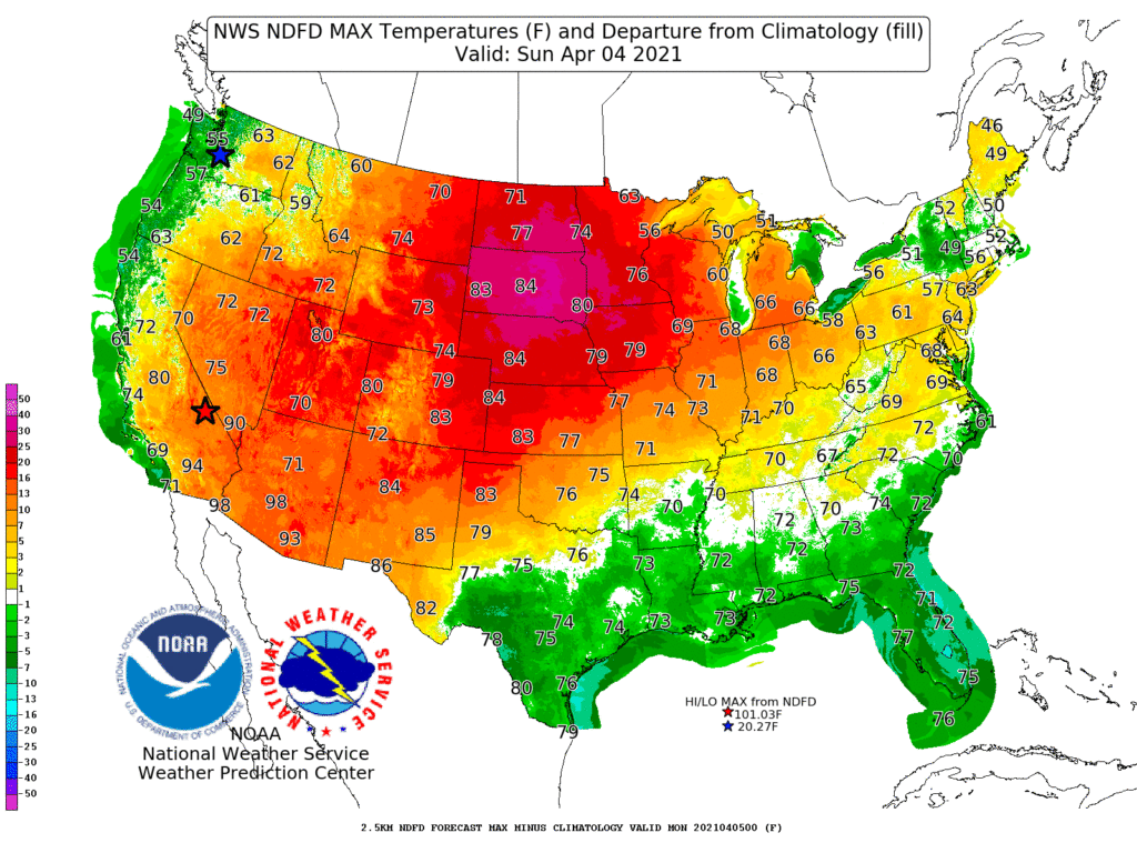
In contrast, warmth will expand across the West and spread into the central U.S., with weekend temperatures topping 80° as far north as the Dakotas.
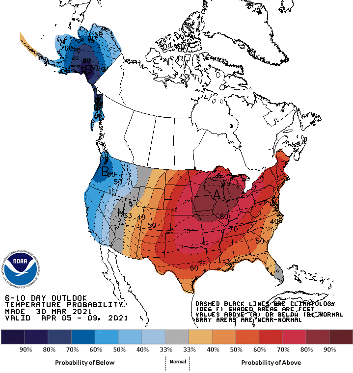
Looking ahead, the 6- to 10-day outlook calls for the likelihood of near- or above-normal temperatures nationwide, except for cooler-than-normal conditions in the Far West.
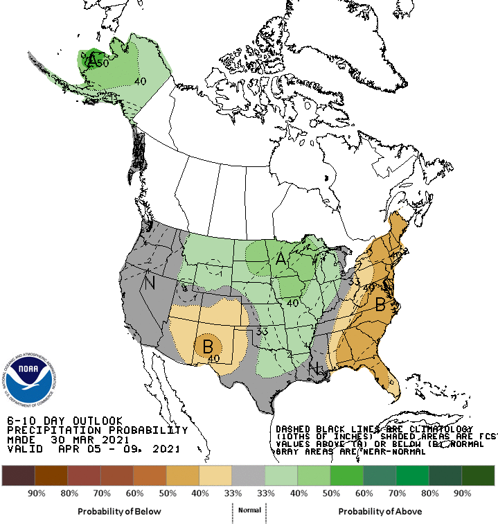
Meanwhile, near- or above-normal precipitation in most areas from the Pacific Coast to the Mississippi Valley and the Midwest should contrast with drier-than-normal weather in the Four Corners region and the eastern U.S.
Add Comment