Weather
Tranquil weather, cooler air headed for the Heartland
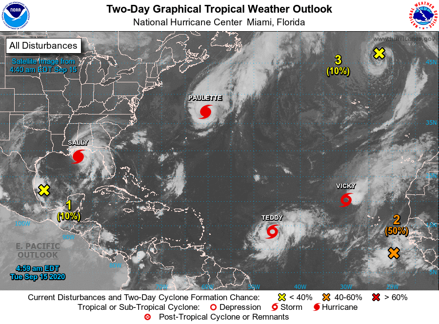
Sally is forecast to reach the central Gulf Coast region of the U.S. on Tuesday as a category 1 hurricane with sustained winds near 85 mph. Potential hazards along and near Sally’s path include torrential rainfall (8 to 16 inches, with isolated amounts up to 24 inches), a dangerous storm surge (as much as 7 to 11 feet from the mouth of the Mississippi River to Ocean Springs, Mississippi), wind damage consistent with a low-end hurricane, and isolated tornadoes.

Elsewhere, showers will begin to spread inland across the Pacific Northwest as the week progresses, but mostly dry weather will cover the remainder of the West, as well as large sections of the Plains and Midwest.
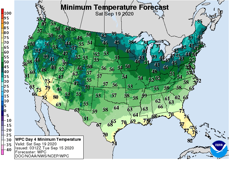
Summer-like warmth will prevail in much of the West, but a surge of cool air will engulf the Midwest and East later in the week.

Looking ahead, the 6- to 10-day outlook calls for the likelihood of cooler-than-normal conditions in most areas along and east of a line from eastern Texas to Lake Michigan, while near- or above-normal temperatures will dominate the western and central U.S.

Meanwhile, wetter-than-normal weather across portions of the northern Plains and upper Midwest should contrast with near- or below-normal precipitation across the remainder of the country.
Add Comment