Weather
Timely, beneficial rains to build across the Heartland
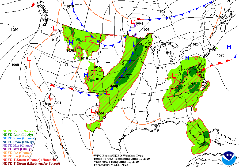
Mid-Atlantic showers will become less numerous as a low-pressure system begins to weaken and move away. Still, additional rainfall could total 1 to 2 inches in Virginia and portions of neighboring states. Parts of Florida’s peninsula may also experience heavy showers.
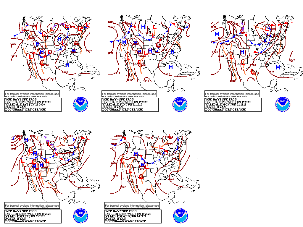
Meanwhile, a slow-moving cold front will move eastward across the Plains and Midwest, preceded by showers and locally severe thunderstorms.
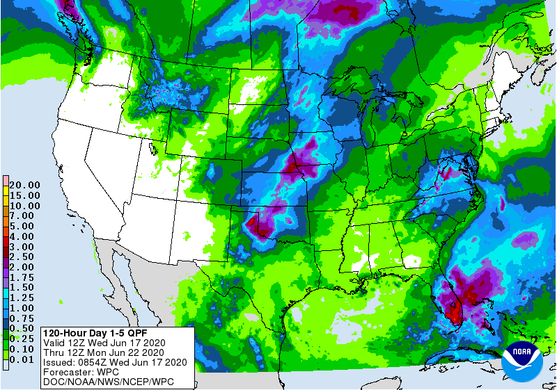
Five-day totals could reach 1 to 3 inches, with locally higher amounts, from the southern Plains into the upper Midwest. Most of the remainder of the country, including New England, the Pacific Coast States, the Great Basin, the Southwest, and much of the Southeast, will remain dry during the next 5 days.
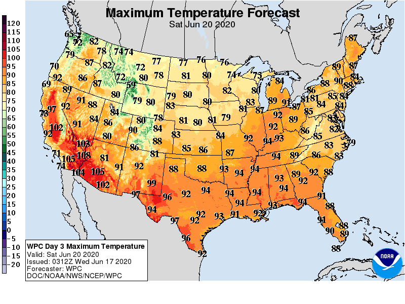
Elsewhere, warmth will continue to build across the Great Lakes and Northeastern States, while cooler weather will prevail for several days on the Plains.
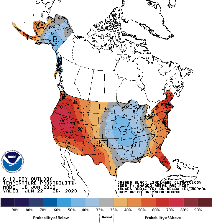
Looking ahead, the 6- to 10-day outlook for the likelihood of below-normal temperatures from the eastern Plains into the Mississippi Valley, while warmer-than-normal weather will prevail in the East and from the Pacific Coast to the High Plains.
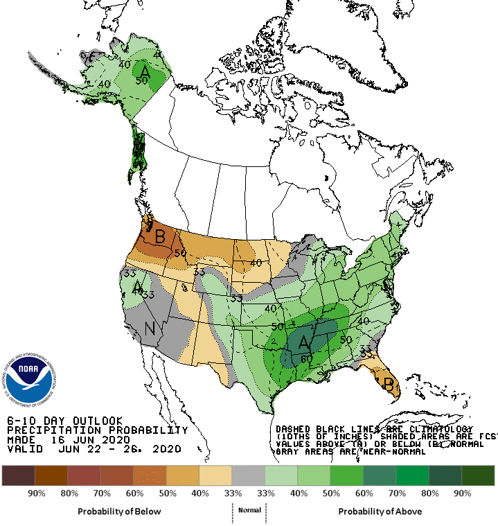
Meanwhile, near- or above-normal rainfall across much of the country should contrast with drier-than-normal conditions across Florida’s peninsula and from the Pacific Northwest into the far upper Midwest.
Add Comment