Weather
Summer-like pattern to dominate the Heartland
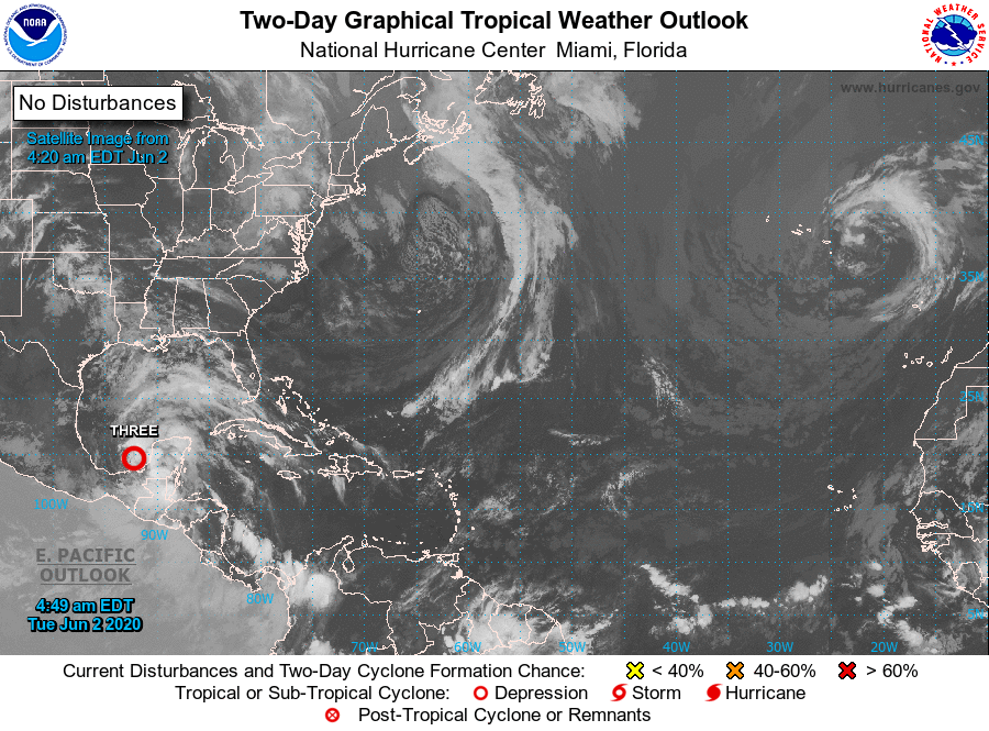
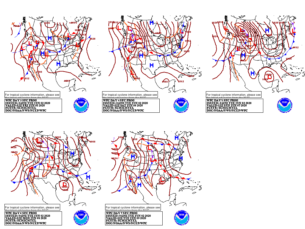
Moisture pooled over the Gulf of Mexico will continue to drift northward, especially later in the week as a cold front begins to interact with Tropical Depression Three.
The tropical depression may achieve tropical-storm status within a few days. which should initially remain well south of the United States but could impact parts of southern Mexico and Central America.

Meanwhile, much of the southern and western U.S. will experience little or no rainfall during the next 5 days. Late in the week however, showers may begin to overspread portions of the Gulf Coast region, as an approaching cold front draws tropical moisture northward. Farther north, a pair of cold fronts will generate scattered showers from the Midwest into the Northeast.
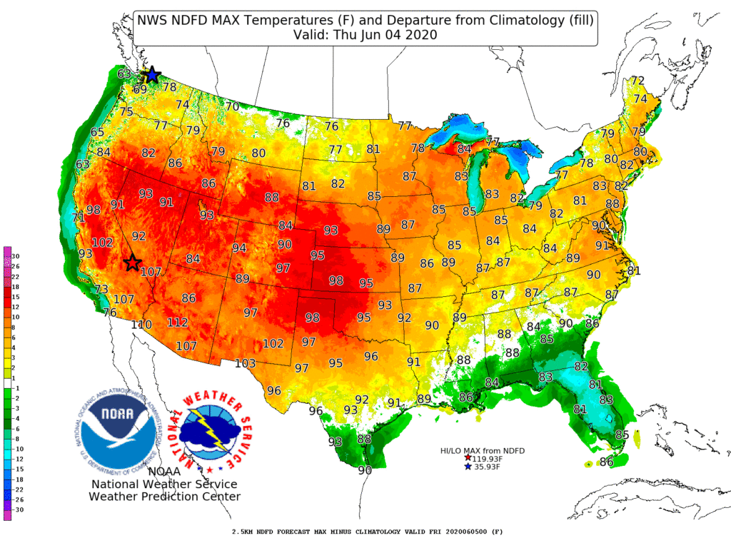
Elsewhere, above-normal temperatures—currently most prominent across the northern Plains and upper Midwest—will expand to cover much of the country during the mid- to late-week period.
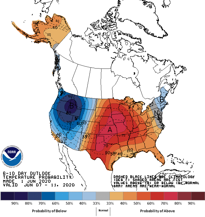
Looking ahead, the 6- to 10-day outlook calls for the likelihood of above-normal temperatures throughout the central and eastern U.S., except northern New England, while cooler-than-normal conditions will dominate the West.
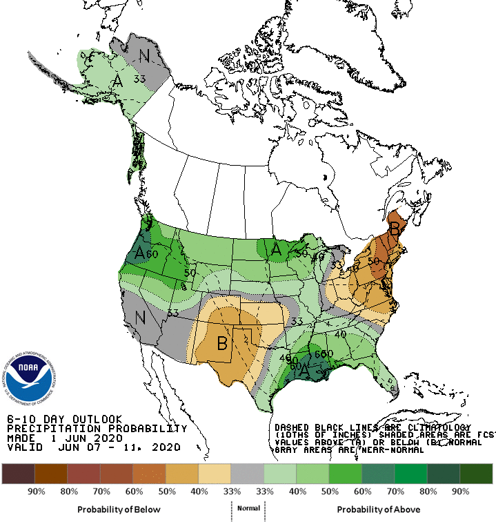
Meanwhile, above-normal rainfall in the Southeast and from the Pacific Northwest into the Great Lakes region should contrast with drier-than-normal weather in the Northeast and central and southern sections of the Rockies and Plains.
Add Comment