Weather
Storms high heat, humidity for much of the Heartland
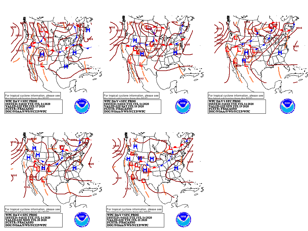
A slow-moving cold front will continue to help focus shower and thunderstorms activity across portions of the Plains and Midwest through mid-week. Subsequently, showers will shift into the East. Meanwhile, a second cold front will spark late-week showers, primarily across the northern Plains and upper Great Lakes region.
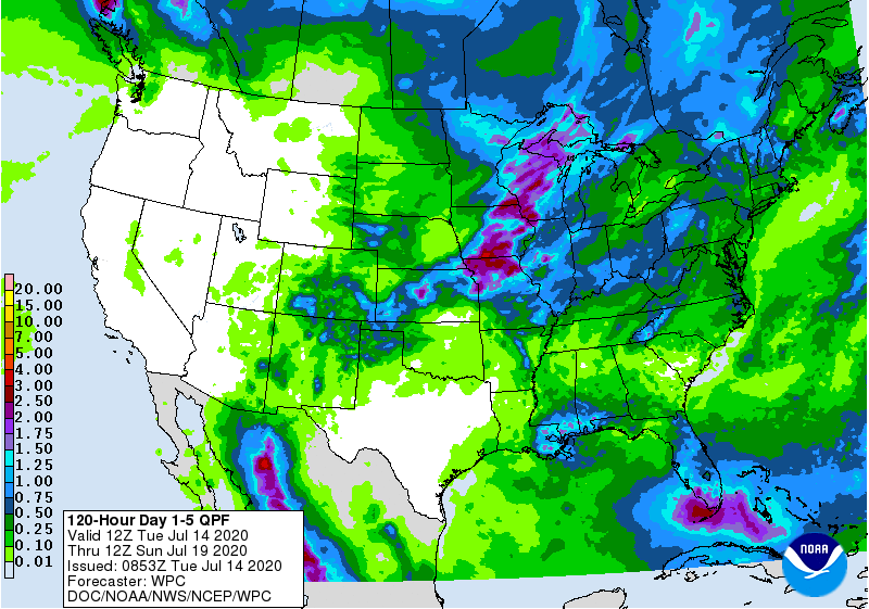
Five-day rainfall totals could reach 1 to 3 inches from Wisconsin to Kansas, while lighter amounts should occur in most other areas from the Plains to the East Coast. Mostly dry weather will persist, however, across Texas, except in the northern panhandle. Dry weather will also cover much of the West, although monsoon-related showers may become more numerous across Colorado, New Mexico, and eastern Arizona.
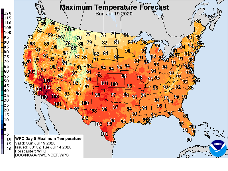
Elsewhere, ongoing heat across the southern Plains and the Southwest will contrast with near- or below-normal Midwestern temperatures.
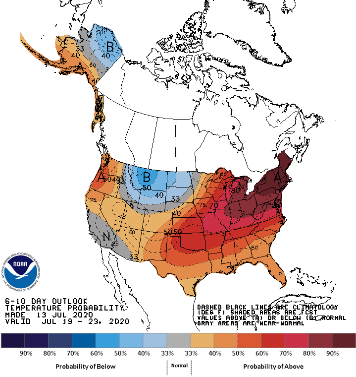
Looking ahead, the 6- to 10-day outlook calls for the likelihood of near- or above-normal temperatures nationwide, except for cooler-than-normal conditions in northern sections of the Rockies and Plains.
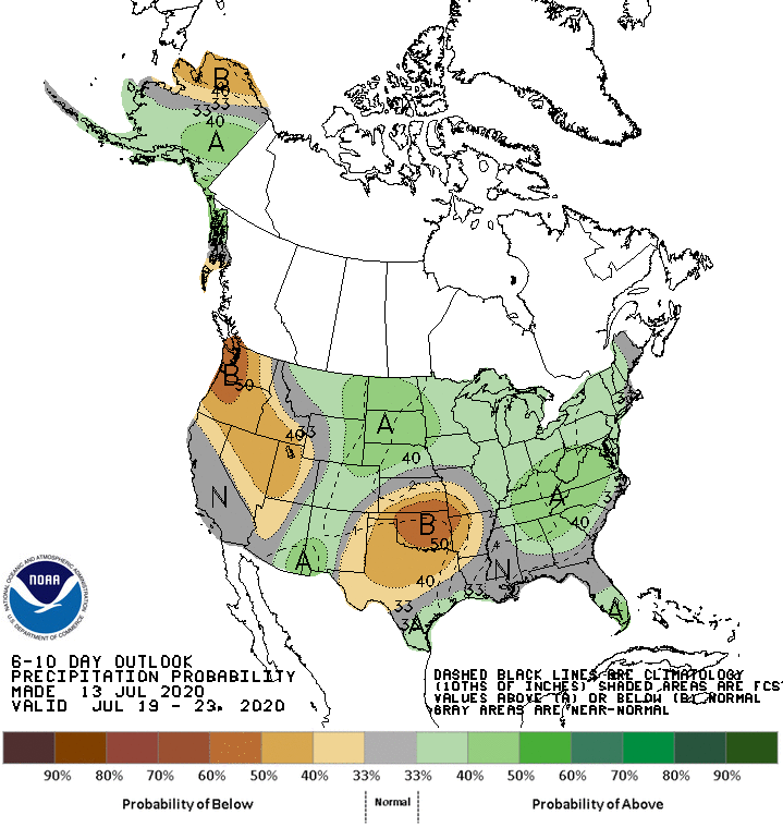
Meanwhile, near- or above-normal rainfall across most of the country should contrast with drier-than-normal weather in the Pacific Northwest, Intermountain West, and southern Plains.
Add Comment