Weather
Sprawling early-winterlike storm still impacting much of the Heartland
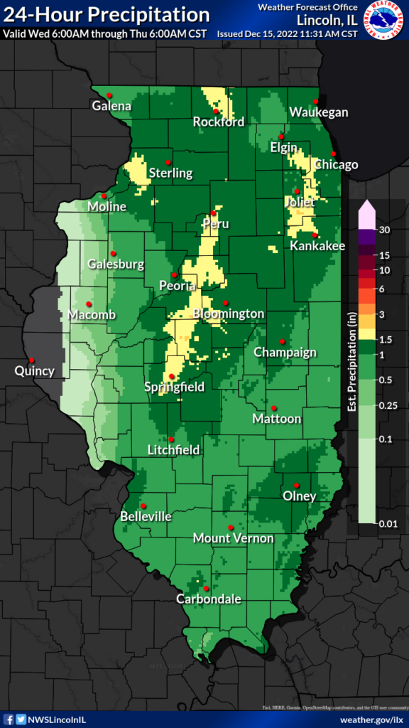
Across the Corn Belt, a significant rain event has ended east of the Mississippi River. On December 14, daily-record precipitation totals were observed in Illinois locations such as Lincoln (1.91 inches), Rockford (1.70 inches), and Springfield (1.58 inches). Meanwhile, widespread wintry weather is causing travel disruptions across the northern Corn Belt, from the Dakotas to Michigan.
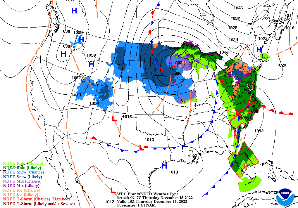
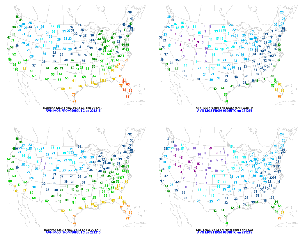
On the Plains, cold, snowy, windy weather lingers across Nebraska, the Dakotas, and eastern sections of Montana and Wyoming, with limited visibility in blowing snow maintaining hazardous conditions for travel and livestock. Meanwhile, cool, dry weather covers the southern half of the Plains. Freezes occurred early Thursday as far south as central Texas.
In the South, recovery efforts are underway in localities affected by the ongoing severe weather outbreak, which since December 13 has spawned more than 50 tornadoes—based on preliminary reports—from northeastern Texas to northern Florida and southern Georgia. Early Thursday, the threat of severe weather continues in parts of Florida and Georgia. Currently, cool, dry air is overspreading areas west of the southern Appalachians.
In the West, cold, mostly dry weather prevails. Freeze Warnings are in effect again Thursday in much of California’s San Joaquin Valley and portions of the Desert Southwest, requiring producers to take protective measures in some instances for temperature-sensitive crops such as citrus.
Add Comment