Weather
Shower clusters on the Plains; fair, dry cool weather covers the eastern Corn Belt
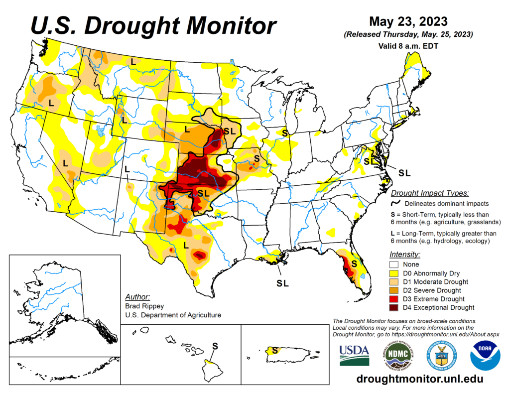
Across the Corn Belt, scattered frost was noted Friday morning in the upper Great Lakes region and parts of Michigan. Throughout the region, cool, dry weather favors planting of any remaining corn and soybean acreage. However, topsoil moisture shortages are becoming more apparent. According to the latest U.S. Drought Monitor, the portion of the nine-state Midwestern region experiencing abnormal dryness or drought increased from 22 to 27% between May 16 and 23.
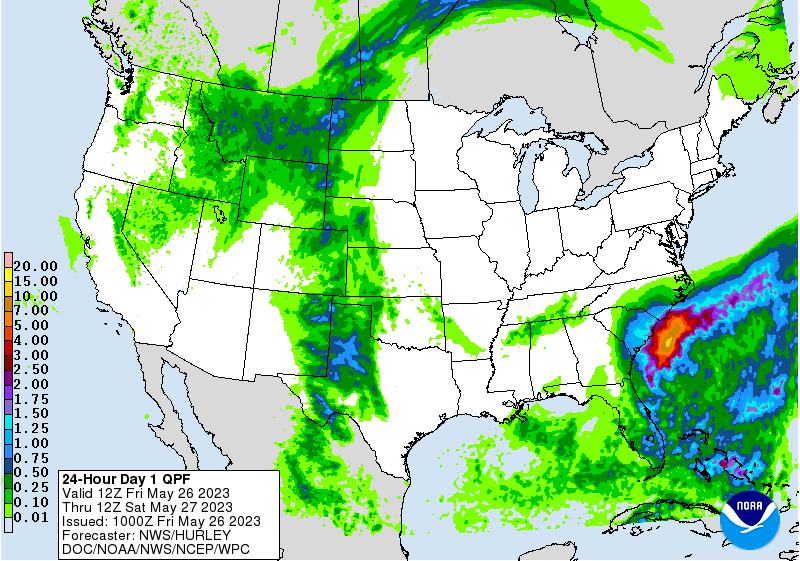
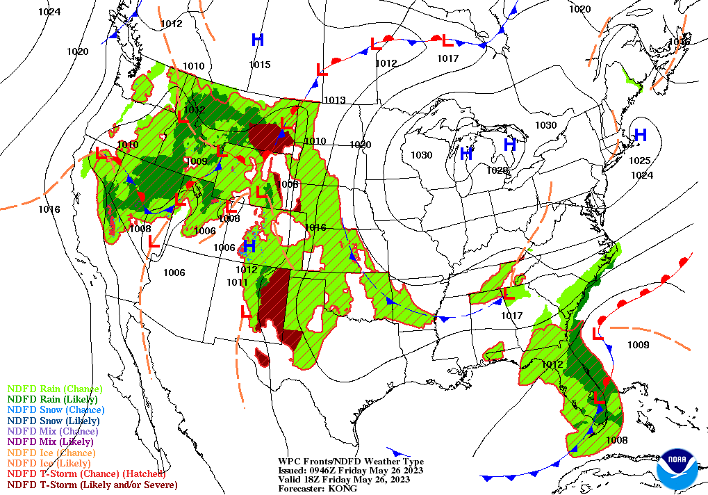
On the Plains, warm, dry weather in the Dakotas favors the emergence and growth of late-planted summer crops. Meanwhile, scattered showers and thunderstorms are affecting the High Plains from Montana to western Texas. The High Plains’ rainfall—although accompanied by scattered reports of high winds and large hail—continues to chip away at long-term drought and is providing beneficial moisture for rangeland, pastures, immature winter grains, and spring-sown crops.
In the South, rain has largely shifted offshore, although spotty showers linger across Florida. The return of dry weather favors Southeastern fieldwork, which has been periodically delayed. By May 21 in Georgia, for example, planting for both peanuts (59% planted) and cotton (51%) was 6 percentage points behind the state’s respective 5-year averages.
In the West, showers remain active across the northern Intermountain West and northern Rockies. Runoff from the rain, combined with melting of high-elevation snowpack, continues to result in some river flooding. In southern Idaho, the Portneuf River at Pocatello—at its highest level since May 1984—continues to slowly rise.
Add Comment