Weather
Seasonally warm, drier days ahead for the Heartland
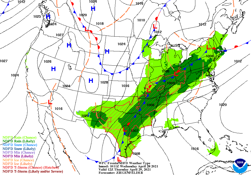
A slow-moving storm system crossing the nation’s mid-section will continue to produce heavy showers and locally severe thunderstorms.
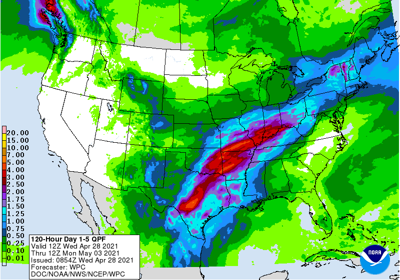
From the southeastern Plains into the Ohio Valley, additional rainfall could total 2 to 4 inches or more, leading to possible flooding.
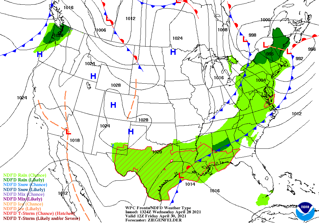
By Friday, however, lingering showers should be confined to the Northeast and the Deep South.
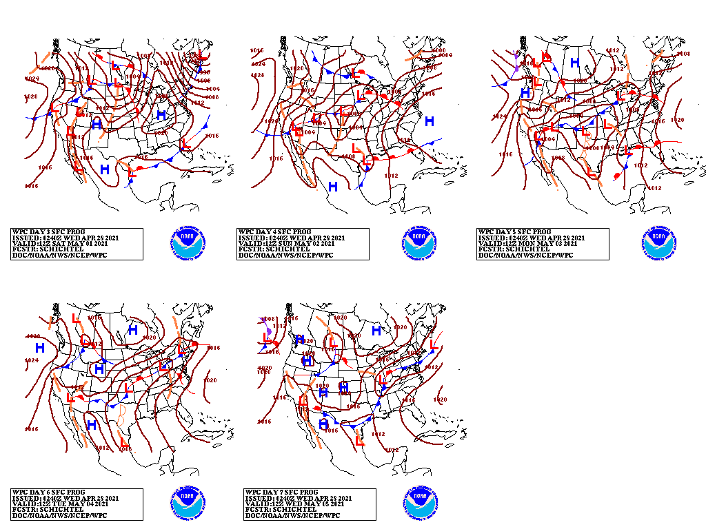
During the weekend, a new storm system may produce spotty rain showers across the central Plains, Midwest, and middle and lower Mississippi Valley. In contrast, dry weather will prevail during the next 5 days across much of the Far West and northern Plains.
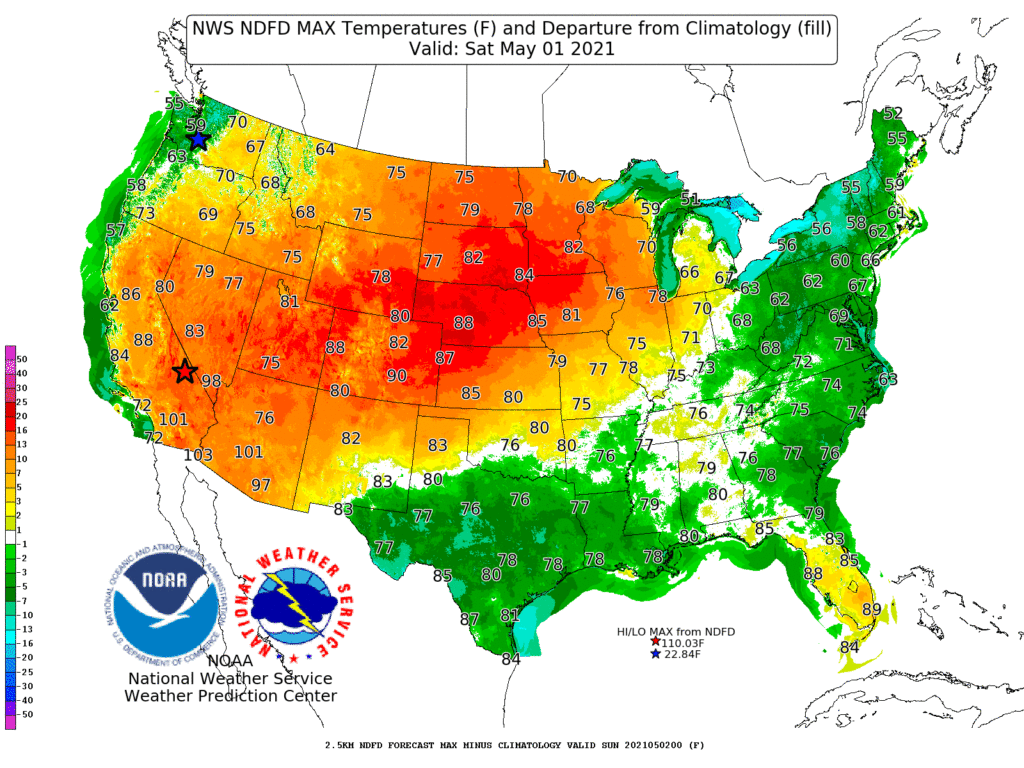
Elsewhere, a late-week heatwave in the Desert Southwest will gradually shift eastward, with weekend temperatures possibly reaching 90° as far north as Nebraska. Early next week, summer-like warmth will be focused across the South.
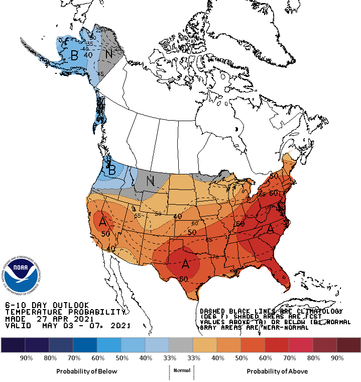
Looking ahead, the 6- to 10-day outlook calls for the likelihood of near- or above-normal temperatures and near- or below-normal precipitation across much of the country.
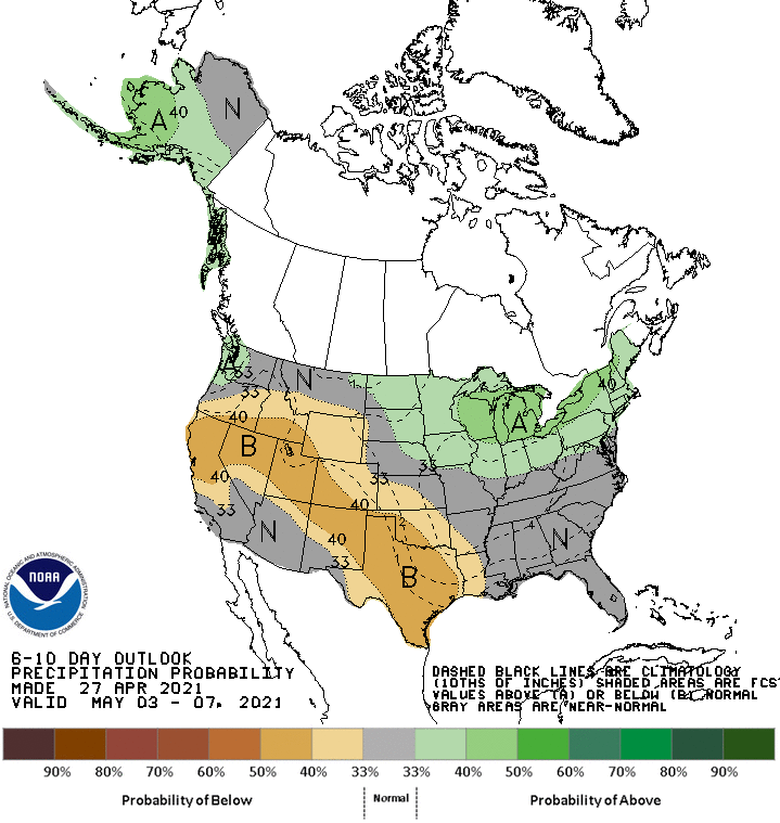
Cooler-than-normal condition will be confined to the Pacific Northwest, while wetter-than-normal weather should be limited to portions of the nation’s northern tier, including western Washington and a broad area stretching from the upper Midwest to New England
Add Comment