Weather
Pattern to remain wet, active across much of the Midwest Corn Belt
a multi-day rainfall event will continue to unfold across the mid-South and Midwest, with 5-day rainfall totals expected to generally range from 2 to 6 inches.
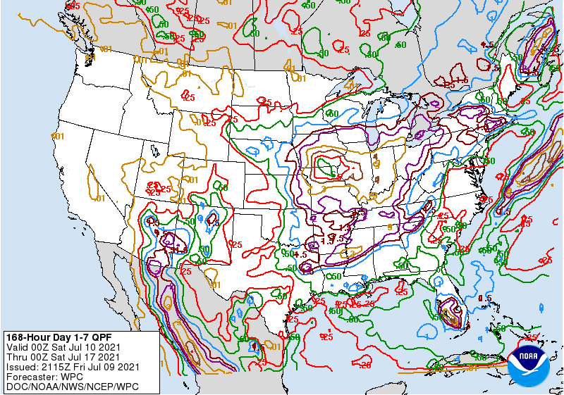
Some of the heaviest rain should occur across the southern Corn Belt. Farther north, however, only light precipitation will fall across drought-affected sections of the northern Plains and northern Corn Belt. Mostly dry weather will also persist west of the Rockies, aside from monsoon-related showers in the Four Corners States.
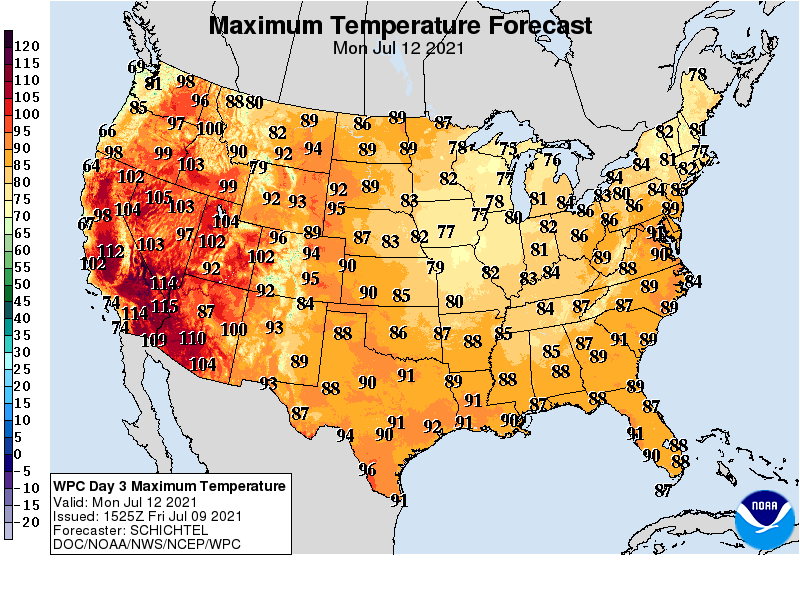
Extremely hot weather will accompany the Western dryness, further exacerbating already serious drought impacts.
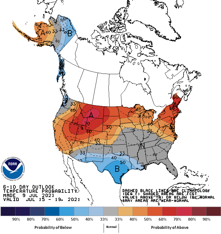
Looking ahead, the 6- to 10-day outlook calls for near- or above-normal temperatures nationwide, except for cooler-than-normal conditions in the south-central U.S. and coastal areas of the Pacific Northwest.
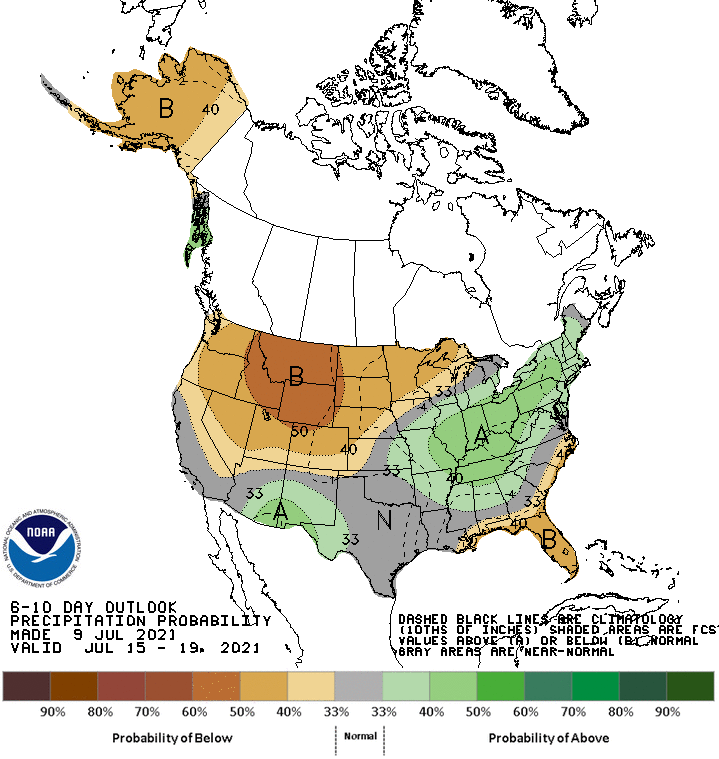
Meanwhile, below-normal rainfall in the southern Atlantic region and most areas from the Pacific Coast to the Plains should contrast with wetter-than-normal weather from eastern Arizona into western and southern Texas and from the middle Mississippi Valley into the Northeast
Add Comment