Weather
Near-seasonal pattern across most of the Heartland
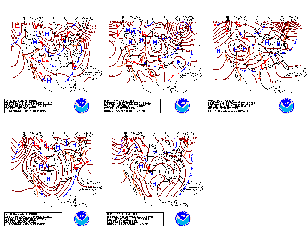
A series of Pacific cold fronts will race eastward across the northern half of the U.S., generating periods of mostly light precipitation. During the weekend, however, one of the cold fronts will merge with a disturbance from the South, helping to enhance precipitation along the Atlantic Seaboard.
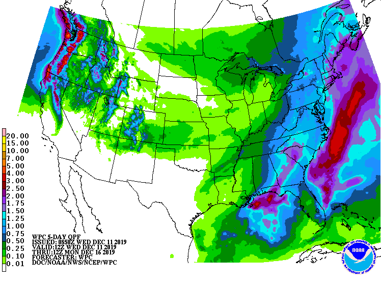
Five-day precipitation totals could reach 2 inches or more in parts of coastal New England. Farther west, occasional snow will affect mountain areas from the Cascades to the northern and central Rockies, while valley locations should receive light rain. In contrast, dry weather will prevail during the next 5 days from southern California to western, central, and southern Texas.
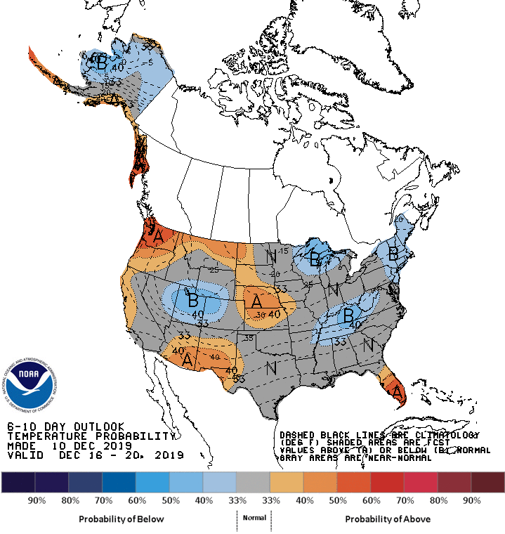
Looking ahead, the 6- to 10-day outlook calls for the likelihood of near- or above-normal temperatures across most of the country. However, pockets of colder-than-normal conditions can be expected in several areas, including the Intermountain West, Tennessee Valley, upper Great Lakes region, and the Northeast.
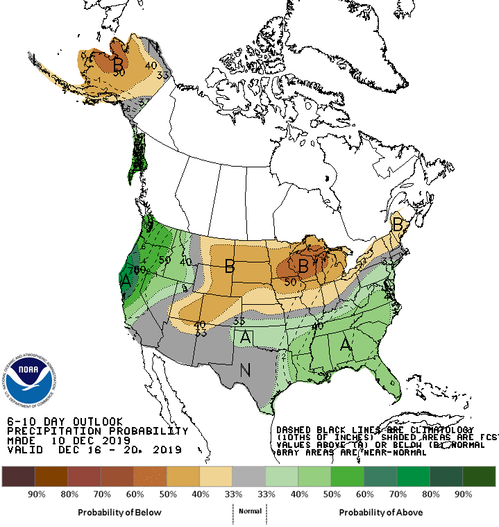
Meanwhile, below-normal precipitation from the northern half of the Plains to New England should contrast with wetter-than-normal weather in northern California, the Pacific Northwest, and the Southeast.
Add Comment