Weather
Much colder pattern ahead across the Heartland
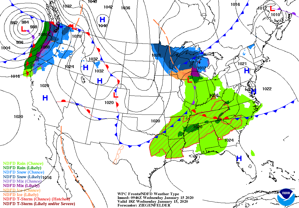
Around mid-week, a batch of wintry precipitation will quickly spread from the Midwest into the Northeast. Meanwhile, Southeastern rain will largely end by Thursday, when a new storm system will begin to emerge from the western U.S.
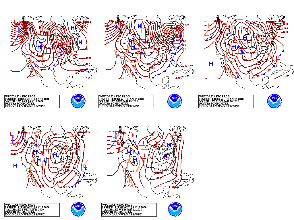
Late-week precipitation in the nation’s mid-section will include snow across the northern Plains and upper Midwest, and rain from the southern Plains into the mid-South. During the weekend, precipitation will continue to spread eastward from the Mississippi Valley to the Atlantic Seaboard; significant weekend snow could accumulate in the Northeast.
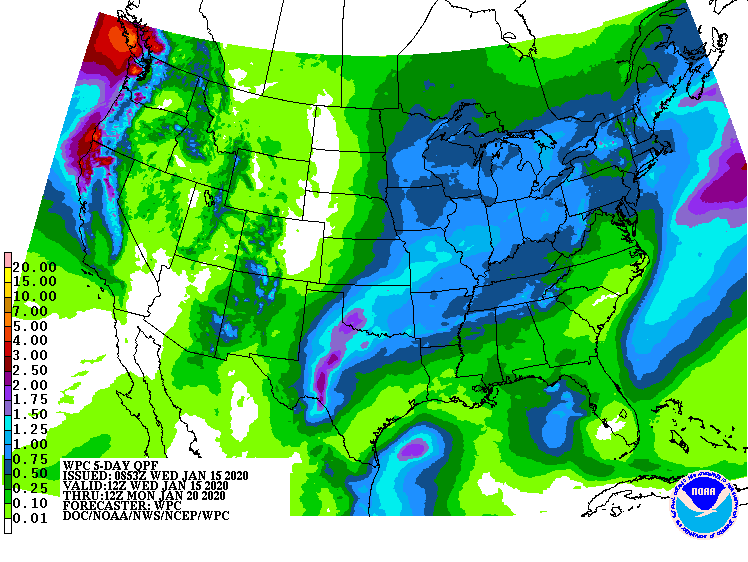
In addition, the late-week storm may aggravate the flood situation across the mid-South and lower Midwest, due to precipitation totaling 1 to 2 inches.
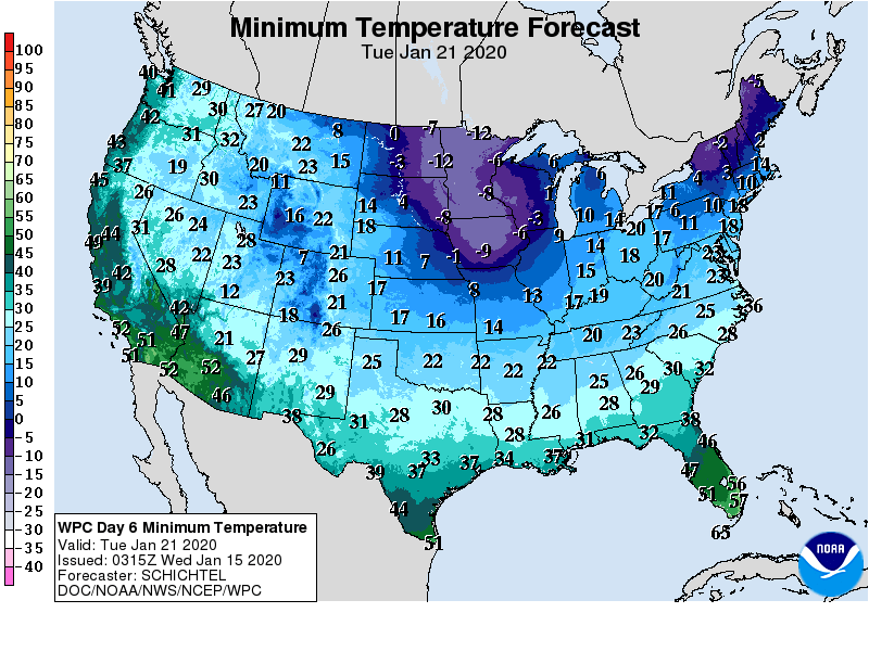
In the storm’s wake, cold air will briefly expand to cover most areas east of the Rockies; weekend temperatures could plunge to sub-zero levels as far south as northern Missouri.

Elsewhere, Western precipitation will briefly shift southward, mainly on Thursday, into California and parts of the Southwest.
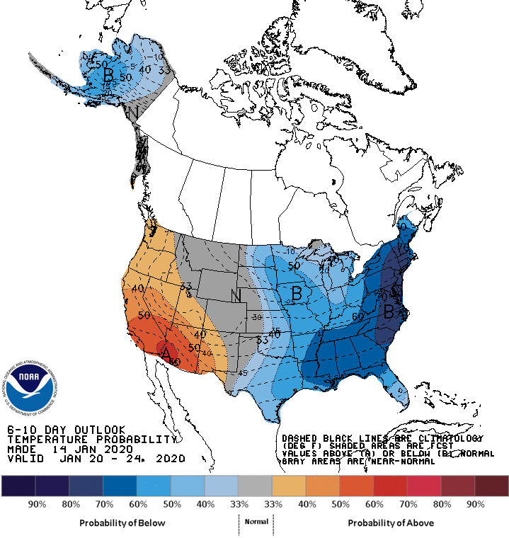
Looking ahead, the 6- to 10-day outlook calls for the likelihood of near- or below-normal temperatures nationwide, except for warmer-than-normal weather in southern California, parts of the Southwest, and across the southern tip of Florida.
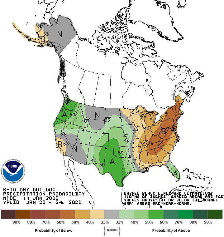
Meanwhile, much of the country can expected near- or below-normal precipitation, although wetter-than-normal conditions may affect Florida’s peninsula, the south-central U.S., and parts of the northern Plains, the Pacific Northwest, and New England.
Add Comment