Weather
More rain for parts of the Midwest Corn Belt; heat wave continues on the southern Plains
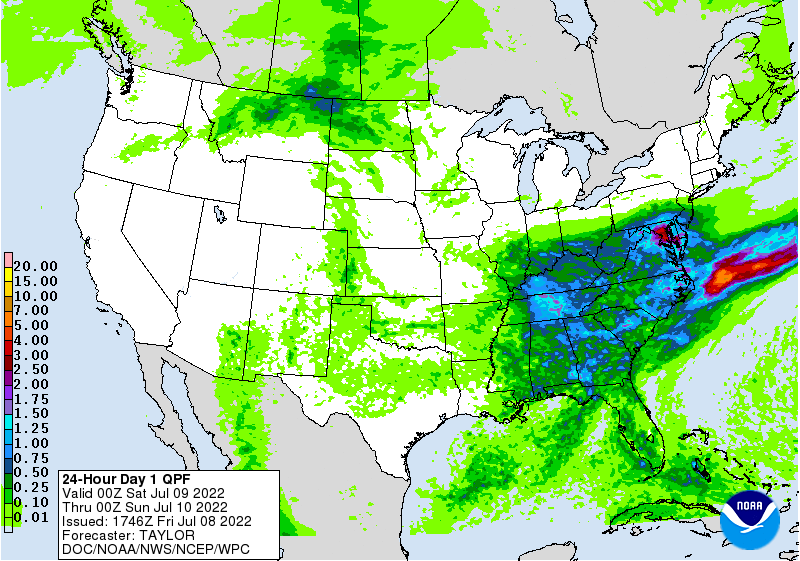
Across the Corn Belt, a final round of rain is spreading eastward from the middle and upper Mississippi Valley. Early Friday, some of the heaviest rain is falling across central Illinois. The recent and ongoing showers have benefited pastures, corn, and soybeans, although many areas of the Midwest are still reporting 30-day rainfall deficits.
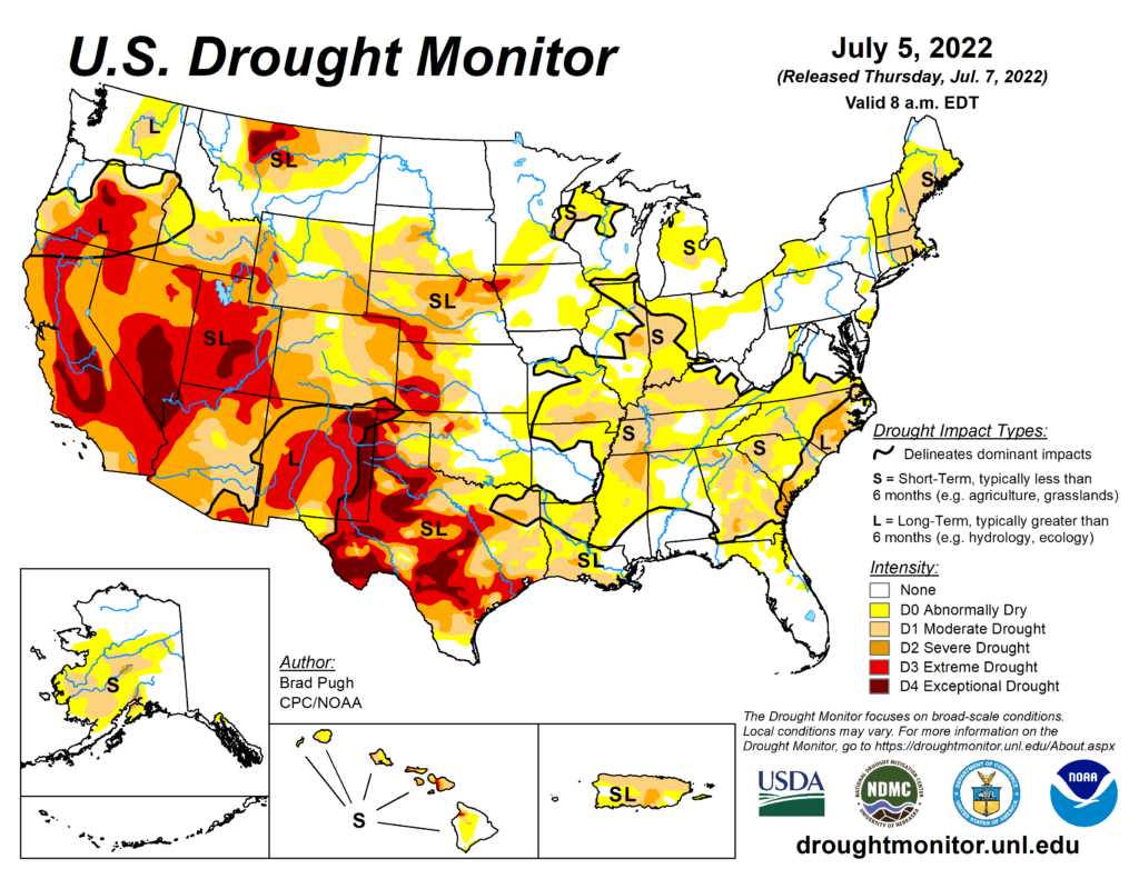
On the Plains, mild, mostly dry weather across the northern half of the region favors crop development and fieldwork, including winter wheat harvesting. Scorching heat persists, however, across the southeastern half of Oklahoma and much of Texas, where Friday’s high temperatures should range from 100 to 105°F. According to the July 5 Drought Monitor, 46% of Texas is experiencing extreme to exceptional drought (D3 to D4), compared with 90% on the same date in 2011.
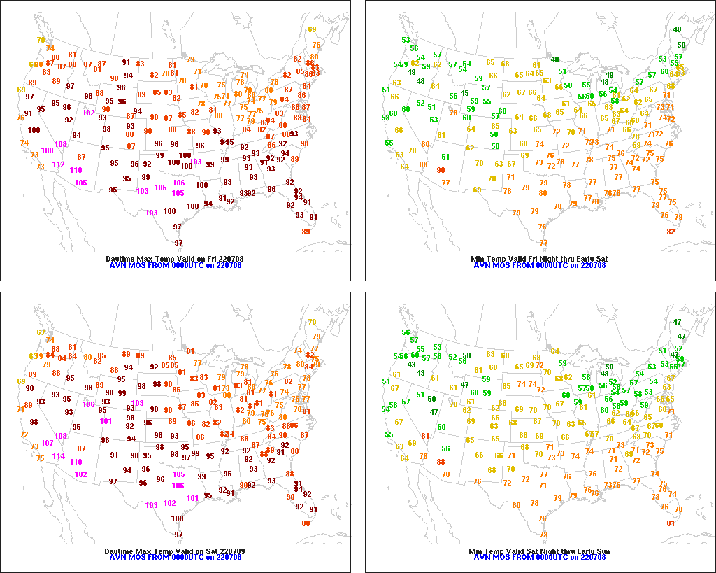
In the South, showers are becoming more numerous in the southern Atlantic States, although warm, humid conditions persist. A heat wave continues across the remainder of the South, with Friday’s high temperatures expected to reach 100°F or higher in many locations from the western Gulf Coast region to the Mississippi Delta. Oppressive humidity accompanies the Southern heat, resulting in stressful conditions for some poultry and livestock.
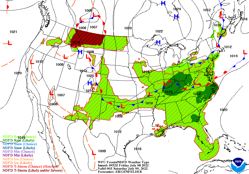
In the West, mostly dry weather accompanies building heat. In addition, the Southwestern monsoon circulation has been disrupted by a strengthening ridge of high pressure, cutting off the flow of tropical moisture into the southern Rockies. Elsewhere, Northwestern warmth favors winter wheat maturation and summer crop development.
Add Comment