Weather
Moisture in the Northwest; warm across the Heartland
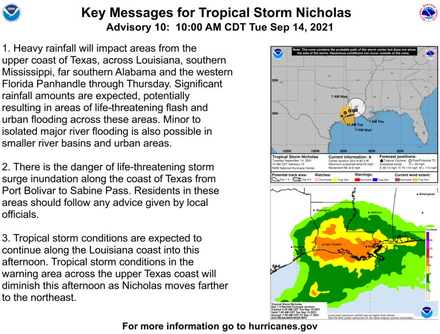
The remnants of former Hurricane Nicholas will drift northeastward, generating additional rainfall totaling 5 to 10 inches or more in the central Gulf Coast region. Notably, a new round of flooding could affect Hurricane Ida recovery areas in southeastern Louisiana.
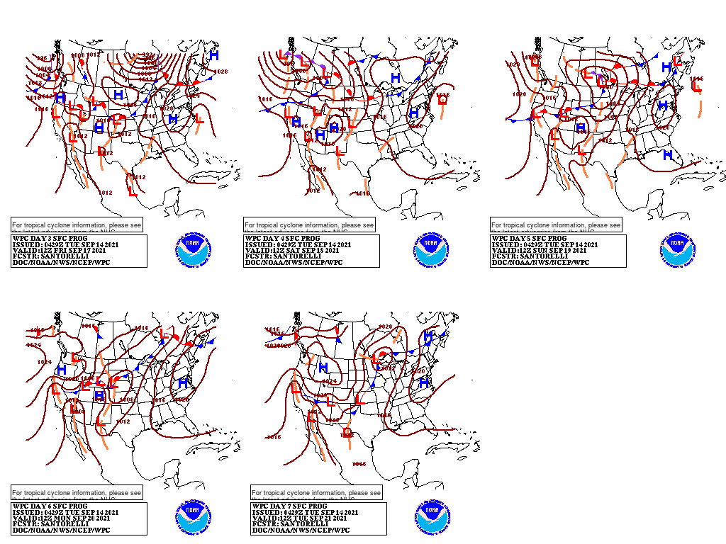
Meanwhile, a pair of cold fronts will generate scattered showers and thunderstorms from the Midwest into the East.
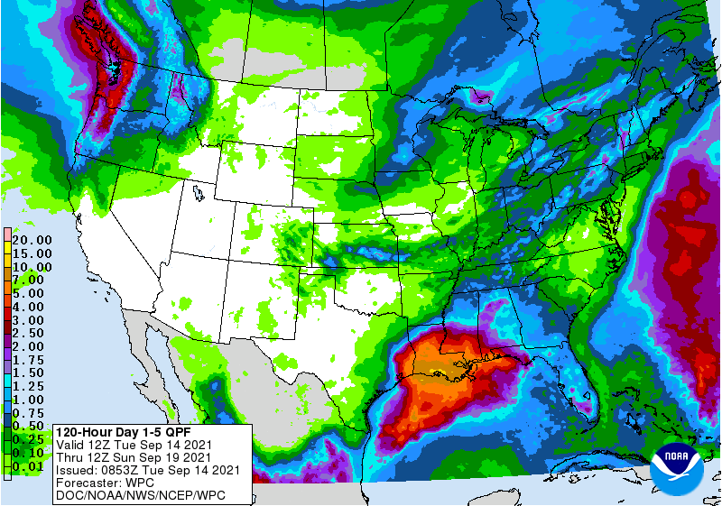
Five-day rainfall totals could reach 1 to 2 inches from the upper Mississippi Valley into the Northeast. In contrast, little or no rain will fall for the remainder of the week from central and southern California to the High Plains.

However, starting on Friday and continuing into the weekend, a significant, early-season precipitation event will unfold from the Pacific Northwest to the northern Rockies, bringing the promise of drought relief to some of the nation’s driest areas.
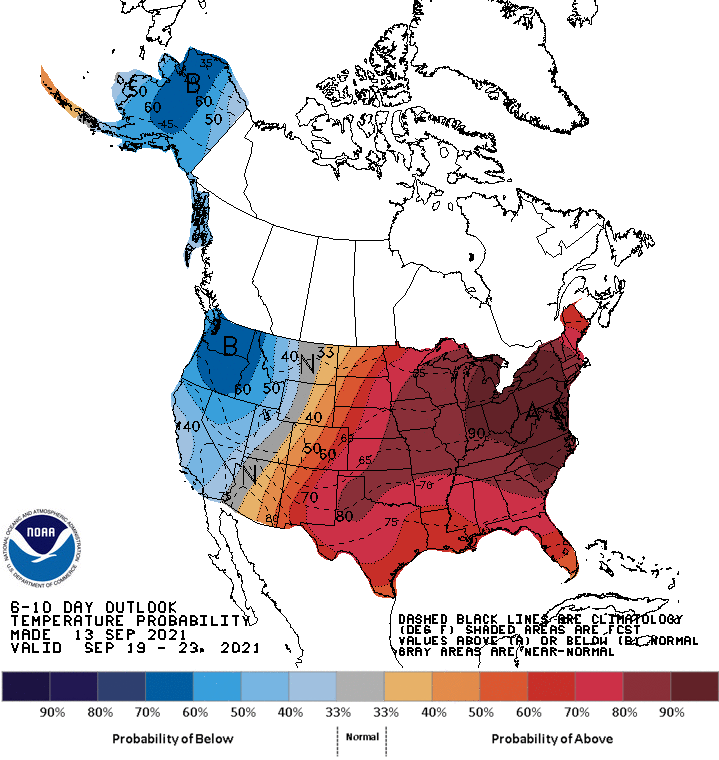
Looking ahead, the 6- to 10-day outlook calls for the likelihood of below-normal temperatures in the Far West, while warmer-than-normal weather will prevail throughout the central and eastern U.S.
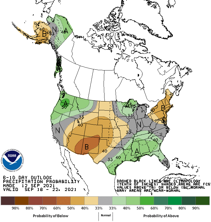
Meanwhile, near- or above-normal precipitation across most of the country should contrast with drier-than-normal conditions across the central and southern High Plains, the Southwest, and parts of the Northeast.
Add Comment