Weather
Milder air on the Plains; more seasonal environs eastern Corn Belt
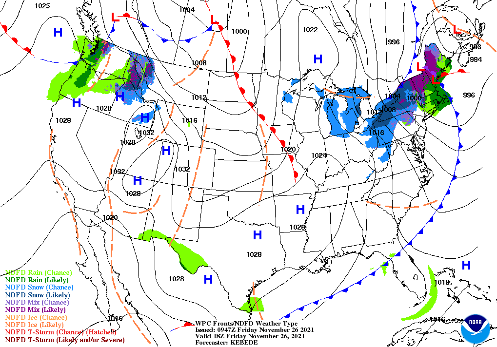
Across the Corn Belt, chilly, breezy conditions—accompanied by snow showers—dominate the Ohio Valley and the Great Lakes region. Friday’s high temperatures will remain below 32°F in portions of the Great Lakes States, where some producers are still trying to complete corn and soybean harvesting. Meanwhile, mild weather prevails in the western Corn Belt; Friday’s temperatures will reach 60°F or higher in much of Nebraska.
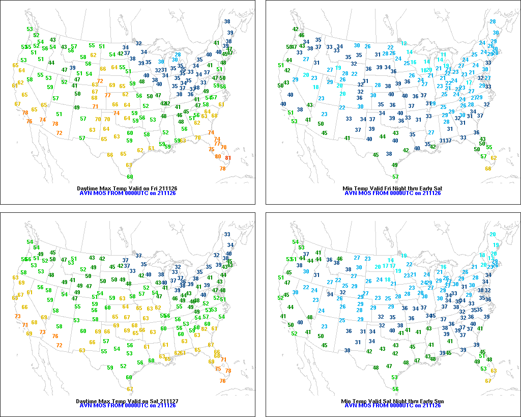
On the Plains, mild, dry weather continues to promote late-autumn fieldwork but reduce soil moisture for winter wheat establishment. By November 21, harvesting of many crops—including sorghum (94% complete, nationally) and sunflowers (90% complete)—was entering its final stages. Meanwhile, soil moisture shortages for winter wheat are particularly acute in Montana and across the southern half of the High Plains, from eastern Colorado to western Texas.
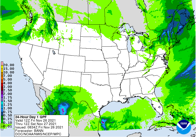
In the South, a cold front near the Atlantic Seaboard is producing a few rain showers. Chilly air trailing the front will hold Friday’s high temperatures below 45°F in much of Kentucky and Tennessee. Despite the cool conditions, producers are making good harvest progress on Southern crops such as cotton and peanuts. However, the Louisiana sugarcane harvest—51% complete on November 21, versus the 5-year average of 58%—is proceeding at a slower-than-normal pace, in part due to lingering impacts, including lodged stalks, from Hurricane Ida, nearly 3 months ago.
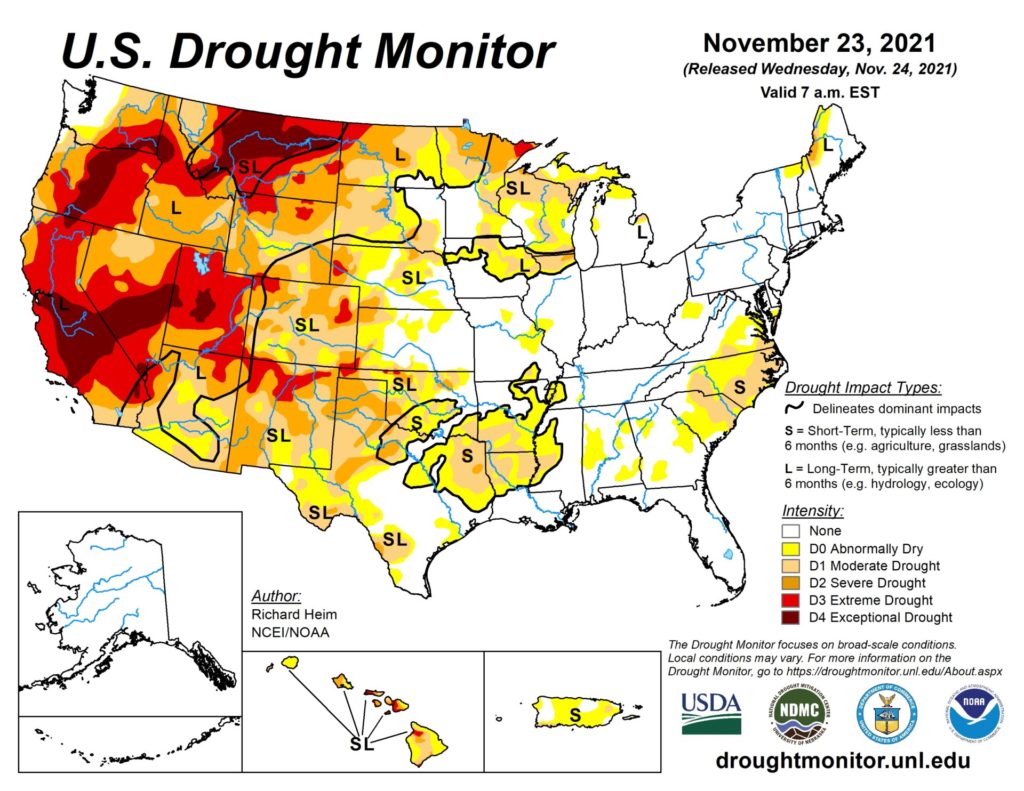
In the West, showery weather has returned across the Pacific Northwest and the northern Rockies. The remainder of the region is experiencing mild, dry weather. In parts of southern California, an elevated wildfire threat persists due to gusty, offshore winds, low humidity levels, and receptive fuels.
Add Comment