Weather
Mild; wet pattern to continue for the Corn Belt
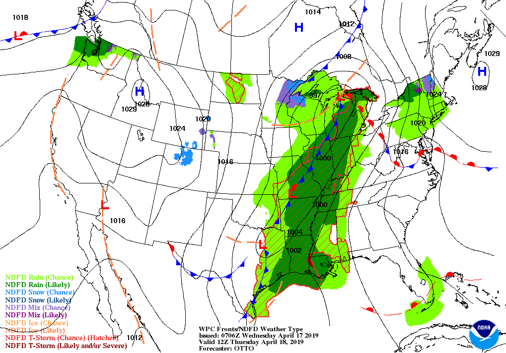
A complex storm system emerging from the West will cross the Plains and upper Midwest later Wednesday and reach the eastern U.S. on Friday.
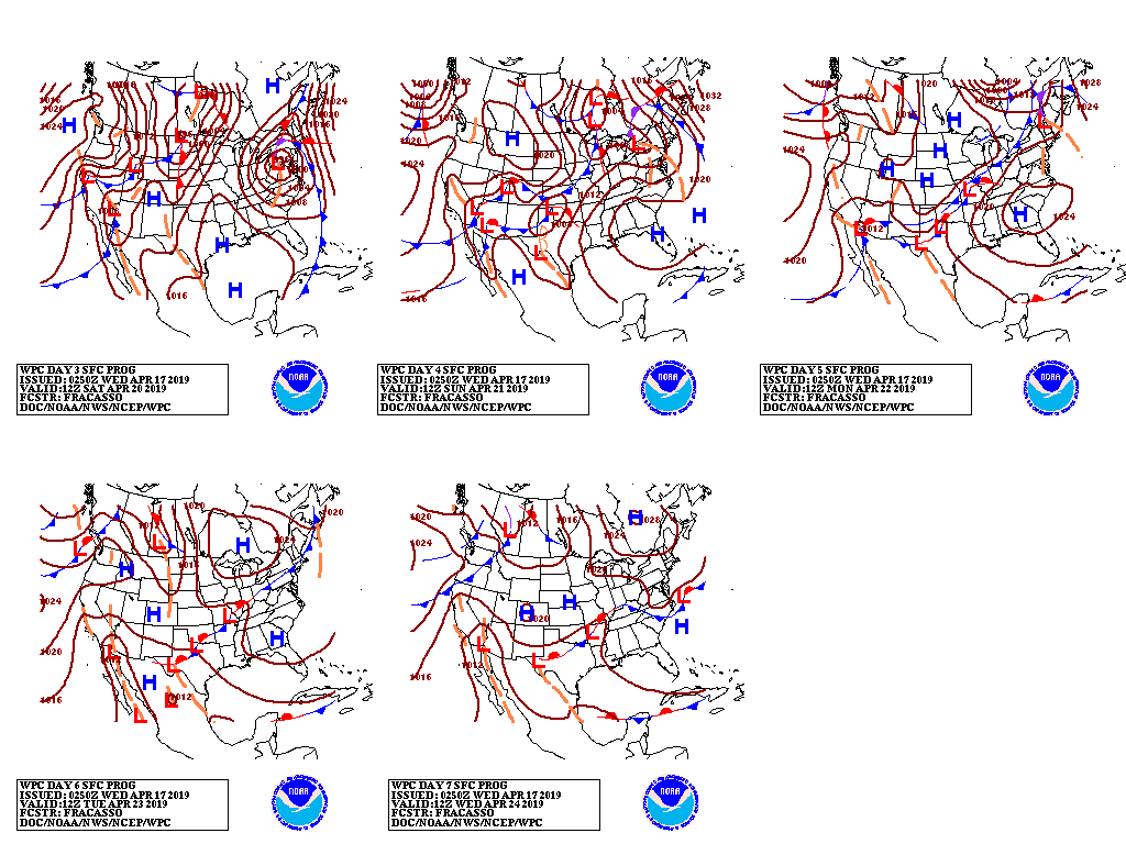
However, the storm will stall over the East, with precipitation lingering through the weekend in the Mid-Atlantic and Northeast.

Storm-total rainfall could reach 1 to 3 inches or more along and east of a line from eastern Texas into the upper Mississippi Valley.
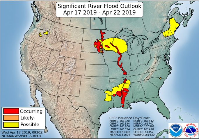
Rain in the latter region could spark flooding, especially in areas where heavy snow fell last week or where rivers are already running high.
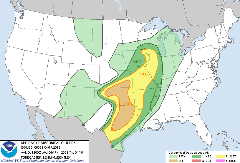
Farther south, a multi-day severe weather outbreak will occur from Wednesday through Friday, with thunderstorms gradually shifting eastward from the southern Plains to the southern Atlantic States.
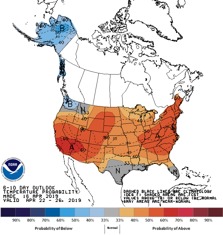
Looking ahead, the 6- to 10-day outlook calls for warmer- and wetter-than-normal weather across most of the country.
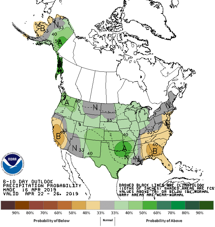
Below-normal temperatures will be limited to Washington State, while below-normal precipitation should be confined to California and the Southeast.
Add Comment