Weather
Major cold wave outbreak ahead for the Heartland

The first in a series of cold fronts will drive southeastward, reaching the Atlantic and Gulf Coasts by Thursday. On Saturday morning, freezes may occur as far south as the middle Ohio Valley and the central Appalachians.
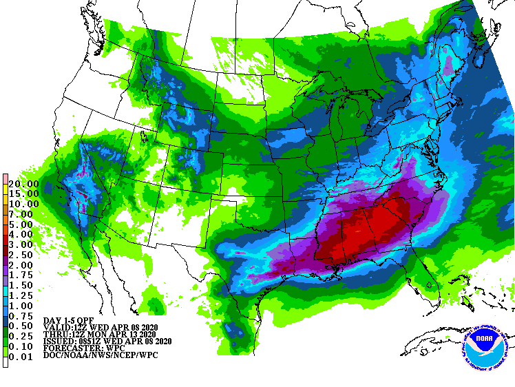
Meanwhile, rainfall could become heavy during the weekend and early next week across the South, as the storm system currently affecting southern California begins to drift eastward. Storm-total rainfall could reach 2 to 4 inches from eastern Texas into Georgia and the Carolinas.
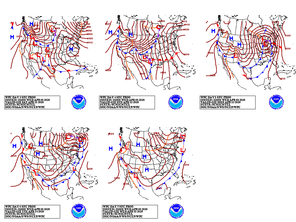
By early next week, a complex weather scenario unfolding across the central and eastern U.S. may include a rapidly intensifying storm system over the Midwest and a second, stronger cold outbreak.
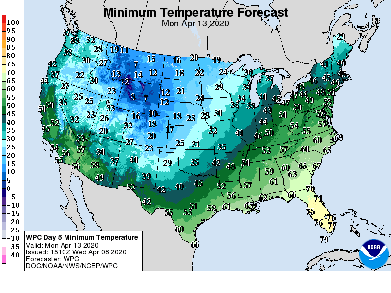
Potential impacts from the mid-April storm and subsequent cold wave could include wind-driven snow in parts of the Midwest; stress on livestock, especially in areas where calving and lambing operations are in progress; and a sharp cold snap in regions where winter wheat, blooming fruits, ornamentals, and emerging summer crops may be vulnerable to freeze injury.
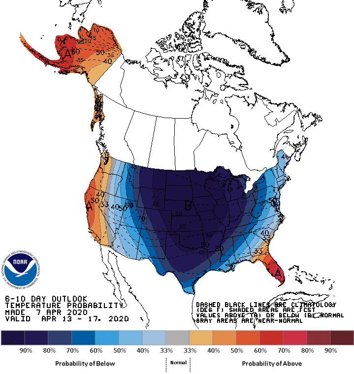
Looking ahead, the 6- to 10-day outlook calls for the strong likelihood of below-normal temperatures nationwide, except for warmer-than-normal weather across Florida’s peninsula and along the Pacific Coast.
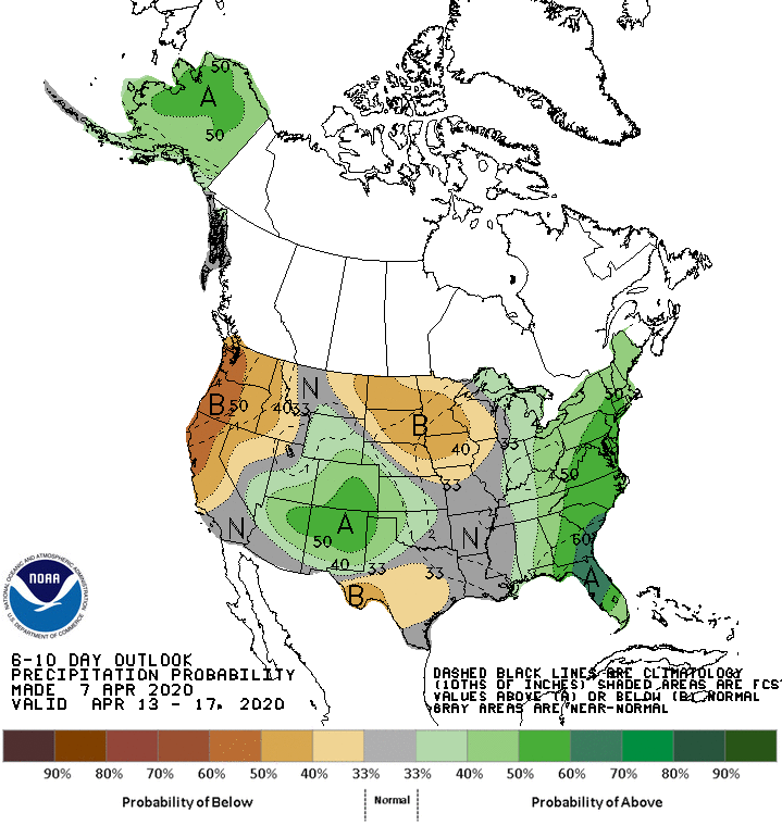
Meanwhile, near- or below-normal precipitation in much of the central and western U.S. should contrast with wetter-than-normal conditions in the East and a small area covering the central and southern Rockies and environs.
Add Comment