Weather
Hot weather builds over parts of the Corn Belt; scattered storms continues across the Plains
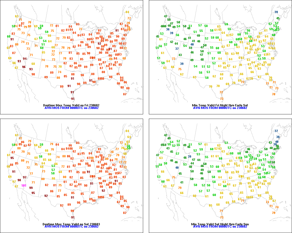
Across the Corn Belt, mostly dry weather and record-setting high temperatures continue to reduce topsoil moisture for summer crop development. On June 1, daily-record high temperatures were tied or broken in locations such as Fargo, North Dakota (97°F), and Muskegon, Michigan (92°F). Later Friday, high temperatures will again approach, reach, or exceed the 90-degree mark throughout the Midwest. Early Friday, any showers are generally light and confined to the western Corn Belt.
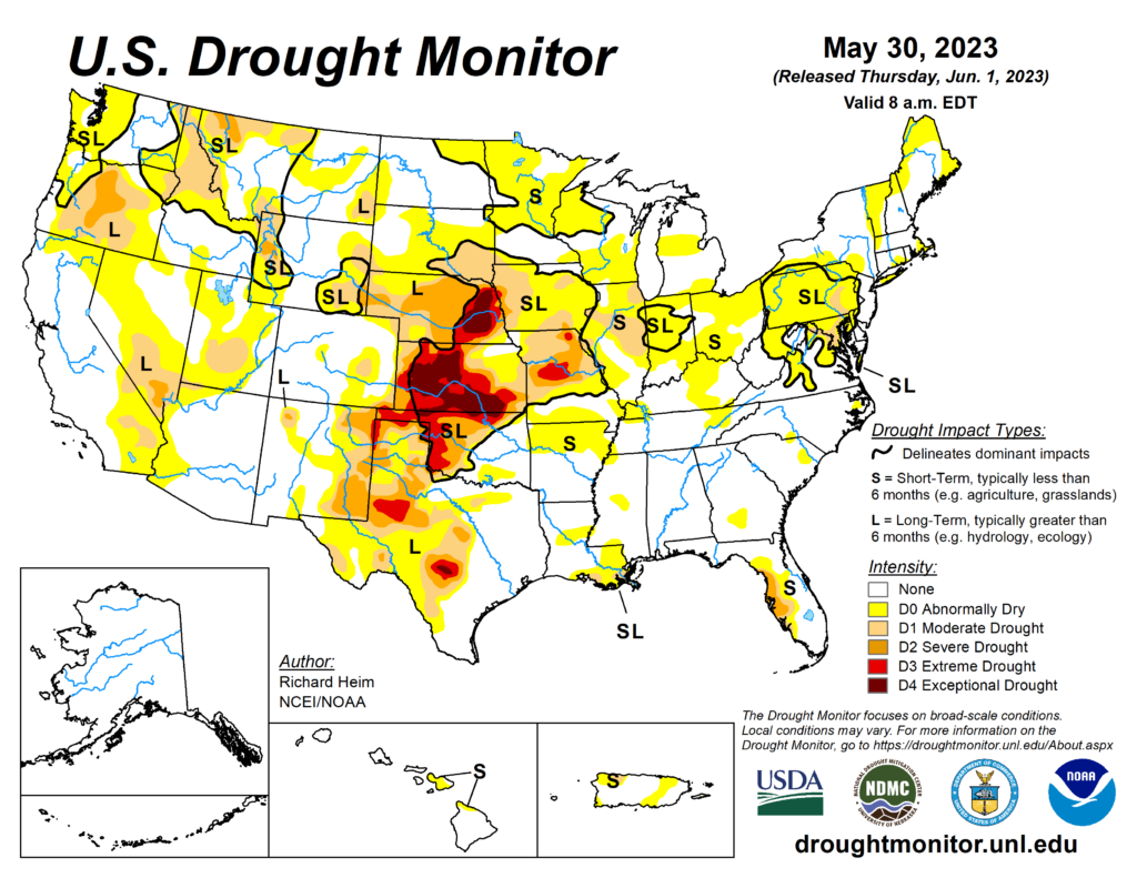
On the Plains, active weather continues. Early Friday, some of the most significant rain is falling on the northern High Plains, including parts of Montana. Despite recent and ongoing showers, pockets of extreme to exceptional drought (D3 to D4) persist from Nebraska to Texas, according to the U.S. Drought Monitor. Notably, topsoil moisture was still rated at least one-half very short to short on May 28 in Nebraska (57%) and Kansas (50%).
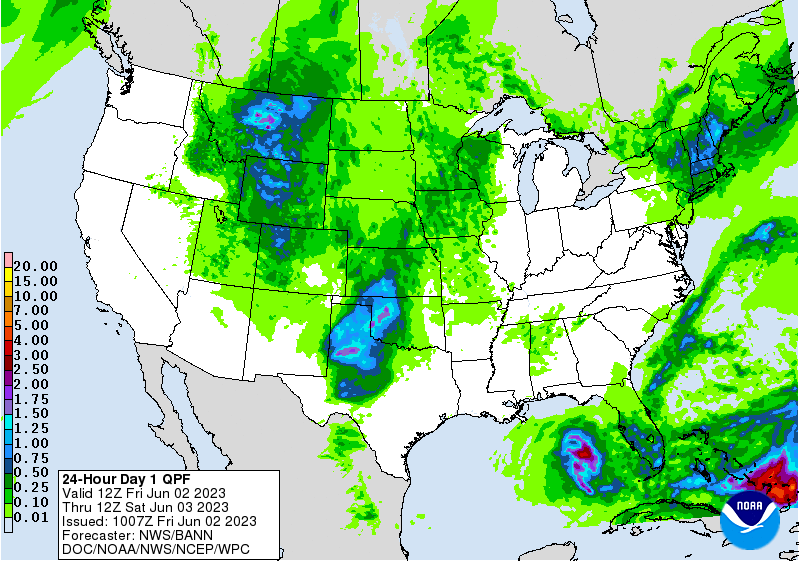
In the South, a tropical depression—currently located over the northeastern Gulf of Mexico less than 300 miles west of Fort Myers, Florida—is drifting southward. The depression, with sustained winds near 35 mph, is soon expected to begin weakening and poses no landfall threat. However, showers not directly related to the tropical depression continue across Florida’s peninsula. Elsewhere in the South, mild, dry weather favors fieldwork and crop development.
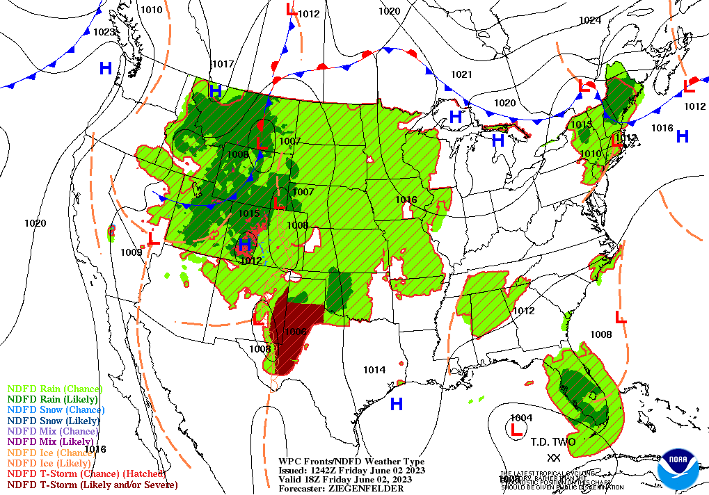
In the West, dry weather in the Great Basin, Pacific Coast States, and Desert Southwest contrasts with scattered showers in the Rockies. Cotton seeding was nearly done by May 28, with planting 97 and 94% complete, respectively, in California and Arizona. On the same date, California’s rice planting was 80% complete, behind the 5-year average of 96%.
Add Comment