Weather
Heat wave pattern to expand across the Heartland
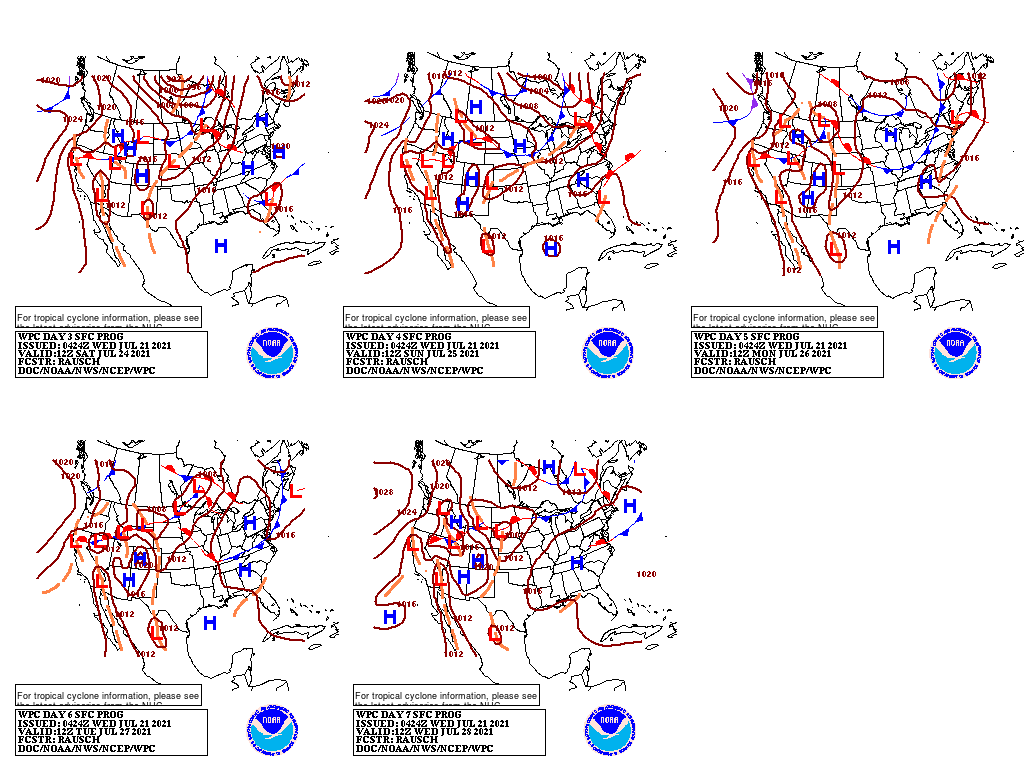
The interaction between the Southwestern monsoon circulation and a cold front will result in locally heavy rain in the Four Corners States but only light showers on the drought-stricken northern Plains.
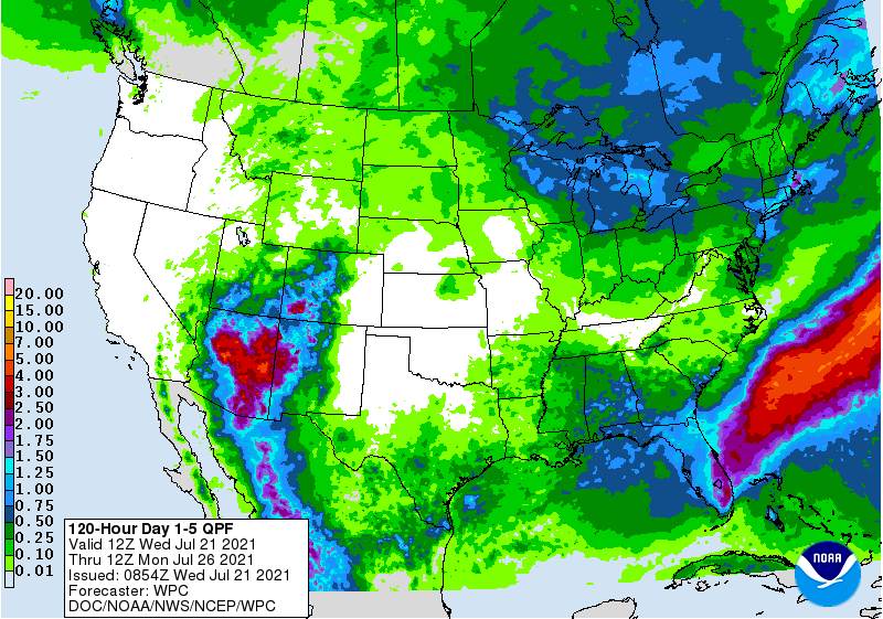
Five-day Southwestern rainfall totals could reach 1 to 3 inches or more, mainly in parts of Arizona, western New Mexico, and southwestern Colorado. Meanwhile, little or no rain will fall in the Pacific Coast States, northern Great Basin, northern Rockies, and central and southern Plains. The southern and western Corn Belt will also experience mostly dry weather, while significant rainfall (1 to 2 inches or more) should be limited to the Great Lakes and Northeastern States, as well as parts of the Southeast. Higher totals may occur in peninsular Florida.
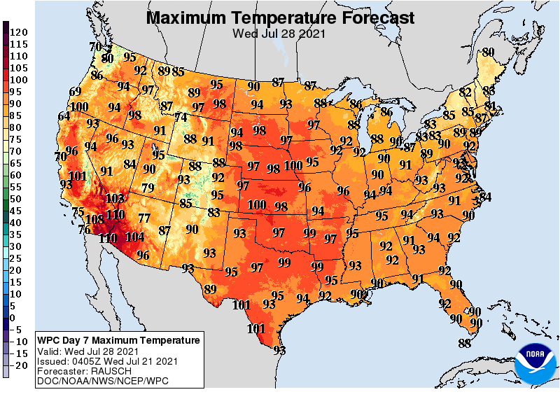
Elsewhere, a significant hot spell will persist into next week across an area centered over the northern Plains, with heat-related impacts reaching into the northern Rockies, Intermountain West, central Plains, and western Corn Belt.
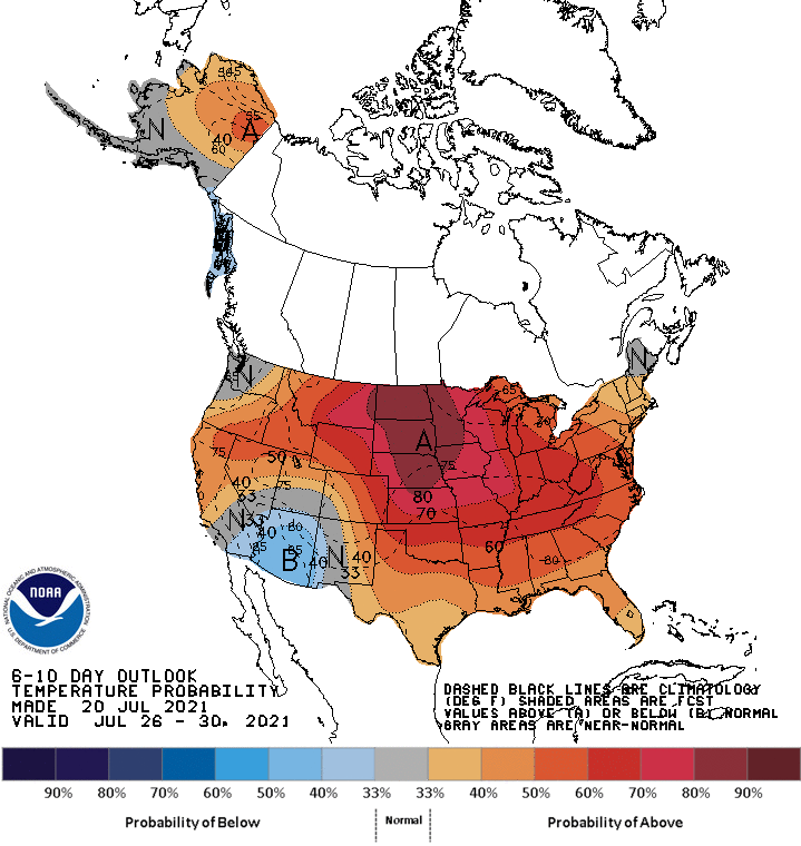
Looking ahead, the 6- to 10-day outlook calls for the likelihood of near- or above-normal temperatures and below-normal rainfall across most of the country.
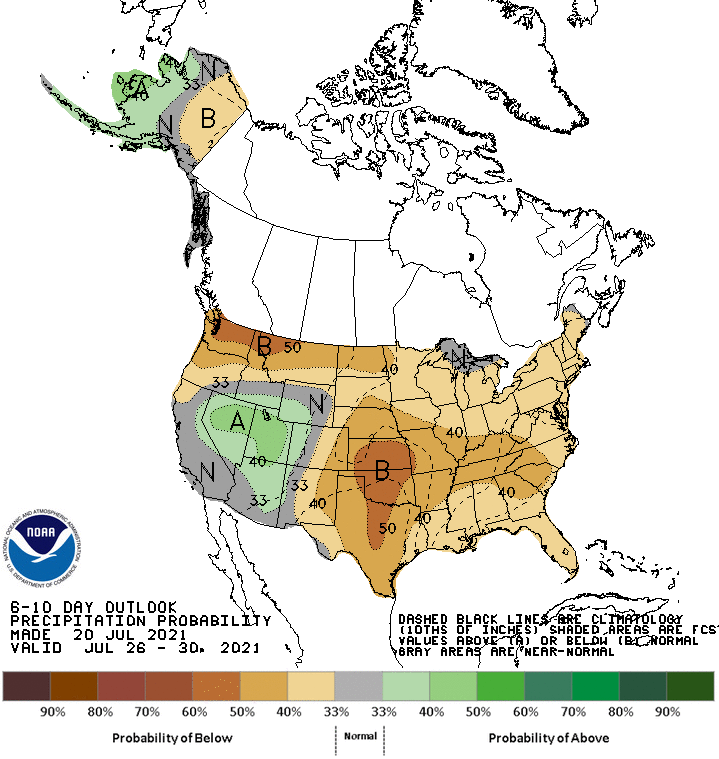
Cooler-than-normal conditions will be confined to the Desert Southwest, while wetter-than-normal weather should be limited to Arizona, Nevada, Utah, and portions of neighboring states.
Add Comment