Weather
Heat returns to the Plains; warmth across the Midwest
Across the Corn Belt, hot weather in southwestern corn and soybean production areas (e.g. lower Missouri Valley) contrasts with sunny, mild weather farther north and east. This month has featured hot Midwestern weather, especially north of Interstate 80, with June 1-13 temperatures averaging more than 10°F above normal in many locations. The heat has promoted a rapid crop development pace but has also sharply reduced topsoil moisture, except in the Ohio Valley.
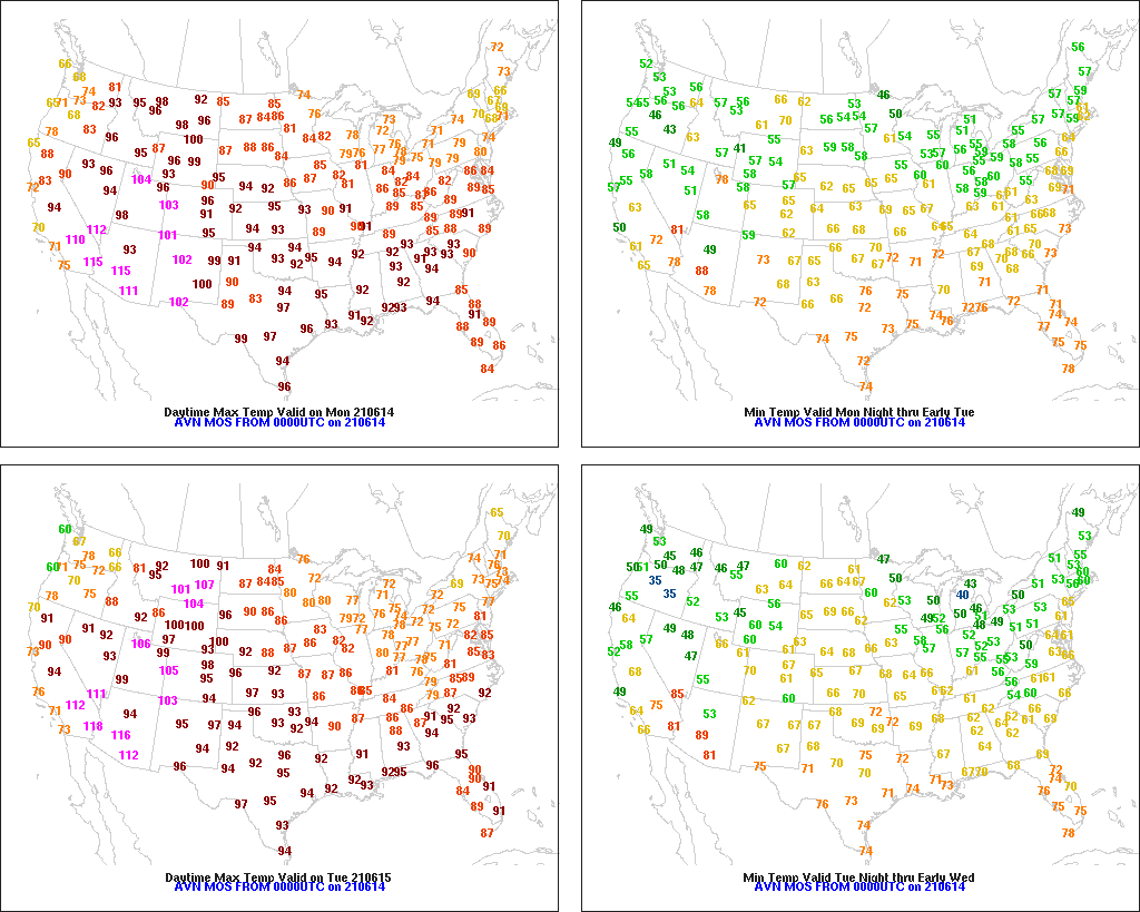
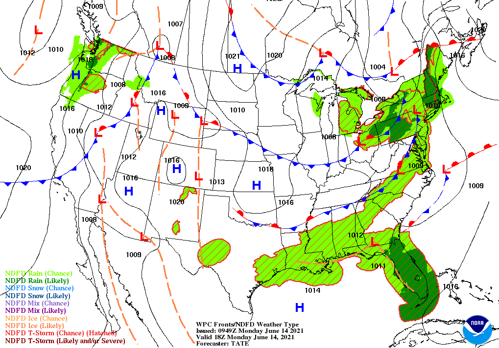
On the Plains, spotty showers are occurring from Nebraska southward. However, hot, dry weather across most of the nation’s mid-section favors winter wheat maturation and harvesting. Monday’s high temperatures will exceed 90°F throughout the Plains, excluding parts of the Dakotas, with scattered readings reaching 100°F as far north as Montana. Drought on the northern Plains continues to adversely affect some winter wheat and spring-sown crops.
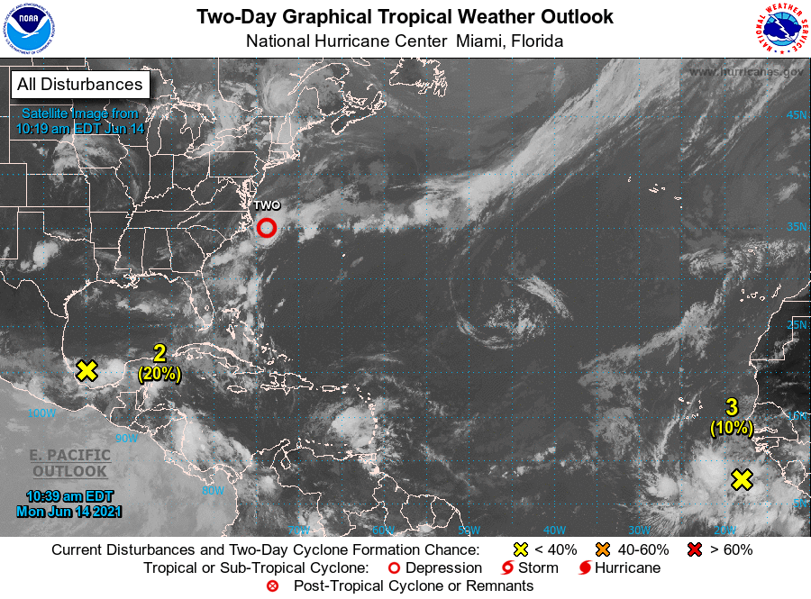
In the South, very warm, humid weather prevails. Widely scattered showers and thunderstorms are primarily confined to the Gulf and Atlantic Coast States. A low-pressure system centered less than 100 miles southeast of Cape Hatteras, North Carolina, has begun to acquire tropical characteristics, but poses no direct threat to the U.S. mainland.

In the West, early-season heat continues to build, except along and near the Pacific Coast. Any precipitation is limited to scattered locations in the Pacific Northwest. Monday’s high temperatures could approach 120°F in the hottest Southwestern desert locations. In Arizona, east of Phoenix, firefighters have made steady progress battling the Telegraph and Mescal Fires, with containment surpassing 75%. Those two fires have scorched more than 150,000 acres of vegetation.
Add Comment