Weather
Heat and high humidity across the Heartland
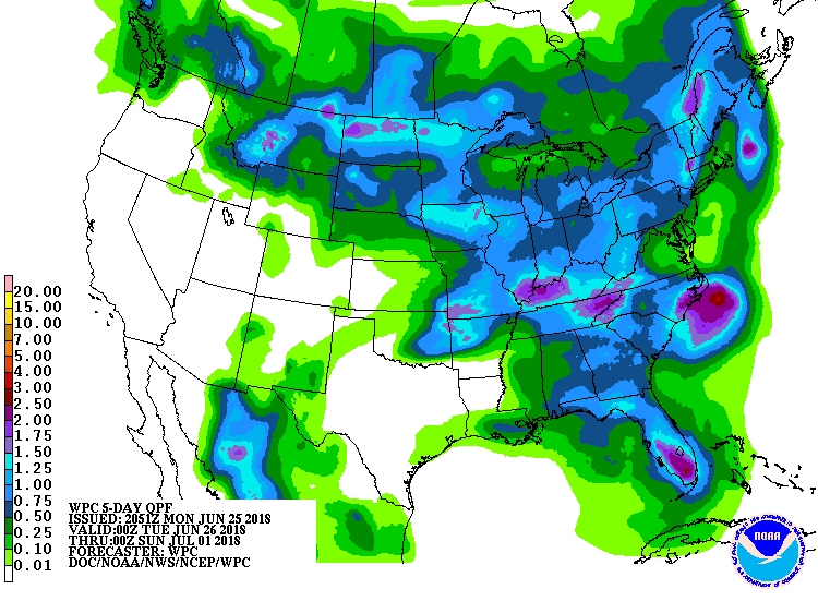 A slow-moving disturbance currently crossing the nation’s mid-section will drift eastward, reaching the Northeast by Thursday. Locally heavy rainfall associated with that disturbance could reach 1 to 3 inches or more in the Midwestern and Eastern States. Subsequently, a new storm system will emerge from the West late in the week.
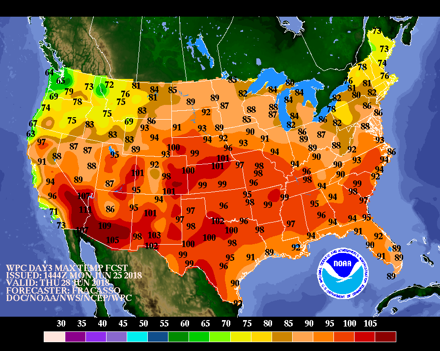 Hot weather in advance of the late-week storm will result in significantly above-normal temperatures in the central and eastern U.S. Widespread triple-digit heat (high temperatures of 100° or greater) can be expected during the mid- to late-week period on the central and southern Plains.
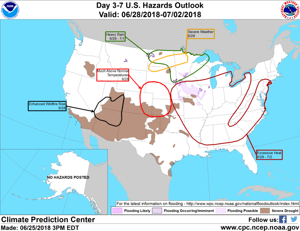 Looking ahead, the 6- to 10-day outlook calls for the likelihood of hotter-than-normal conditions along and east of a line from the southern Rockies to the Red River (of the North) Valley, while near- to below-normal temperatures can be expected across the northern High Plains and much of the West. Meanwhile, near- to above-normal rainfall across most of the country should contrast with drier-than-normal weather in the Northeast and the central and southern Plains.
Add Comment