Weather
Excessive rainfall potential for parts of the Corn Belt
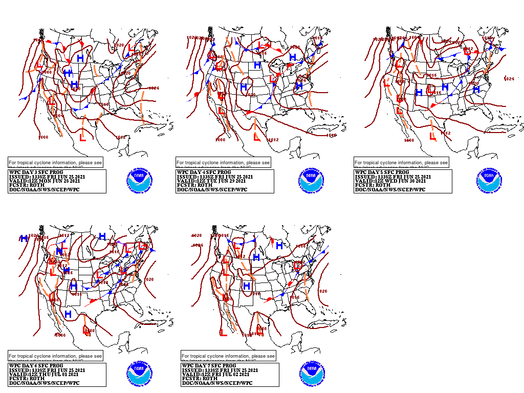
Stormy weather, featuring heavy showers and locally severe thunderstorms, will continue into next week across portions of the central and southern Plains and the Midwest, with a gradual southeastward shift in the axis of heaviest rain.
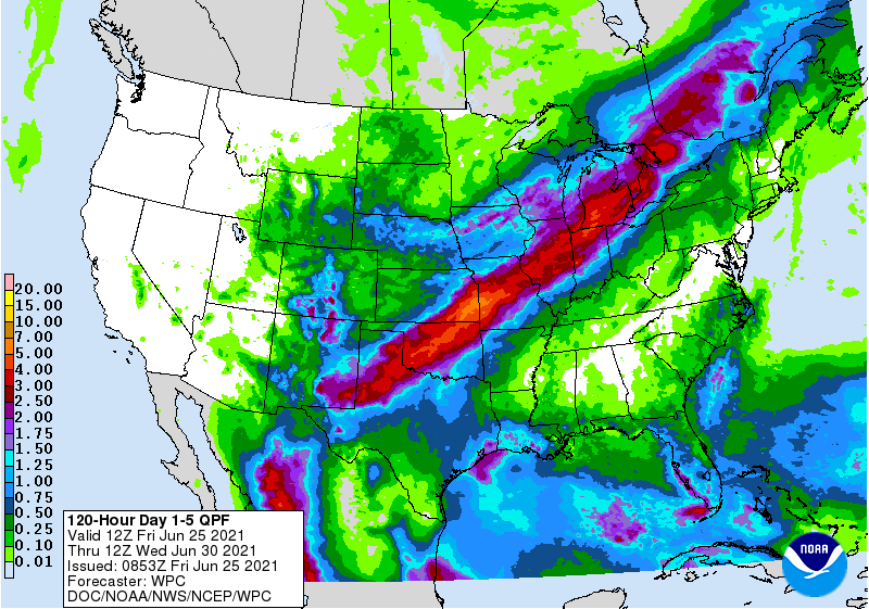
Five-day rainfall totals could reach 2 to 6 inches or more from northern Texas to Michigan. In contrast, the northern Plains and far upper Midwest will receive only light precipitation. The Southeast will also remain mostly dry, aside from lingering thundershowers across Florida and along the Gulf Coast. Meanwhile in the drought-stricken Far West, dry weather will accompany another period of scorching heat.
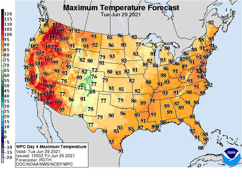
In fact, all-time temperature records could be threatened early next week across the Northwest, with temperatures rising to 110°F or higher in some locations. Relatively cool weather will prevail, however, across the central and southern Plains and the Midwest.
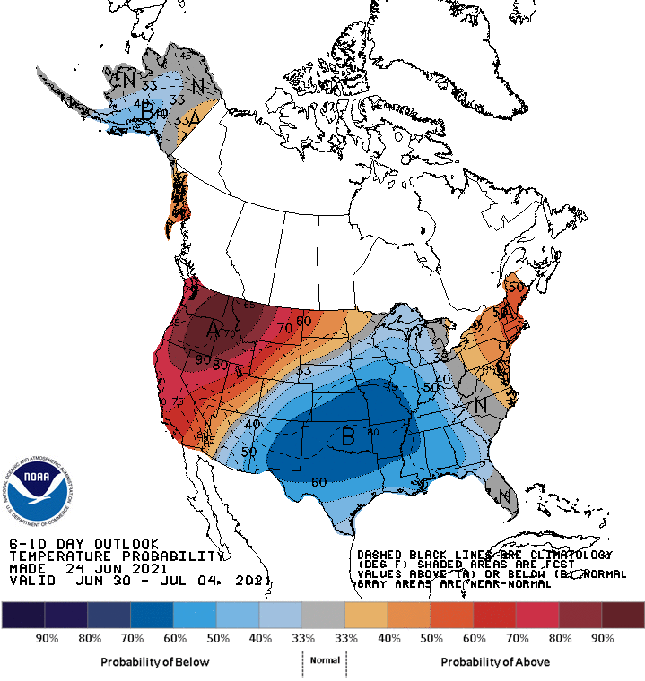
Looking ahead, the 6- to 10-day outlook calls for the likelihood of above-normal temperatures in the Northeast and along and northwest of a line from the lower Colorado River Valley to the Dakotas, while cooler-than-normal conditions will cover the southern Rockies, central and southern Plains, and the Mississippi Valley.
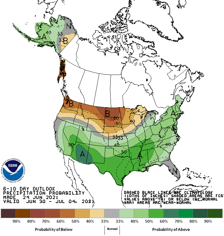
Meanwhile, below-normal rainfall from the Pacific Northwest into the upper Midwest should contrast with wetter-than-normal weather in most other parts of the country, including the South, East, and lower Midwest.
Add Comment