Weather
Drier, near-seasonal temps ahead for the Heartland
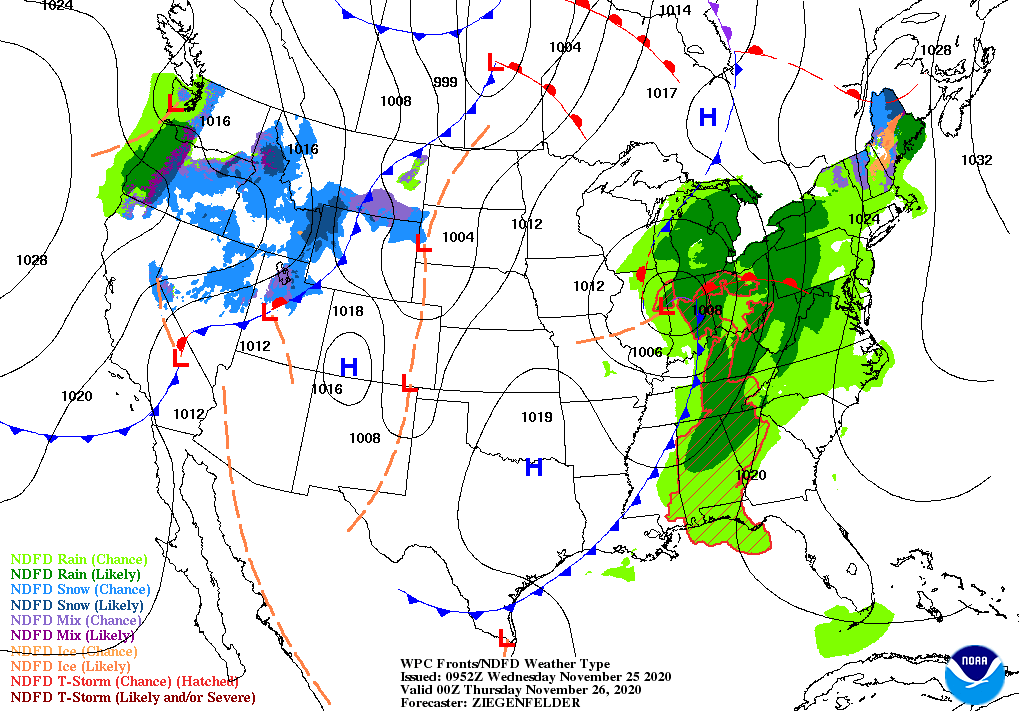
For the remainder of Wednesday, a low-pressure system crossing the middle Mississippi Valley will spark a widespread rain event, with thunderstorms expected along a trailing cold front.
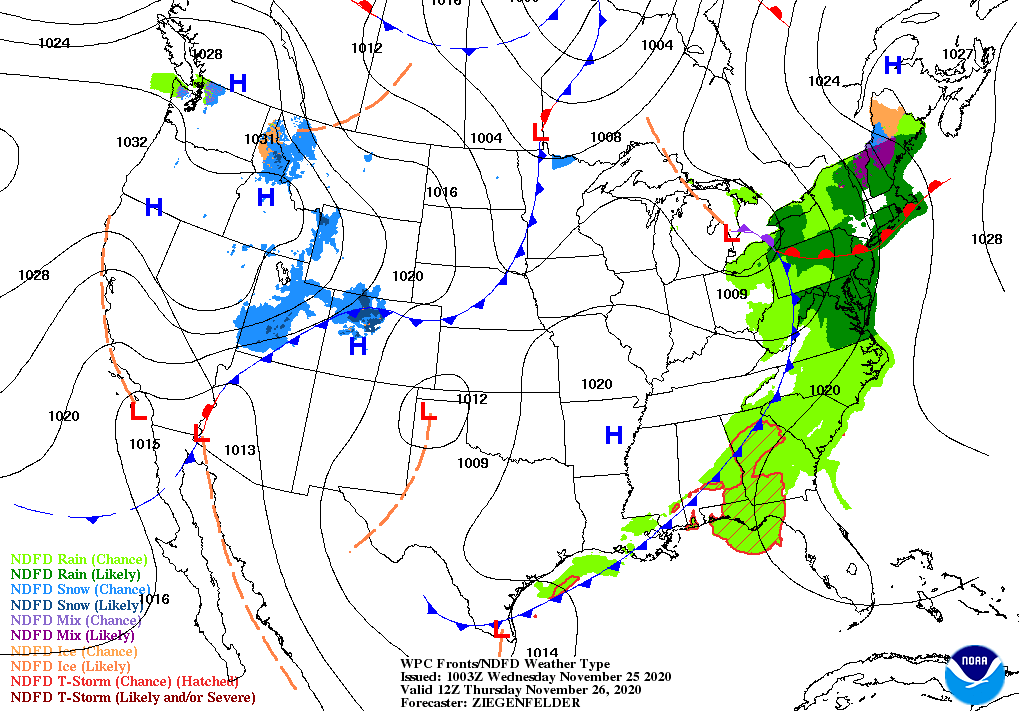
By November 26 (Thanksgiving Day), rain will shift into the East, although cloudiness and a few showers will linger across the Deep South.
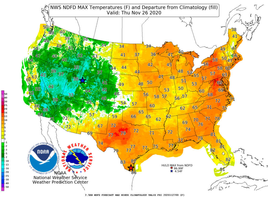
Most of the remainder of the country will experience a mild, dry Thanksgiving, with temperatures remaining below 40° in the Rockies and along the Canadian border—but ranging from 70 to 85° in the Deep South.
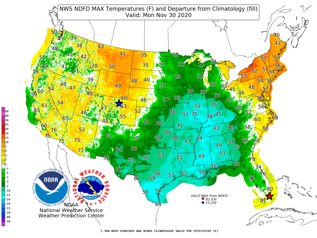
Late-week freezes may occur, however, in California’s San Joaquin Valley. Late in the weekend and early next week, a surge of cold air will arrive across the Midwest.
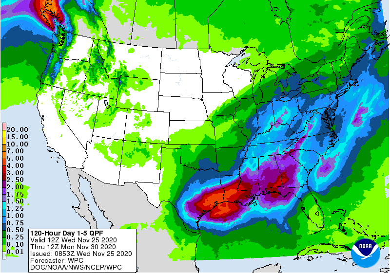
Meanwhile, heavy rain (locally 2 to 5 inches or more) will develop across the South and begin to spread northward.
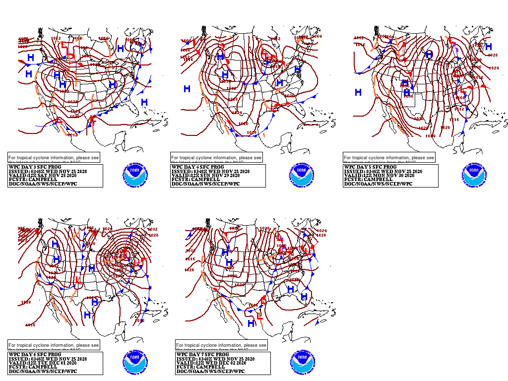
As cold air and moisture interact, there is the potential for a significant precipitation event in the eastern U.S. and the possibility of snow from the central Appalachians and the lower Great Lakes region into the Northeast.
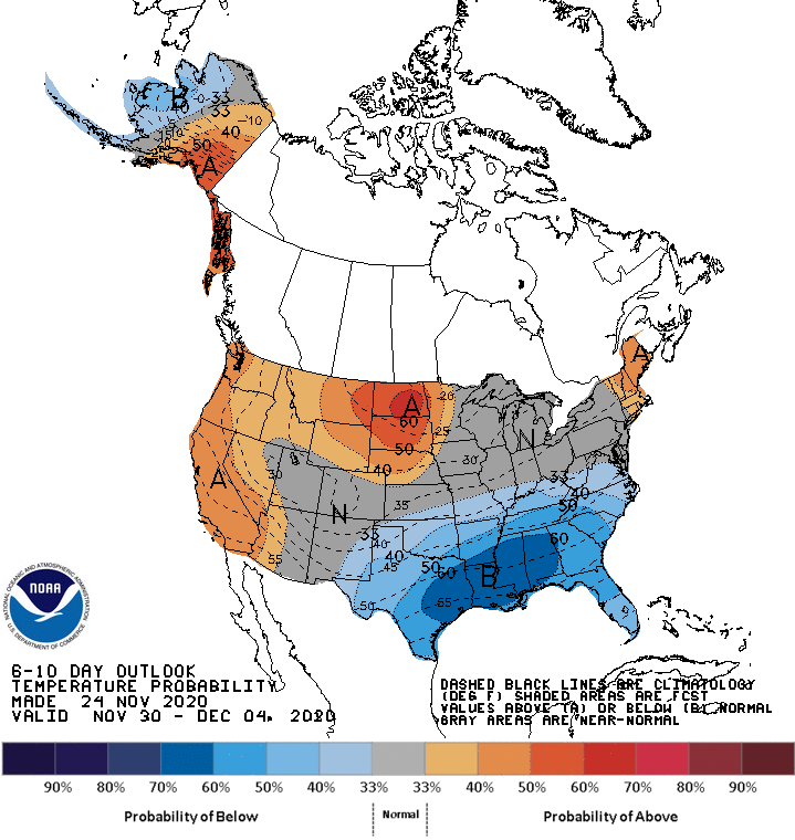
Looking ahead, the 6- to 10-day outlook calls for the likelihood of near- or above-normal temperatures throughout the northern and western U.S., while cooler-than-normal conditions will cover the South.
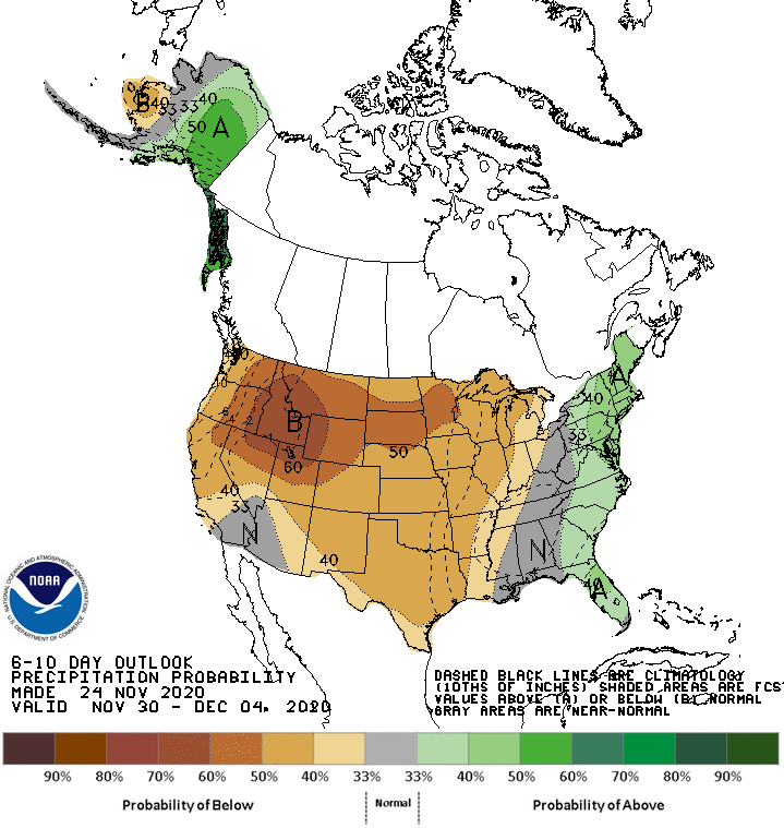
Meanwhile, below-normal precipitation in the western and central U.S. should contrast with wetter-than-normal weather in the Atlantic Coast States.
Add Comment