Weather
Drier, cooler weather generally covers much of the Heartland
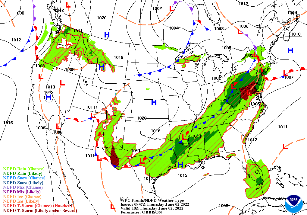
Across the Corn Belt, cool, dry weather across the upper Midwest favors late-season planting efforts, except in areas of Minnesota and North Dakota where muddy field conditions are not conducive to supporting farm machinery. Thursday’s high temperatures will remain below 70°F in the Red River Valley of the North, limiting evaporation rates. Meanwhile, showers and a few thunderstorms are spreading across the eastern Corn Belt.
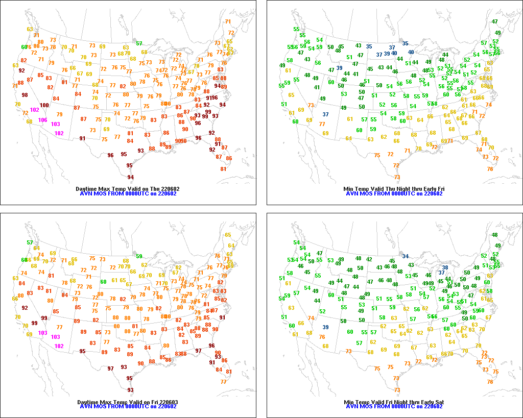
On the Plains, thunderstorms in Texas and Oklahoma continue to tighten the gradient between drought and excessive wetness. Early Thursday, some of the heaviest rain is falling in the Red River Valley, along the Texas-Oklahoma border. Cooler-than-normal weather prevails throughout the region, with Thursday’s high temperatures expected to range generally from 65 to 80°F. On the northern Plains, the cool weather is slowing the emergence and growth of late-planted crops.
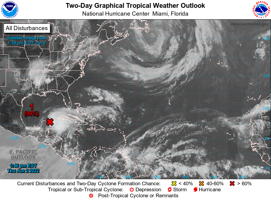
In the South, hot weather in the Gulf and Atlantic Coast States continues to promote a rapid pace of crop development. Meanwhile, showers and thunderstorms are edging into the mid-South and the Tennessee Valley. Producers in southern Florida are monitoring a disorganized low-pressure system currently centered near the Yucatan Peninsula; there is a high likelihood of tropical cyclone formation during the next couple of days as the system drifts northeastward.
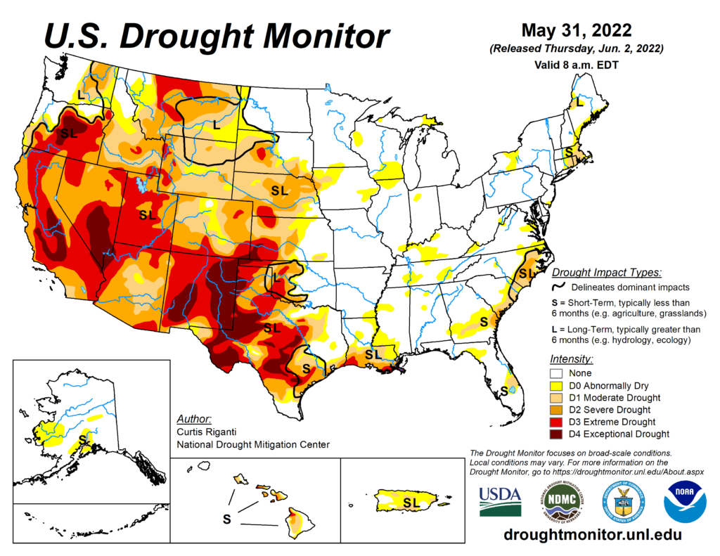
In the West, widely scattered showers stretch from the Pacific Northwest to the northern Rockies. Meanwhile, near- or above-normal temperatures have returned across much of the West. Elsewhere, the Black Fire in southwestern New Mexico has burned more than 258,000 acres of vegetation—with containment reported at just 25%—and has already become the third-largest wildfire in modern state history.
Add Comment