Weather
Colder, drier weather to return to the Heartland
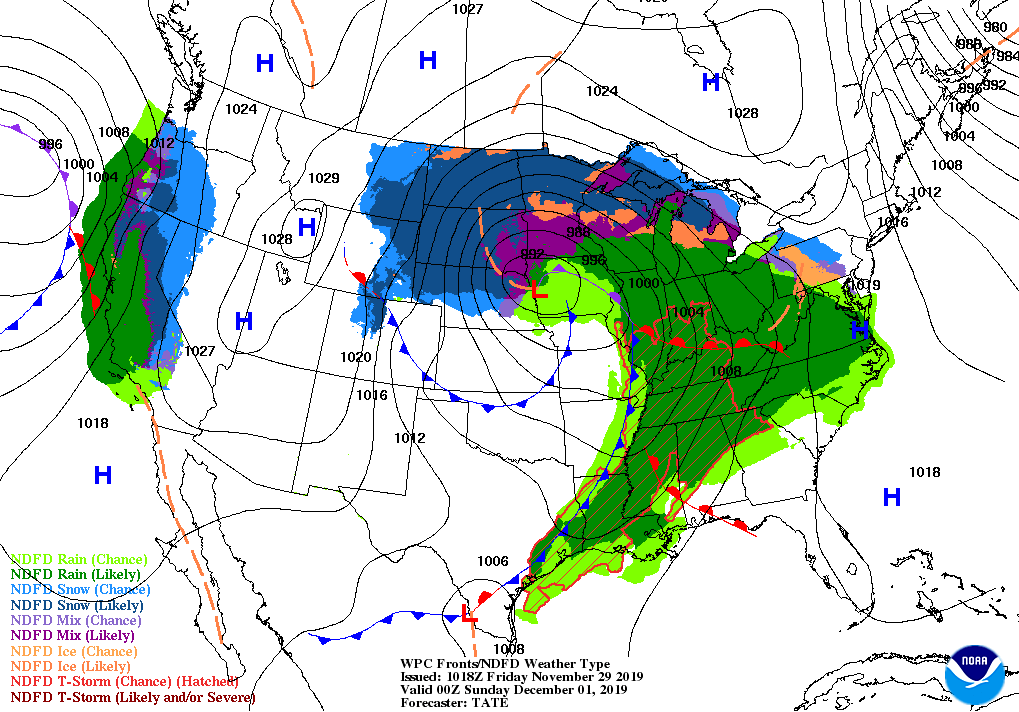
The winter storm system currently trudging through the nation’s midsection will advance slowly toward the Atlantic Coast through the weekend. By Sunday, upper Midwestern snow is expected to reach as far east as the eastern Great Lakes, with a mixture of locally heavy precipitation — including the potential for some freezing rain — dipping southward into the mid-Atlantic. Locally heavy showers and strong thunderstorms may also develop along the associated cold front in parts of the Deep South.
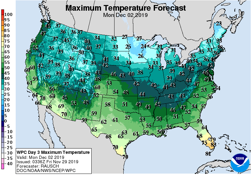
Cold, windy conditions and another brief shot of snow are forecast for the Midwest in the wake of the storm before drier conditions develop.
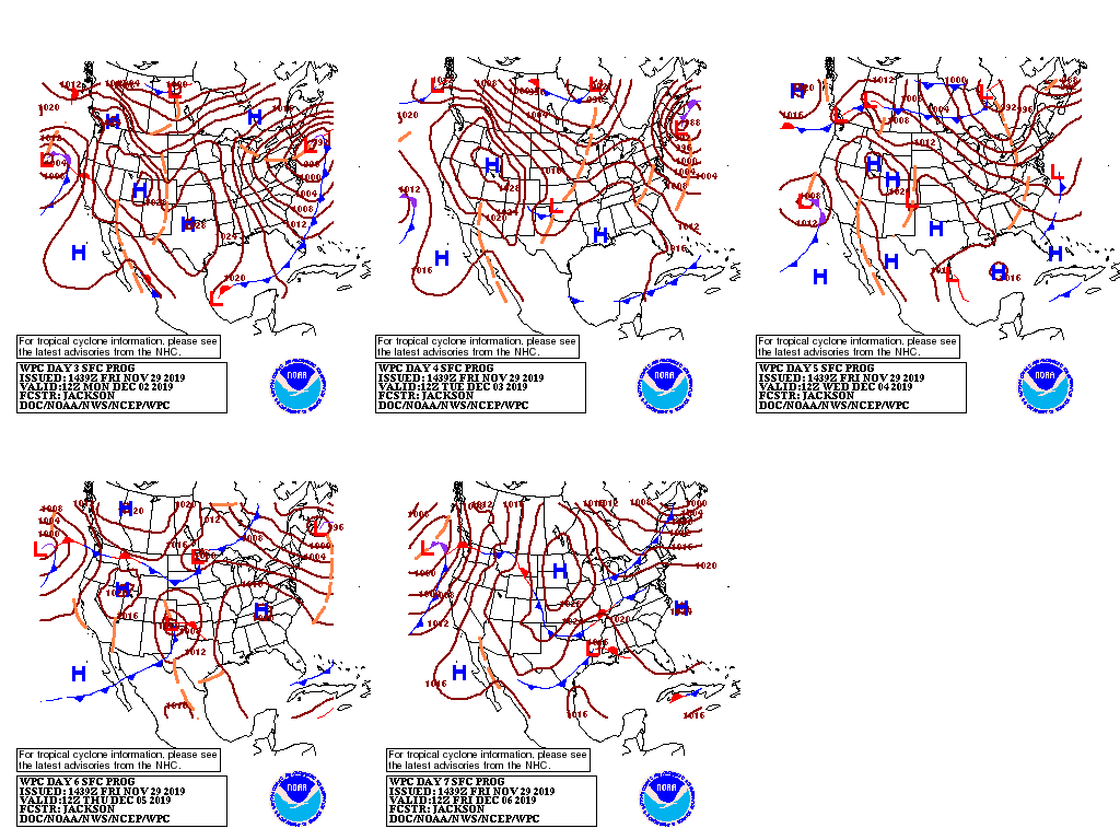
Meanwhile, the West Coast will almost immediately begin feeling the effects of a new Pacific Storm, with snow returning to the interior Northwest by the end of the weekend.

The heaviest precipitation (3-day totals of 1-3 inches, liquid equivalent) is expected in northern California, adding to the snow pack but renewing disruptions in travel and transportation.
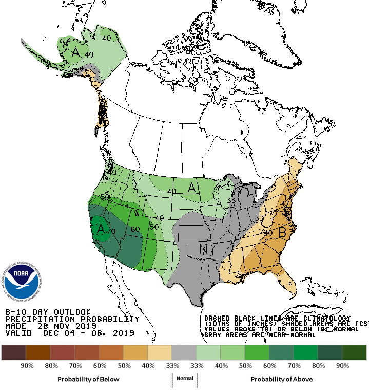
Looking ahead, the 6- to 10-day outlook depicts wetter-than-normal weather throughout the West, as well as on the northern Plains and in the upper Mississippi Valley; in contrast, drier conditions are expected in the East from the Gulf Coast to New England.
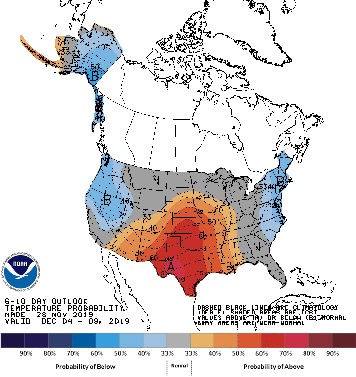
Unseasonable warmth is forecast for the central and southern Plains, extending into neighboring sections of the Mississippi Valley and Four Corners Region. Meanwhile, cooler weather should prevail in parts of the Northwest and Northeast.

Add Comment