Weather
Brownfield Ag Weather Today
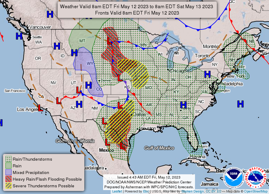
A powerful spring storm, currently on the central High Plains, will drift across the western Corn Belt by week’s end. Additional rainfall across the northern half of the Plains should total 1 to 3 inches, with some of the precipitation accompanied by large hail and high winds. Farther south, a secondary low-pressure system—forming along the initial storm’s trailing cold front—will intensify on Friday across Texas. Impacts from the secondary system may include torrential rain, flash flooding, and severe thunderstorms. Event-total rainfall in parts of central and southern Texas could reach 4 to 8 inches or more. Meanwhile, totals of 1 to 2 inches should occur in the Mississippi, Ohio, and Tennessee Valleys. In contrast, little or no precipitation will fall during the next 5 days west of the Rockies and from the upper Great Lakes region to southern New England. In the Far West, early-season heat will accompany the dry weather.
Add Comment