Weather
Brownfield Ag Weather Today

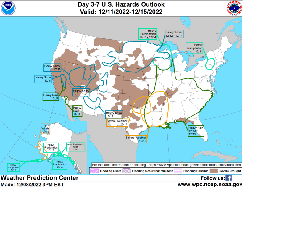
For the remainder of Friday, wintry precipitation—snow and freezing rain—will provide beneficial moisture but may cause travel disruptions from the upper Midwest to the southern Great Lakes region, while showers shift across the remainder of the Midwestern Corn Belt. Elsewhere, disorganized disturbances will continue to affect various parts of the country into the weekend, when a well-organized storm system will arrive along the Pacific Coast. That system will provide another boost in Western snowpack, especially in the Sierra Nevada. By early next week, the storm will emerge from the Rockies, crossing the central Plains. Potential weather hazards early next week may include blizzard conditions (heavy snow and high winds) on the northern Plains and severe thunderstorms across the South. In advance of the storm’s approach, unusual warmth will prevail, especially across the South. In contrast, cold air will remain in place in much of the northern and western U.S.

Add Comment