Weather
Brownfield Ag Weather Today
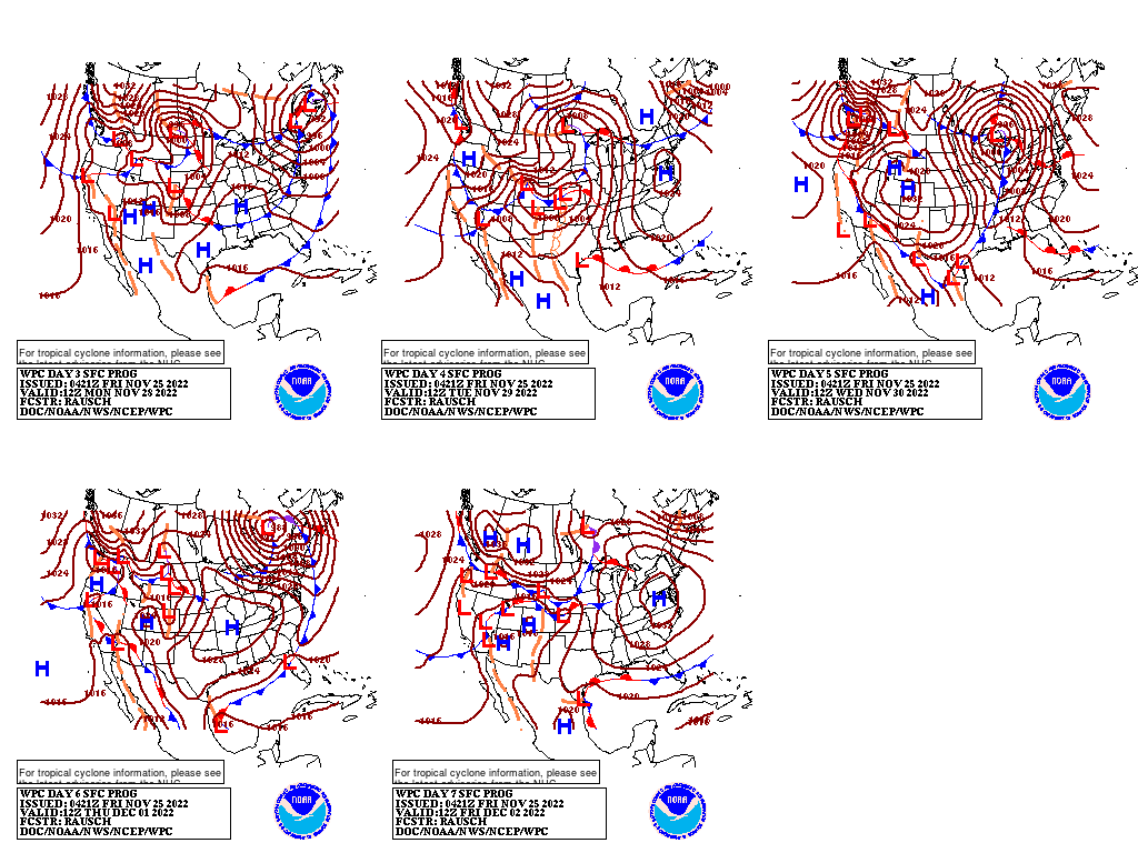
The storm system currently impacting the Northwest will move farther inland over the next few days, generating a mixture of rain and high-elevation snow across the northern Rockies, followed by a second wave of precipitation over the weekend. Meanwhile, the storm currently developing over Texas is forecast to intensify and move northeastward into the Ohio Valley through the weekend, generating locally heavy rain over the Southeast after only a brief respite from the current showers. Despite a disruption in fieldwork, however, the rainfall depicted over the next 7 days in the Ohio Valley – approaching 2 inches locally – will benefit winter grains and eventually filter down into the Mississippi River Valley, helping to raise low river levels that have impeded transportation. Heavier rainfall (accumulations locally exceeding 3 inches) from the Gulf Coast to the Tennessee River Valley will have similar effects on crops and long-term moisture reserves.
Add Comment