Weather
An intense spring storm to sweep the Heartland
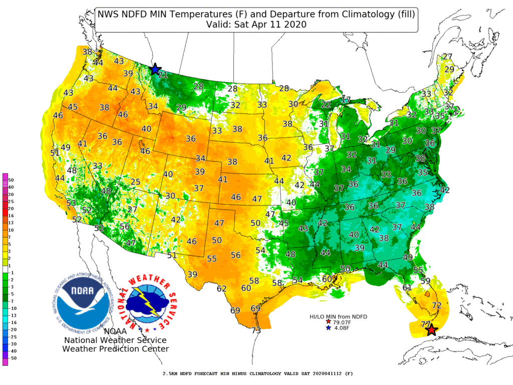
Frost and freezes may occur on Saturday morning as far south as the interior Southeast (e.g. Kentucky and Tennessee), where a variety of watches and warnings have been issued by the National Weather Service.
Meanwhile, another strong cold front will arrive on Saturday across the northern Plains, where snow will accompany windy, cold weather. Accumulations of wind-driven snow could exceed 4 inches in western South Dakota, western and southern Montana, and much of Wyoming, significantly stressing livestock.
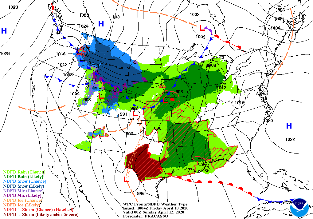
By Sunday, wind and snow will briefly spread southward across the central Plains. Early next week, a band of potentially heavy snow will extend northeastward from the central Plains, affecting parts of Iowa, Minnesota, and Wisconsin, as well as the upper peninsula of Michigan.
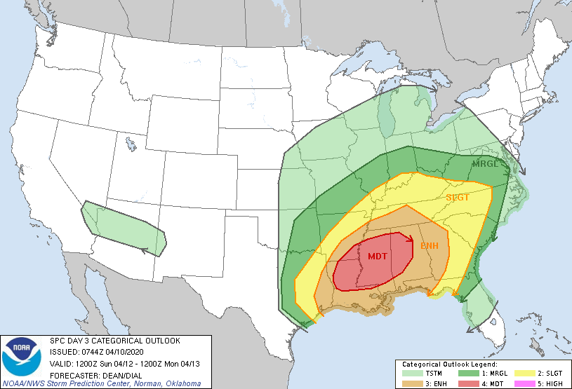
Farther south, a multi-day severe weather outbreak can be expected, starting late Friday on the southern High Plains; continuing through Saturday in the south-central U.S.; and shifting on Sunday into the Southeast.
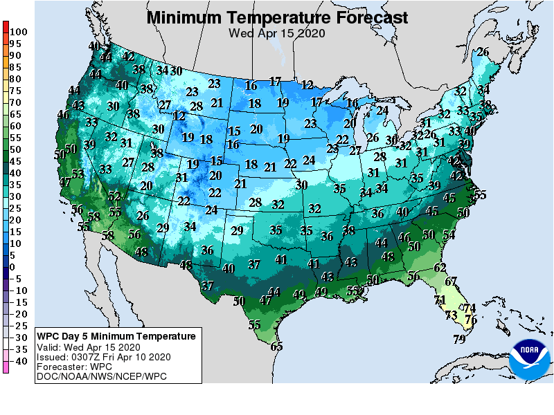
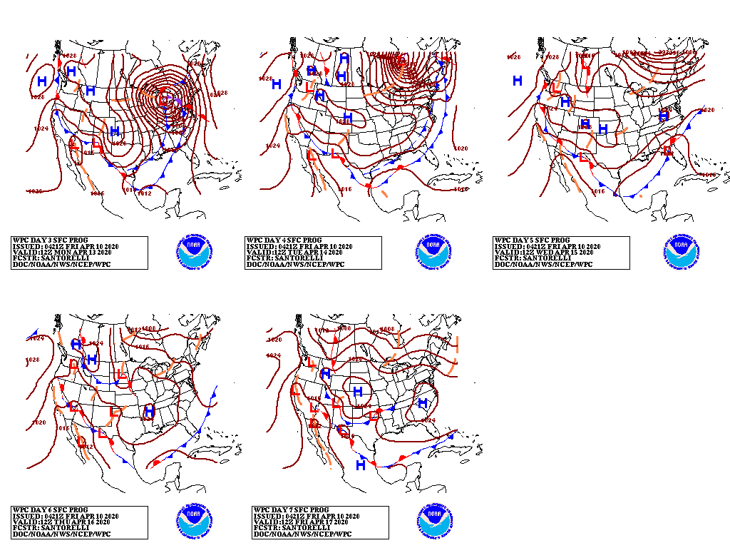
Next week, in the storm’s wake, freezes along and north of a line from west-central Texas into the Tennessee Valley could threaten jointing to heading winter wheat; blooming fruits; and newly emerged summer crops.
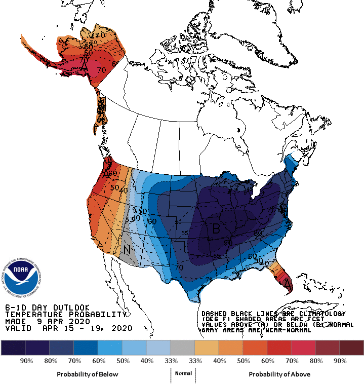
Looking ahead, the 6- to 10-day outlook calls for the likelihood of below-normal temperatures nationwide, except for warmer-than-normal weather in the Far West and across Florida’s peninsula.
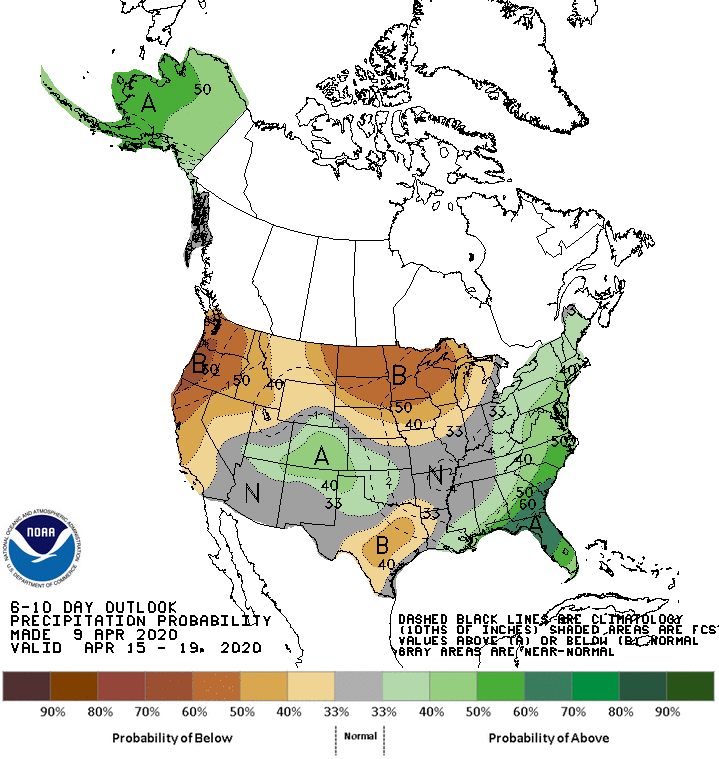
Meanwhile, near- or below-normal precipitation across much of the western and central U.S. should contrast with wetter-than-normal conditions in the East and a small area centered over the central Rockies.
Add Comment