Weather
An active pattern next week & beyond for the Heartland
Cool, breezy conditions will linger across the Great Lakes and Northeastern States through the weekend, followed by warmer weather.
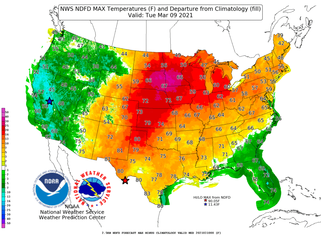
Meanwhile, dry weather and significantly above-normal temperatures will return (or continue) on the Plains, where temperatures could reach 80° early next week as far north as Kansas.
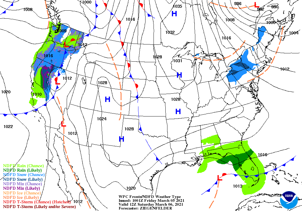
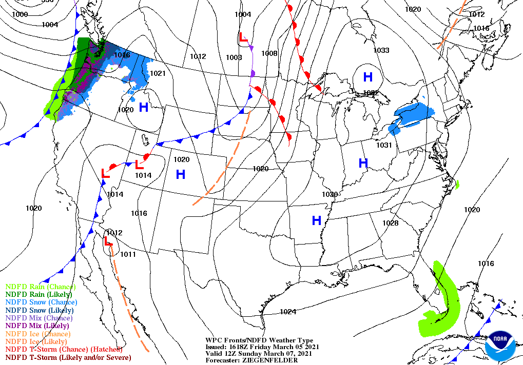
The storm system currently affecting the central and southern Plains will shift southeastward, crossing Florida’s peninsula on Saturday. Elsewhere, precipitation during the next several days will be largely limited to the Far West.
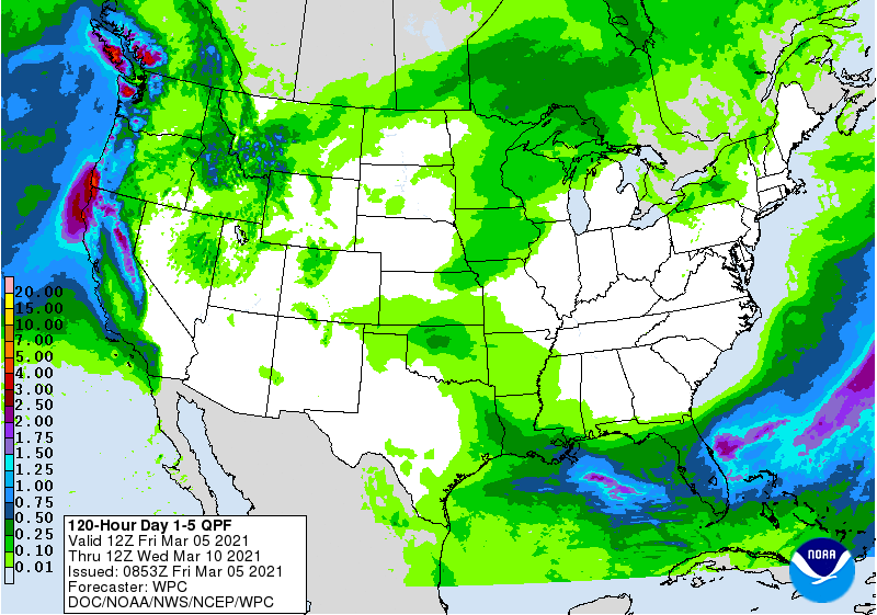
Five-day precipitation totals could reach 1 to 3 inches or more in northern California and the Pacific Northwest, including the Sierra Nevada. Early next week, storminess may briefly shift southward into central and southern California.
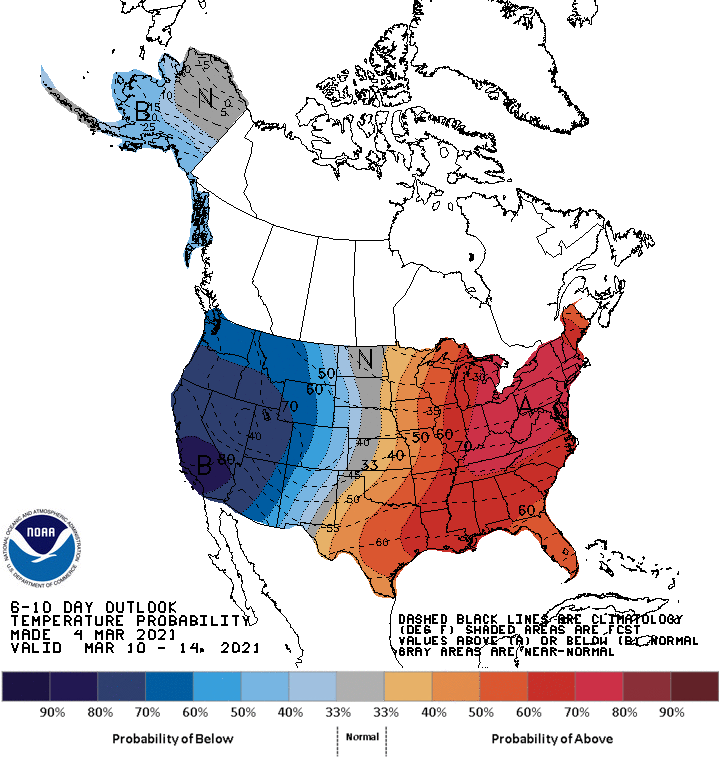
Looking ahead, the 6- to 10-day outlook calls for the likelihood of above-normal temperatures across the eastern half of the U.S., while colder-than-normal conditions will cover the northern and central High Plains and the West.
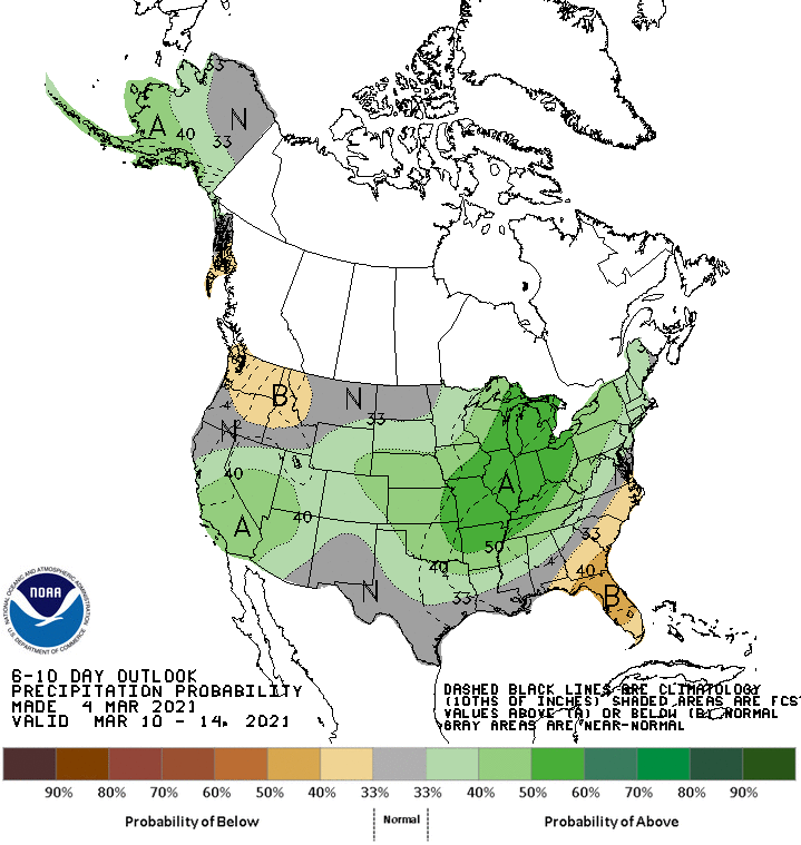
Meanwhile, near- or above-normal precipitation across most of the country should contrast with drier-than-normal weather in the lower Southeast and parts of the Northwest.
Add Comment