Weather
An active pattern, as temps vary across the Heartland
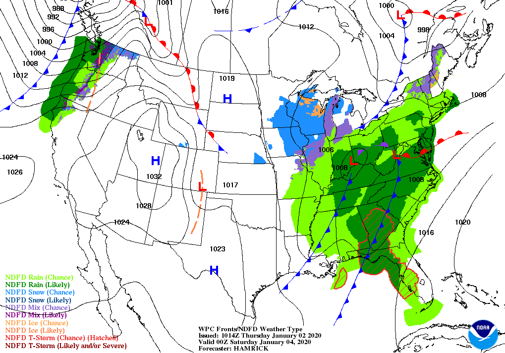
A storm system will affect parts of the South, East, and Midwest into the weekend.
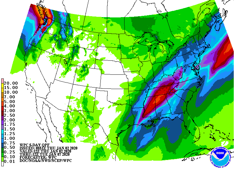
Storm-total rainfall should reach 2 to 4 inches from the lower Mississippi Valley to the central and southern Appalachians. By Saturday and early Sunday, accumulating snow could fall from the lower Great Lakes region into parts of New England.
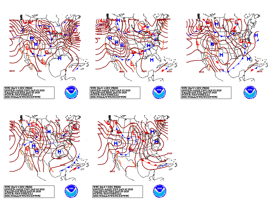
Subsequently, a pair of disturbances will cross the northern U.S., generating periods of generally light precipitation. The most significant precipitation should fall in the northern Rockies and Pacific Northwest. Elsewhere, little or no precipitation will fall during the next 5 days from central and southern California to the central and southern Plains.
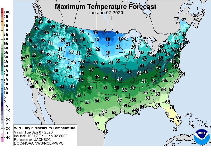
Modest surges of cold air will trail the disturbances, with below-normal temperatures becoming established across the northern Plains and Midwest by early next week.
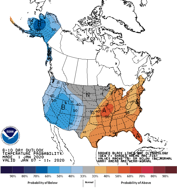
Looking ahead, the 6- to 10-day outlook calls for the likelihood of above-normal temperatures across much of the eastern half of the country, while colder-than-normal conditions will dominate the West.
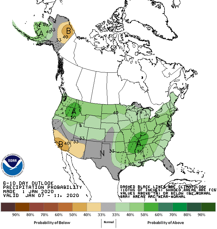
Elsewhere, much of the nation should experience near- or above-normal precipitation, while drier-than-normal weather will be limited to southern California and the Desert Southwest.
Add Comment