Weather
An active, moisture-laden pattern for the Heartland
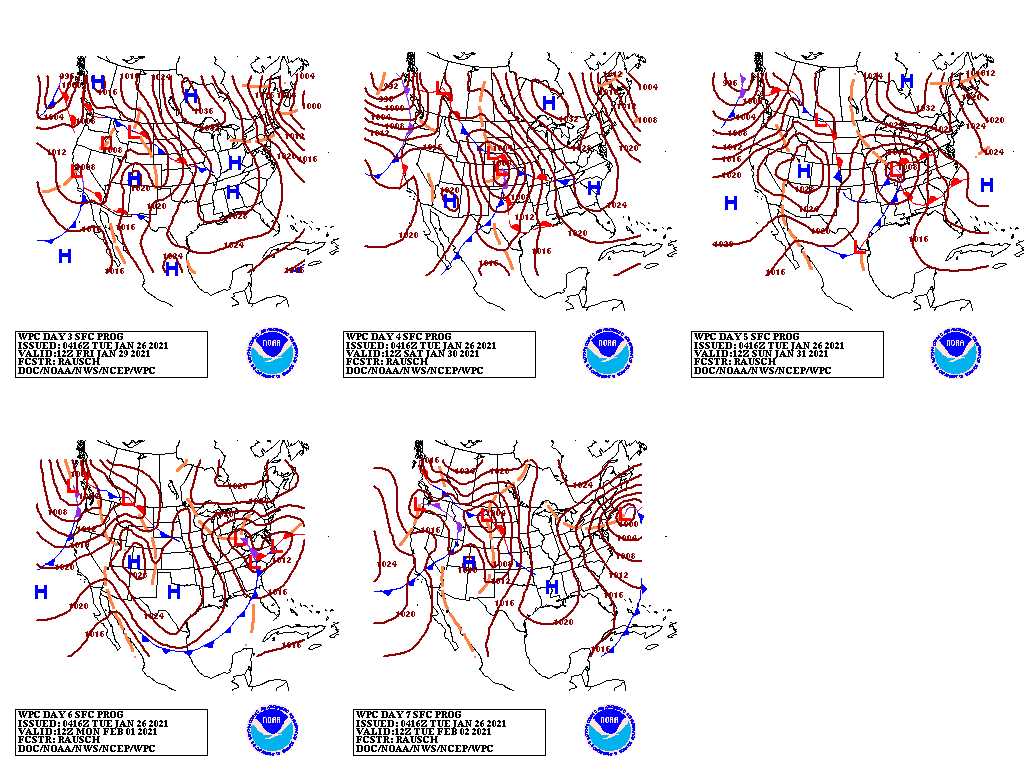
During the next 5 days, an active weather pattern will feature a series of storm systems dropping southward along the Pacific Coast before turning and accelerating northeastward across the continental U.S. As a result, precipitation will fall in all areas of the country, except the northern Plains, southern Florida, and parts of the south-central U.S.
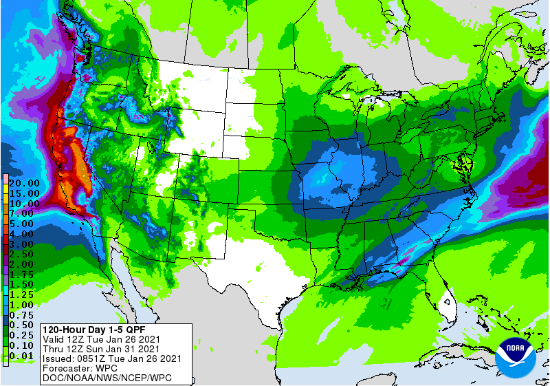
Some of the heaviest precipitation will occur in California and the Southeast. In addition, the storm system currently crossing the nation’s midsection will produce heavy snow in parts of the Midwest and significant rain as far north as the Ohio Valley. The South may experience locally severe thunderstorms. California’s heaviest precipitation will fall during the mid- to late-week period, when substantial snow should blanket the Sierra Nevada.
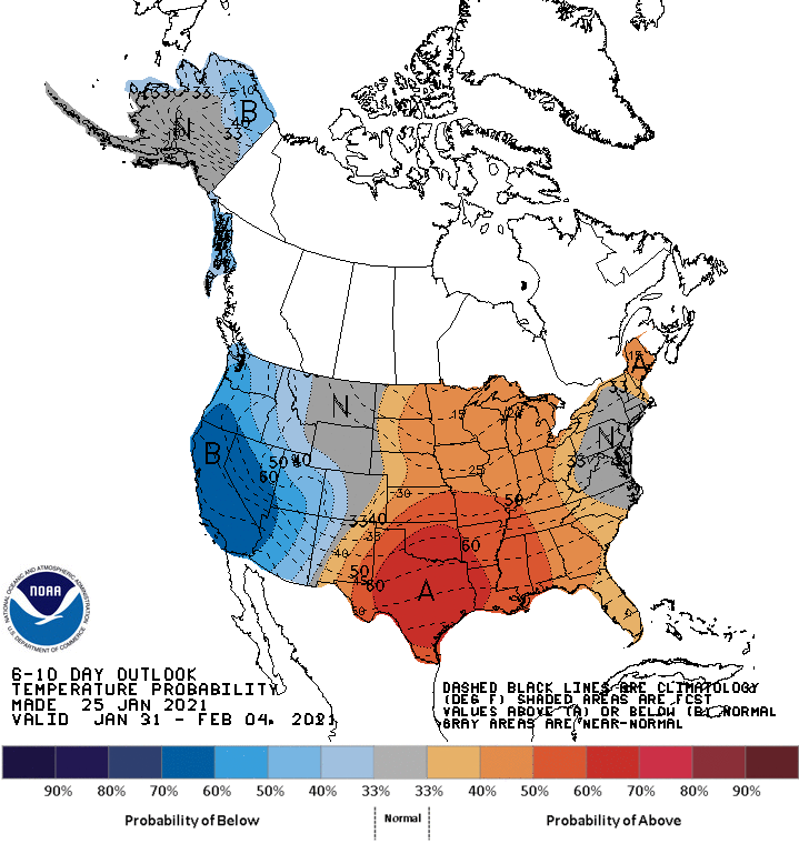
Looking ahead, the 6- to 10-day outlook calls for the likelihood of above-normal temperatures from the Plains to the East Coast, while colder-than-normal conditions will prevail west of the Rockies.

Meanwhile, below-normal precipitation across the southern High Plains and Florida’s peninsula should contrast with wetter-than-normal weather in most other areas—particularly the northern two-thirds of the U.S.
Add Comment